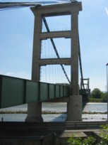
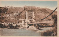
This is a single suspension bridge from the Bridgemeister historical inventory of suspension bridges.
1931: Teil
Le Teil, Ardèche and Montélimar, Drôme, France - Rhône River
| Bridgemeister ID: | 1549 (added 2004-11-13) |
| Year Completed: | 1931 |
| Name: | Teil |
| Location: | Le Teil, Ardèche and Montélimar, Drôme, France |
| Crossing: | Rhône River |
| Coordinates: | 44.5519 N 4.692617 E |
| Maps: | Acme, GeoHack, Google, OpenStreetMap |
| References: | AAJ, BPF |
| Use: | Vehicular (two-lane, heavy vehicles), with walkway |
| Status: | In use (last checked: 2023) |
| Main Cables: | Wire (steel) |
| Suspended Spans: | 1 |
| Main Span: | 1 x 235 meters (771 feet) |
Notes:
- Destroyed, 1940. Rebuilt, 1943. Destroyed again, 1944. Rebuilt, 1950.
- Replaced 1839 Teil - Le Teil, Ardèche and Montélimar, Drôme, France.
- All past and present bridges at this location.
External Links:
- Pont routier du Teil - Inventaire Général du Patrimoine Culturel. Detailed history and many images of the suspension bridges at Le Teil. Translated: "In June 1940, the retreating French army cut the cables, which caused the deck and pylons to fall. A ferry was then put back into service. Rebuilt and reopened to traffic in 1943, the bridge was destroyed again in August 1944, following bombings, except for the gantries. Its reconstruction, almost identically, was undertaken from 1947 and completed in 1950, the year of its inauguration. In September 2007, following the rupture of a load-bearing cable, the bridge was closed to the public. Traffic was temporarily restored before definitive repairs were carried out in 2009."
- Structurae - Structure ID 20001106
Image Sets:


Jochem Hollestelle contributed to the information and/or images for this bridge.
Do you have any information or photos about this bridge that you would like to share? Please email david.denenberg@bridgemeister.com.
Mail | Facebook | X (Twitter) | Bluesky