Inventory Search Results (1-100 of 206)
206 suspension bridges were found for search criteria: "(pipeline bridge)". Bridges 1 through 100 (of 206 total) appear below. Click the Bridgemeister ID number to isolate the bridge on its own page. If you don't see what you were looking for, try an image search with the same criteria: "(pipeline bridge)". This will find the bridge if it is pictured on the site, but is not a catenary suspension bridge.
Related:
1891: (pipeline bridge)
Lane Cove North, New South Wales, Australia - Lane Cove River
| Bridgemeister ID: | 2685 (added 2019-05-26) |
| Year Completed: | 1891 |
| Name: | (pipeline bridge) |
| Location: | Lane Cove North, New South Wales, Australia |
| Crossing: | Lane Cove River |
| Coordinates: | 33.802904 S 151.143883 E |
| Maps: | Acme, GeoHack, Google, OpenStreetMap |
| Use: | Pipeline |
| Status: | Replaced |
| Main Cables: | Wire (steel) |
Notes:
- Multi-span pipeline suspension bridge carrying a large water main. Since replaced with a bridge carrying both pedestrians and a large pipeline.
1930: (pipeline bridge)
Hollenberg, Kansas, USA - Little Blue River
| Bridgemeister ID: | 167 (added before 2003) |
| Year Completed: | 1930 |
| Name: | (pipeline bridge) |
| Location: | Hollenberg, Kansas, USA |
| Crossing: | Little Blue River |
| Principals: | Matthews & Kenan |
| References: | USS |
| Use: | Pipeline |
| Main Cables: | Wire (steel) |
| Suspended Spans: | 3 |
| Main Span: | 1 x 152.4 meters (500 feet) |
| Side Spans: | 2 x 70.1 meters (230 feet) |
1940: (pipeline bridge)
Sioux City, Iowa and Dakota City vicinity, Nebraska, USA - Missouri River
| Bridgemeister ID: | 2252 (added 2007-03-31) |
| Year Completed: | 1940 |
| Name: | (pipeline bridge) |
| Location: | Sioux City, Iowa and Dakota City vicinity, Nebraska, USA |
| Crossing: | Missouri River |
| Coordinates: | 42.43842 N 96.38387 W |
| Maps: | Acme, GeoHack, Google, OpenStreetMap |
| References: | AAJ |
| Use: | Pipeline |
| Status: | Removed, 2005 |
| Main Cables: | Wire (steel) |
| Main Span: | 1 x 404 meters (1,325.5 feet) estimated |
Notes:
- Large pipeline suspension bridge located near the Big Soo terminal.
External Links:
1949: (pipeline bridge)
Purcell vicinity, Oklahoma, USA - Canadian River
| Bridgemeister ID: | 1447 (added 2004-07-31) |
| Year Completed: | 1949 |
| Name: | (pipeline bridge) |
| Location: | Purcell vicinity, Oklahoma, USA |
| Crossing: | Canadian River |
| Principals: | Austin Bridge Co. |
| References: | AUB |
| Use: | Pipeline |
| Main Cables: | Wire (steel) |
Notes:
- Unusual for a pipeline suspension bridge, this bridge has at least two main spans.
1950: (pipeline bridge)
Clanton vicinity, Alabama, USA - Coosa River
| Bridgemeister ID: | 1446 (added 2004-07-31) |
| Year Completed: | 1950 |
| Name: | (pipeline bridge) |
| Location: | Clanton vicinity, Alabama, USA |
| Crossing: | Coosa River |
| Coordinates: | 32.794583 N 86.429267 W |
| Maps: | Acme, GeoHack, Google, OpenStreetMap |
| Principals: | Austin Bridge Co. |
| References: | AUB |
| Use: | Pipeline |
| Status: | Extant (last checked: 2005) |
| Main Cables: | Wire (steel) |
| Suspended Spans: | 1 |
| Main Span: | 1 x 213.4 meters (700 feet) |
Image Sets:
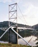
| Bridgemeister ID: | 3100 (added 2019-10-27) |
| Year Completed: | 1958 |
| Name: | (pipeline bridge) |
| Location: | Leoben, Austria |
| Crossing: | Mur River |
| Coordinates: | 47.387642 N 15.104475 E |
| Maps: | Acme, GeoHack, Google, OpenStreetMap |
| Use: | Pipeline |
| Status: | Extant (last checked: 2019) |
| Main Cables: | Wire (steel) |
| Main Span: | 1 x 80 meters (262.5 feet) |
1961: (pipeline bridge)
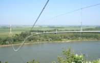
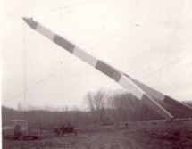
Jefferson vicinity, South Dakota and Ponca State Park, Nebraska, USA - Missouri River
| Bridgemeister ID: | 3809 (added 2020-03-01) |
| Year Completed: | 1961 |
| Name: | (pipeline bridge) |
| Location: | Jefferson vicinity, South Dakota and Ponca State Park, Nebraska, USA |
| Crossing: | Missouri River |
| Coordinates: | 42.593000 N 96.698267 W |
| Maps: | Acme, GeoHack, Google, OpenStreetMap |
| Use: | Pipeline |
| Status: | Removed, 2006 or 2007 |
| Main Cables: | Wire (steel) |
| Main Span: | 1 x 823 meters (2,700 feet) estimated |
Notes:
- Completed in 1961 or 1962. Removed in late 2006 or 2007.
- Replaced (pipeline bridge) - Jefferson vicinity, South Dakota and Ponca State Park, Nebraska, USA.
- All past and present bridges at this location.
Image Sets:
1962: (pipeline bridge)
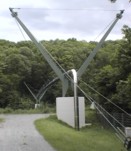
Aldingen, Baden-Württemberg, Germany - Neckar River
| Bridgemeister ID: | 2153 (added 2006-11-21) |
| Year Completed: | 1962 |
| Name: | (pipeline bridge) |
| Location: | Aldingen, Baden-Württemberg, Germany |
| Crossing: | Neckar River |
| Coordinates: | 48.853198 N 9.249430 E |
| Maps: | Acme, GeoHack, Google, OpenStreetMap |
| Principals: | Waagner-Biro Brückenbau AG |
| Use: | Pipeline and Footbridge |
| Status: | In use (last checked: 2006) |
| Main Cables: | Wire (steel) |
| Suspended Spans: | 1 |
| Main Span: | 1 x 10³ meters (337.9 feet) |
| Deck width: | 0.35 meter walkway, 0.44 meter diameter pipe |
Notes:
- Carries a fresh water pipeline.
Image Sets:
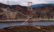
1962: (pipeline bridge)
Flaming Gorge National Recreation Area, Wyoming, USA - Green River
| Bridgemeister ID: | 1309 (added 2004-04-10) |
| Year Completed: | 1962 |
| Name: | (pipeline bridge) |
| Location: | Flaming Gorge National Recreation Area, Wyoming, USA |
| Crossing: | Green River |
| At or Near Feature: | Flaming Gorge Reservoir |
| Coordinates: | 41.03215 N 109.55519 W |
| Maps: | Acme, GeoHack, Google, OpenStreetMap |
| Use: | Pipeline |
| Status: | In use (last checked: 2019) |
| Main Cables: | Wire (steel) |
| Suspended Spans: | 1 |
| Main Span: | 1 x 584.9 meters (1,919 feet) |
Notes:
- Located two miles north of the Utah-Wyoming border.
External Links:
Image Sets:
1962: (pipeline bridge)
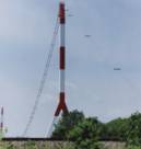
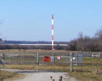
Grays Branch, Greenup vicinity, Kentucky and Franklin Furnace, Ohio, USA - Ohio River
| Bridgemeister ID: | 880 (added 2003-09-01) |
| Year Completed: | 1962 |
| Name: | (pipeline bridge) |
| Location: | Grays Branch, Greenup vicinity, Kentucky and Franklin Furnace, Ohio, USA |
| Crossing: | Ohio River |
| Coordinates: | 38.66058 N 82.85889 W |
| Maps: | Acme, GeoHack, Google, OpenStreetMap |
| Principals: | Weldon F. Appelt, P.E., Clear Span Engineering, Inc |
| Use: | Pipeline |
| Status: | Extant (last checked: 2021) |
| Main Cables: | Wire (steel) |
| Main Span: | 1 x 609.6 meters (2,000 feet) |
Notes:
- Just downstream of Greenup Dam. Built for Tennessee Gas Pipeline Co. Carries two 30" gas pipelines.
External Links:
Image Sets:
1967: (pipeline bridge)
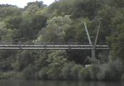
Neckargröningen, Remseck, Baden-Württemberg, Germany - Neckar River
| Bridgemeister ID: | 2150 (added 2006-11-18) |
| Year Completed: | 1967 |
| Name: | (pipeline bridge) |
| Location: | Neckargröningen, Remseck, Baden-Württemberg, Germany |
| Crossing: | Neckar River |
| Coordinates: | 48.878357 N 9.277363 E |
| Maps: | Acme, GeoHack, Google, OpenStreetMap |
| Principals: | Waagner-Biro Brückenbau AG |
| Use: | Pipeline and Footbridge |
| Status: | Extant (last checked: 2018) |
| Main Cables: | Wire (steel) |
| Suspended Spans: | 1 |
| Main Span: | 1 x 80 meters (262.5 feet) |
| Deck width: | 0.75 meters |
Notes:
- Carries two water pipelines (1 fresh water, 1 waste water) with a gated service walkway above the pipes. Eckhard Bernstorff notes: "it supplies Neckargröningen with fresh water and pipelines waste water back (central waterworks and waste water treatment plant are on the other side of Neckar river)."
External Links:
Image Sets:
1967: (pipeline bridge)
Savage River, Tasmania, Australia - Savage River
| Bridgemeister ID: | 4600 (added 2020-06-06) |
| Year Completed: | 1967 |
| Name: | (pipeline bridge) |
| Location: | Savage River, Tasmania, Australia |
| Crossing: | Savage River |
| Coordinates: | 41.475961 S 145.215867 E |
| Maps: | Acme, GeoHack, Google, OpenStreetMap |
| Use: | Pipeline |
| Status: | Extant (last checked: 2019) |
| Main Cables: | Wire (steel) |
| Suspended Spans: | 1 |
| Main Span: | 1 x 305 meters (1,000.7 feet) |
External Links:
1974: (pipeline bridge)
Kelif vicinity, Turkmenistan and Keleft, Afghanistan - Amu Darya
| Bridgemeister ID: | 1430 (added 2004-07-25) |
| Year Completed: | 1974 |
| Name: | (pipeline bridge) |
| Location: | Kelif vicinity, Turkmenistan and Keleft, Afghanistan |
| Crossing: | Amu Darya |
| Coordinates: | 37.345302 N 66.260926 E |
| Maps: | Acme, GeoHack, Google, OpenStreetMap |
| Use: | Pipeline |
| Main Cables: | Wire (steel) |
| Main Span: | 1 x 660 meters (2,165.4 feet) |
1975: (pipeline bridge)
Calumet vicinity, Louisiana, USA - Wax Lake Outlet
| Bridgemeister ID: | 1807 (added 2005-05-19) |
| Year Completed: | 1975 |
| Name: | (pipeline bridge) |
| Location: | Calumet vicinity, Louisiana, USA |
| Crossing: | Wax Lake Outlet |
| Coordinates: | 29.693867 N 91.374017 W |
| Maps: | Acme, GeoHack, Google, OpenStreetMap |
| Principals: | Clear Span Engineering |
| Use: | Pipeline |
| Status: | Removed, c. 2015-2019 |
| Main Cables: | Wire (steel) |
| Suspended Spans: | 1 |
| Main Span: | 1 x 243.8 meters (800 feet) |
Notes:
- Removed at some point in the 2015-2019 time frame.
- Carried a 22" oil line.
- Next to 1976 (pipeline bridge) - Calumet vicinity, Louisiana, USA.
- Next to 1976 (pipeline bridge) - Calumet vicinity, Louisiana, USA.
- Next to 1980 (pipeline bridge) - Calumet vicinity, Louisiana, USA.
- Next to 1980 (pipeline bridge) - Calumet vicinity, Louisiana, USA.
- Near 1980 (pipeline bridge) - Calumet vicinity, Louisiana, USA.
- All past and present bridges at this location.
Image Sets:
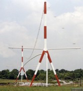
1976: (pipeline bridge)
Calumet vicinity, Louisiana, USA - Wax Lake Outlet
| Bridgemeister ID: | 1808 (added 2005-05-19) |
| Year Completed: | 1976 |
| Name: | (pipeline bridge) |
| Location: | Calumet vicinity, Louisiana, USA |
| Crossing: | Wax Lake Outlet |
| Coordinates: | 29.693233 N 91.3743 W |
| Maps: | Acme, GeoHack, Google, OpenStreetMap |
| Principals: | Clear Span Engineering |
| Use: | Pipeline |
| Status: | Extant (last checked: 2023) |
| Main Cables: | Wire (steel) |
| Suspended Spans: | 1 |
| Main Span: | 1 x 243.8 meters (800 feet) |
Notes:
- Carries a 30" natural gas line.
- Next to 1975 (pipeline bridge) - Calumet vicinity, Louisiana, USA.
- Next to 1976 (pipeline bridge) - Calumet vicinity, Louisiana, USA.
- Next to 1980 (pipeline bridge) - Calumet vicinity, Louisiana, USA.
- Next to 1980 (pipeline bridge) - Calumet vicinity, Louisiana, USA.
- Near 1980 (pipeline bridge) - Calumet vicinity, Louisiana, USA.
- All past and present bridges at this location.
Image Sets:
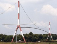
1976: (pipeline bridge)
Calumet vicinity, Louisiana, USA - Wax Lake Outlet
| Bridgemeister ID: | 1809 (added 2005-05-19) |
| Year Completed: | 1976 |
| Name: | (pipeline bridge) |
| Location: | Calumet vicinity, Louisiana, USA |
| Crossing: | Wax Lake Outlet |
| Coordinates: | 29.691483 N 91.37495 W |
| Maps: | Acme, GeoHack, Google, OpenStreetMap |
| Principals: | Clear Span Engineering |
| Use: | Pipeline |
| Status: | Extant (last checked: 2023) |
| Main Cables: | Wire (steel) |
| Suspended Spans: | 1 |
| Main Span: | 1 x 243.8 meters (800 feet) |
Notes:
- Carries three natural gas lines.
- Next to 1975 (pipeline bridge) - Calumet vicinity, Louisiana, USA.
- Next to 1976 (pipeline bridge) - Calumet vicinity, Louisiana, USA.
- Next to 1980 (pipeline bridge) - Calumet vicinity, Louisiana, USA.
- Next to 1980 (pipeline bridge) - Calumet vicinity, Louisiana, USA.
- Near 1980 (pipeline bridge) - Calumet vicinity, Louisiana, USA.
- All past and present bridges at this location.
Image Sets:
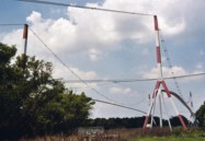
1979: (pipeline bridge)
Saporoshje (Zaporizzja) vicinity, Ukraine - Dnieper River
| Bridgemeister ID: | 1431 (added 2004-07-25) |
| Year Completed: | 1979 |
| Name: | (pipeline bridge) |
| Location: | Saporoshje (Zaporizzja) vicinity, Ukraine |
| Crossing: | Dnieper River |
| Coordinates: | 48.121897 N 35.068470 E |
| Maps: | Acme, GeoHack, Google, OpenStreetMap |
| Use: | Pipeline |
| Status: | Extant (last checked: 2019) |
| Main Cables: | Wire (steel) |
| Suspended Spans: | 1 |
| Main Span: | 1 x 720 meters (2,362.2 feet) |
Notes:
- This is likely the same bridge as the Pridneprovsk pipeline bridge referenced on Structurae.
External Links:
1980: (pipeline bridge)
Calumet vicinity, Louisiana, USA - Wax Lake Outlet
| Bridgemeister ID: | 1810 (added 2005-05-19) |
| Year Completed: | 1980 |
| Name: | (pipeline bridge) |
| Location: | Calumet vicinity, Louisiana, USA |
| Crossing: | Wax Lake Outlet |
| Coordinates: | 29.69095 N 91.374967 W |
| Maps: | Acme, GeoHack, Google, OpenStreetMap |
| Principals: | Clear Span Engineering |
| Use: | Pipeline |
| Status: | Extant (last checked: 2023) |
| Main Cables: | Wire (steel) |
| Suspended Spans: | 1 |
| Main Span: | 1 x 259.1 meters (850 feet) |
Notes:
- Carries a 30" natural gas line.
- Next to 1975 (pipeline bridge) - Calumet vicinity, Louisiana, USA.
- Next to 1976 (pipeline bridge) - Calumet vicinity, Louisiana, USA.
- Next to 1976 (pipeline bridge) - Calumet vicinity, Louisiana, USA.
- Next to 1980 (pipeline bridge) - Calumet vicinity, Louisiana, USA.
- Near 1980 (pipeline bridge) - Calumet vicinity, Louisiana, USA.
- All past and present bridges at this location.
Image Sets:
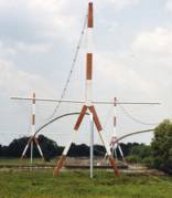
1980: (pipeline bridge)
Calumet vicinity, Louisiana, USA - Wax Lake Outlet
| Bridgemeister ID: | 1811 (added 2005-05-19) |
| Year Completed: | 1980 |
| Name: | (pipeline bridge) |
| Location: | Calumet vicinity, Louisiana, USA |
| Crossing: | Wax Lake Outlet |
| Coordinates: | 29.710683 N 91.3673 W |
| Maps: | Acme, GeoHack, Google, OpenStreetMap |
| Principals: | Clear Span Engineering |
| Use: | Pipeline |
| Status: | Extant (last checked: 2023) |
| Main Cables: | Wire (steel) |
| Suspended Spans: | 1 |
| Main Span: | 1 x 304.8 meters (1,000 feet) |
Notes:
- Carries a 24-inch natural gas line.
- Near 1975 (pipeline bridge) - Calumet vicinity, Louisiana, USA.
- Near 1976 (pipeline bridge) - Calumet vicinity, Louisiana, USA.
- Near 1976 (pipeline bridge) - Calumet vicinity, Louisiana, USA.
- Near 1980 (pipeline bridge) - Calumet vicinity, Louisiana, USA.
- Near 1980 (pipeline bridge) - Calumet vicinity, Louisiana, USA.
Image Sets:
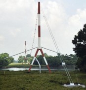
1980: (pipeline bridge)
Calumet vicinity, Louisiana, USA - Wax Lake Outlet
| Bridgemeister ID: | 1812 (added 2005-05-19) |
| Year Completed: | 1980 |
| Name: | (pipeline bridge) |
| Location: | Calumet vicinity, Louisiana, USA |
| Crossing: | Wax Lake Outlet |
| Coordinates: | 29.68845 N 91.375933 W |
| Maps: | Acme, GeoHack, Google, OpenStreetMap |
| Principals: | Clear Span Engineering |
| Use: | Pipeline |
| Status: | Extant (last checked: 2023) |
| Main Cables: | Wire (steel) |
| Suspended Spans: | 1 |
| Main Span: | 1 x 266.7 meters (875 feet) |
Notes:
- Carries a 36-inch natural gas line.
- Next to 1975 (pipeline bridge) - Calumet vicinity, Louisiana, USA.
- Next to 1976 (pipeline bridge) - Calumet vicinity, Louisiana, USA.
- Next to 1976 (pipeline bridge) - Calumet vicinity, Louisiana, USA.
- Next to 1980 (pipeline bridge) - Calumet vicinity, Louisiana, USA.
- Near 1980 (pipeline bridge) - Calumet vicinity, Louisiana, USA.
- All past and present bridges at this location.
Image Sets:
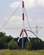
1982: (pipeline bridge)
Gelsenkirchen, North Rhine-Westphalia, Germany - Rhein-Herne Canal
| Bridgemeister ID: | 1963 (added 2005-11-12) |
| Year Completed: | 1982 |
| Name: | (pipeline bridge) |
| Location: | Gelsenkirchen, North Rhine-Westphalia, Germany |
| Crossing: | Rhein-Herne Canal |
| Coordinates: | 51.534661 N 7.065796 E |
| Maps: | Acme, GeoHack, Google, OpenStreetMap |
| Use: | Pipeline |
| Status: | Extant (last checked: 2019) |
| Main Cables: | Wire (steel) |
| Suspended Spans: | 1 |
External Links:
1982: (pipeline bridge)
Idaho Falls, Idaho, USA - Snake River
| Bridgemeister ID: | 1513 (added 2004-10-09) |
| Year Completed: | 1982 |
| Name: | (pipeline bridge) |
| Location: | Idaho Falls, Idaho, USA |
| Crossing: | Snake River |
| Coordinates: | 43.46399 N 112.07037 W |
| Maps: | Acme, GeoHack, Google, OpenStreetMap |
| Principals: | Clear Span Engineering, Inc. |
| Use: | Pipeline |
| Status: | Extant (last checked: 2019) |
| Main Cables: | Wire (steel) |
| Suspended Spans: | 1 |
| Main Span: | 1 x 167.6 meters (550 feet) |
Notes:
- Carries a 24-inch sewer pipe.
1986: (pipeline bridge)
Summit Bridge, Delaware, USA - Chesapeake and Delaware Canal
| Bridgemeister ID: | 1515 (added 2004-10-10) |
| Year Completed: | 1986 |
| Name: | (pipeline bridge) |
| Location: | Summit Bridge, Delaware, USA |
| Crossing: | Chesapeake and Delaware Canal |
| Coordinates: | 39.54241 N 75.72397 W |
| Maps: | Acme, GeoHack, Google, OpenStreetMap |
| Principals: | Clear Span Engineering, Inc., Trinity Steel Co. |
| Use: | Pipeline |
| Status: | In use (last checked: 2019) |
| Main Cables: | Wire (steel) |
| Main Span: | 1 x 371.9 meters (1,220 feet) |
Notes:
- Carries a 12-inch natural gas line.
Image Sets:
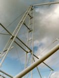
1988: (pipeline bridge)
Cody, Wyoming, USA - Sulphur Creek
| Bridgemeister ID: | 3325 (added 2019-12-01) |
| Year Completed: | 1988 |
| Name: | (pipeline bridge) |
| Location: | Cody, Wyoming, USA |
| Crossing: | Sulphur Creek |
| Coordinates: | 44.523354 N 109.084426 W |
| Maps: | Acme, GeoHack, Google, OpenStreetMap |
| Principals: | Clear Span Engineering |
| Use: | Pipeline |
| Status: | Extant (last checked: 2019) |
| Main Cables: | Wire (steel) |
| Main Span: | 1 x 137.2 meters (450 feet) |
Notes:
- Carries a 16-inch sewer line.
1992: (pipeline bridge)
Watson, Oklahoma, USA - Mountain Fork River
| Bridgemeister ID: | 1514 (added 2004-10-10) |
| Year Completed: | 1992 |
| Name: | (pipeline bridge) |
| Location: | Watson, Oklahoma, USA |
| Crossing: | Mountain Fork River |
| Coordinates: | 34.461641 N 94.554642 W |
| Maps: | Acme, GeoHack, Google, OpenStreetMap |
| Principals: | Clear Span Engineering, Inc. |
| Use: | Pipeline |
| Status: | Extant (last checked: 2019) |
| Main Cables: | Wire (steel) |
| Main Span: | 1 x 236.2 meters (775 feet) |
Notes:
- Carries a 48-inch gas pipeline.
| Bridgemeister ID: | 3302 (added 2019-11-27) |
| Year Completed: | 2012 |
| Name: | (pipeline bridge) |
| Location: | Cayma and Alto Selva Alegre, Arequipa, Peru |
| Crossing: | Rio Chili |
| Coordinates: | 16.324340 S 71.525940 W |
| Maps: | Acme, GeoHack, Google, OpenStreetMap |
| Principals: | Inprocon Asociados S.A. |
| Use: | Pipeline |
| Status: | Extant (last checked: 2014) |
| Main Cables: | Wire (steel) |
| Suspended Spans: | 1 |
| Main Span: | 1 x 78 meters (255.9 feet) |
2014: (pipeline bridge)
Taipingzhen (太平镇), Shidian County (施甸县), Baoshan (保山市), Yunnan, China - Nujiang
| Bridgemeister ID: | 8363 (added 2024-02-11) |
| Year Completed: | 2014 |
| Name: | (pipeline bridge) |
| Location: | Taipingzhen (太平镇), Shidian County (施甸县), Baoshan (保山市), Yunnan, China |
| Crossing: | Nujiang |
| Coordinates: | 24.836000 N 98.911806 E |
| Maps: | Acme, GeoHack, Google, OpenStreetMap |
| Use: | Pipeline |
| Status: | Extant (last checked: 2022) |
| Main Span: | 1 x 316 meters (1,036.7 feet) estimated |
| Bridgemeister ID: | 3636 (added 2020-01-05) |
| Year Completed: | 2019 |
| Name: | (pipeline bridge) |
| Location: | Fuling, Chongqing, China |
| Crossing: | Wujiang |
| Coordinates: | 29.587410 N 107.452185 E |
| Maps: | Acme, GeoHack, Google, OpenStreetMap |
| Use: | Pipeline |
| Status: | In use (last checked: 2019) |
| Main Cables: | Wire (steel) |
| Main Span: | 1 x 355 meters (1,164.7 feet) |
2022: (pipeline bridge)
Qurgonteppa (Қӯрғонтеппа) vicinity, Tajikistan - Vakhsh River
| Bridgemeister ID: | 8416 (added 2024-03-03) |
| Year Completed: | 2022 |
| Name: | (pipeline bridge) |
| Location: | Qurgonteppa (Қӯрғонтеппа) vicinity, Tajikistan |
| Crossing: | Vakhsh River |
| Coordinates: | 37.881889 N 68.884583 E |
| Maps: | Acme, GeoHack, Google, OpenStreetMap |
| Use: | Pipeline |
| Status: | Extant (last checked: 2023) |
| Main Span: | 1 x 115 meters (377.3 feet) estimated |
| Bridgemeister ID: | 5148 (added 2020-09-07) |
| Name: | (pipeline bridge) |
| Location: | Aizuwakamatsu, Fukushima, Japan |
| Crossing: | Aga River |
| Coordinates: | 37.403093 N 139.923350 E |
| Maps: | Acme, GeoHack, Google, OpenStreetMap |
| Use: | Pipeline |
| Status: | Extant (last checked: 2014) |
| Main Cables: | Wire (steel) |
| Suspended Spans: | 1 |
| Main Span: | 1 x 124 meters (406.8 feet) estimated |
(pipeline bridge)
Albasuyoc, Echarate, La Convención, Peru
(pipeline bridge)
Alsip, Illinois, USA - Calumet Sag Channel
| Bridgemeister ID: | 3246 (added 2019-11-16) |
| Name: | (pipeline bridge) |
| Location: | Alsip, Illinois, USA |
| Crossing: | Calumet Sag Channel |
| Coordinates: | 41.651809 N 87.699943 W |
| Maps: | Acme, GeoHack, Google, OpenStreetMap |
| Use: | Pipeline |
| Status: | Extant (last checked: 2019) |
| Main Cables: | Wire (steel) |
Notes:
- Next to (pipeline bridge) - Alsip, Illinois, USA.
- Next to (pipeline bridge) - Alsip, Illinois, USA.
- Next to (pipeline bridge) - Alsip, Illinois, USA.
- All past and present bridges at this location.
External Links:
(pipeline bridge)
Alsip, Illinois, USA - Calumet Sag Channel
| Bridgemeister ID: | 3247 (added 2019-11-16) |
| Name: | (pipeline bridge) |
| Location: | Alsip, Illinois, USA |
| Crossing: | Calumet Sag Channel |
| Coordinates: | 41.651663 N 87.703783 W |
| Maps: | Acme, GeoHack, Google, OpenStreetMap |
| Use: | Pipeline |
| Status: | Extant (last checked: 2019) |
| Main Cables: | Wire (steel) |
Notes:
- Next to (pipeline bridge) - Alsip, Illinois, USA.
- Next to (pipeline bridge) - Alsip, Illinois, USA.
- Next to (pipeline bridge) - Alsip, Illinois, USA.
- All past and present bridges at this location.
External Links:
(pipeline bridge)
Alsip, Illinois, USA - Calumet Sag Channel
| Bridgemeister ID: | 3248 (added 2019-11-16) |
| Name: | (pipeline bridge) |
| Location: | Alsip, Illinois, USA |
| Crossing: | Calumet Sag Channel |
| Coordinates: | 41.651633 N 87.706524 W |
| Maps: | Acme, GeoHack, Google, OpenStreetMap |
| Use: | Pipeline |
| Status: | Extant (last checked: 2019) |
| Main Cables: | Wire (steel) |
Notes:
- Next to (pipeline bridge) - Alsip, Illinois, USA.
- Next to (pipeline bridge) - Alsip, Illinois, USA.
- Next to (pipeline bridge) - Alsip, Illinois, USA.
- All past and present bridges at this location.
External Links:
(pipeline bridge)
Alsip, Illinois, USA - Calumet Sag Channel
| Bridgemeister ID: | 3249 (added 2019-11-16) |
| Name: | (pipeline bridge) |
| Location: | Alsip, Illinois, USA |
| Crossing: | Calumet Sag Channel |
| Coordinates: | 41.651614 N 87.713846 W |
| Maps: | Acme, GeoHack, Google, OpenStreetMap |
| Use: | Pipeline |
| Status: | Extant (last checked: 2019) |
| Main Cables: | Wire (steel) |
Notes:
- Next to (pipeline bridge) - Alsip, Illinois, USA.
- Next to (pipeline bridge) - Alsip, Illinois, USA.
- Next to (pipeline bridge) - Alsip, Illinois, USA.
- All past and present bridges at this location.
External Links:
(pipeline bridge)
Antioch vicinity, Texas, USA - Trinity River
| Bridgemeister ID: | 3327 (added 2019-12-01) |
| Name: | (pipeline bridge) |
| Location: | Antioch vicinity, Texas, USA |
| Crossing: | Trinity River |
| Coordinates: | 31.061728 N 95.651119 W |
| Maps: | Acme, GeoHack, Google, OpenStreetMap |
| Use: | Pipeline |
| Status: | Extant (last checked: 2019) |
| Main Cables: | Wire (steel) |
Notes:
- 2019: Appears to be flood damaged.
(pipeline bridge)
Argancy, Moselle, France - Moselle/Mosel River
| Bridgemeister ID: | 4688 (added 2020-06-20) |
| Name: | (pipeline bridge) |
| Location: | Argancy, Moselle, France |
| Crossing: | Moselle/Mosel River |
| Coordinates: | 49.193081 N 6.194095 E |
| Maps: | Acme, GeoHack, Google, OpenStreetMap |
| Use: | Pipeline |
| Status: | Extant (last checked: 2019) |
| Main Cables: | Wire (steel) |
| Suspended Spans: | 1 |
External Links:
(pipeline bridge)
Aurora, Colorado, USA - Cherry Creek Reservoir spillway
| Bridgemeister ID: | 1588 (added 2005-01-24) |
| Name: | (pipeline bridge) |
| Location: | Aurora, Colorado, USA |
| Crossing: | Cherry Creek Reservoir spillway |
| Coordinates: | 39.65919 N 104.82509 W |
| Maps: | Acme, GeoHack, Google, OpenStreetMap |
| Use: | Pipeline |
| Status: | Extant (last checked: 2006) |
| Main Cables: | Wire (steel) |
| Suspended Spans: | 1 |
Notes:
- Carrys a 66-inch water pipeline. Patrick O'Donnell estimates the length of the suspended portion of the span at 250 feet.
Image Sets:
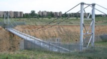
(pipeline bridge)
Babahoyo, Los Rios, Ecuador - Babahoyo River
| Bridgemeister ID: | 7229 (added 2022-07-16) |
| Name: | (pipeline bridge) |
| Location: | Babahoyo, Los Rios, Ecuador |
| Crossing: | Babahoyo River |
| Coordinates: | 1.797178 S 79.533913 W |
| Maps: | Acme, GeoHack, Google, OpenStreetMap |
| Use: | Pipeline |
| Status: | Extant (last checked: 2015) |
| Main Cables: | Wire (steel) |
| Suspended Spans: | 1 |
| Main Span: | 1 x 171 meters (561 feet) estimated |
Notes:
- Next to El Salto - Babahoyo, Los Rios, Ecuador.
- Near (footbridge) - Babahoyo, Los Rios, Ecuador.
- All past and present bridges at this location.
External Links:
(pipeline bridge)
Benson, Arizona, USA - San Pedro River
| Bridgemeister ID: | 2328 (added 2007-06-11) |
| Name: | (pipeline bridge) |
| Location: | Benson, Arizona, USA |
| Crossing: | San Pedro River |
| Coordinates: | 31.975290 N 110.278883 W |
| Maps: | Acme, GeoHack, Google, OpenStreetMap |
| Use: | Pipeline |
| Status: | Extant (last checked: 2019) |
| Main Cables: | Wire (steel) |
Notes:
- Likely several pipeline suspension bridges across the San Pedro near Benson.
- Next to (pipeline bridge) - Benson, Arizona, USA.
- Near (pipeline bridge) - Benson, Arizona, USA.
- All past and present bridges at this location.
(pipeline bridge)
Benson, Arizona, USA - San Pedro River
| Bridgemeister ID: | 3303 (added 2019-11-28) |
| Name: | (pipeline bridge) |
| Location: | Benson, Arizona, USA |
| Crossing: | San Pedro River |
| Coordinates: | 31.980649 N 110.281095 W |
| Maps: | Acme, GeoHack, Google, OpenStreetMap |
| Use: | Pipeline |
| Status: | Extant (last checked: 2019) |
| Main Cables: | Wire (steel) |
Notes:
(pipeline bridge)
Benson, Arizona, USA - San Pedro River
| Bridgemeister ID: | 3304 (added 2019-11-28) |
| Name: | (pipeline bridge) |
| Location: | Benson, Arizona, USA |
| Crossing: | San Pedro River |
| Coordinates: | 31.974698 N 110.278894 W |
| Maps: | Acme, GeoHack, Google, OpenStreetMap |
| Use: | Pipeline |
| Status: | Extant (last checked: 2019) |
| Main Cables: | Wire (steel) |
Notes:
(pipeline bridge)
Benteng, Bogor Regency and Rancabungur, Bogor Regency, West Java, Indonesia - Cisadane River
| Bridgemeister ID: | 7663 (added 2023-06-11) |
| Name: | (pipeline bridge) |
| Location: | Benteng, Bogor Regency and Rancabungur, Bogor Regency, West Java, Indonesia |
| Crossing: | Cisadane River |
| Coordinates: | 6.536846 S 106.699151 E |
| Maps: | Acme, GeoHack, Google, OpenStreetMap |
| Use: | Pipeline |
| Status: | Extant (last checked: 2022) |
| Main Cables: | Wire (steel) |
Notes:
- Small pipeline suspension bridge between two road bridges.
(pipeline bridge)
Billère and Jurançon, Pyrénées-Atlantiques, France - Ousse River
| Bridgemeister ID: | 4564 (added 2020-06-02) |
| Name: | (pipeline bridge) |
| Location: | Billère and Jurançon, Pyrénées-Atlantiques, France |
| Crossing: | Ousse River |
| Coordinates: | 43.293272 N 0.395823 W |
| Maps: | Acme, GeoHack, Google, OpenStreetMap |
| Use: | Pipeline |
| Status: | Extant (last checked: 2019) |
| Main Cables: | Wire (steel) |
| Suspended Spans: | 1 |
External Links:
(pipeline bridge)
Blénod-lès-Pont-à-Mousson and Loisy, Meurthe-et-Moselle, France - Moselle/Mosel River
| Bridgemeister ID: | 4731 (added 2020-06-27) |
| Name: | (pipeline bridge) |
| Location: | Blénod-lès-Pont-à-Mousson and Loisy, Meurthe-et-Moselle, France |
| Crossing: | Moselle/Mosel River |
| Coordinates: | 48.878972 N 6.087439 E |
| Maps: | Acme, GeoHack, Google, OpenStreetMap |
| Use: | Pipeline |
| Status: | Extant (last checked: 2016) |
| Main Cables: | Wire (steel) |
| Main Spans: | 2 |
External Links:
(pipeline bridge)
Blythe, California and Ehrenberg, Arizona, USA - Colorado River
| Bridgemeister ID: | 2522 (added 2010-01-02) |
| Name: | (pipeline bridge) |
| Location: | Blythe, California and Ehrenberg, Arizona, USA |
| Crossing: | Colorado River |
| Coordinates: | 33.60182 N 114.53324 W |
| Maps: | Acme, GeoHack, Google, OpenStreetMap |
| Use: | Pipeline |
| Status: | Extant (last checked: 2010) |
| Main Cables: | Wire (steel) |
| Suspended Spans: | 1 |
| Bridgemeister ID: | 6788 (added 2021-10-29) |
| Name: | (pipeline bridge) |
| Location: | Bogor, West Java, Indonesia |
| Crossing: | Ciliwung |
| At or Near Feature: | Bogor Botanical Gardens |
| Coordinates: | 6.601567 S 106.801665 E |
| Maps: | Acme, GeoHack, Google, OpenStreetMap |
| Use: | Pipeline |
| Status: | Extant (last checked: 2020) |
| Main Cables: | Wire |
| Suspended Spans: | 1 |
Notes:
(pipeline bridge)
Bradford, Pennsylvania, USA
| Bridgemeister ID: | 4827 (added 2020-07-05) |
| Name: | (pipeline bridge) |
| Location: | Bradford, Pennsylvania, USA |
| Coordinates: | 41.967963 N 78.625340 W |
| Maps: | Acme, GeoHack, Google, OpenStreetMap |
| Use: | Pipeline |
| Status: | Extant (last checked: 2020) |
| Main Cables: | Wire (steel) |
| Suspended Spans: | 1 |
(pipeline bridge)
Bradford, Pennsylvania, USA - Tunungwant Creek
| Bridgemeister ID: | 4828 (added 2020-07-05) |
| Name: | (pipeline bridge) |
| Location: | Bradford, Pennsylvania, USA |
| Crossing: | Tunungwant Creek |
| Coordinates: | 41.967349 N 78.629287 W |
| Maps: | Acme, GeoHack, Google, OpenStreetMap |
| Use: | Pipeline |
| Status: | Extant (last checked: 2020) |
| Main Cables: | Wire (steel) |
| Suspended Spans: | 1 |
(pipeline bridge)
Bungin, Tana Toraja Regency, South Sulawesi, Indonesia - Sadang River
| Bridgemeister ID: | 8929 (added 2024-11-27) |
| Name: | (pipeline bridge) |
| Location: | Bungin, Tana Toraja Regency, South Sulawesi, Indonesia |
| Crossing: | Sadang River |
| Coordinates: | 3.061556 S 119.858583 E |
| Maps: | Acme, GeoHack, Google, OpenStreetMap |
| Use: | Pipeline |
| Status: | Extant (last checked: 2023) |
| Main Cables: | Wire (steel) |
Notes:
(pipeline bridge)
Burbank, California, USA - Los Angeles River
| Bridgemeister ID: | 2523 (added 2010-01-02) |
| Name: | (pipeline bridge) |
| Location: | Burbank, California, USA |
| Crossing: | Los Angeles River |
| Coordinates: | 34.15051 N 118.32908 W |
| Maps: | Acme, GeoHack, Google, OpenStreetMap |
| Use: | Pipeline |
| Status: | Extant (last checked: 2009) |
| Main Cables: | Wire |
| Suspended Spans: | 1 |
(pipeline bridge)
Burgess Falls, Sparta vicinity, Tennessee, USA - Falling Water River
| Bridgemeister ID: | 2346 (added 2007-08-12) |
| Name: | (pipeline bridge) |
| Location: | Burgess Falls, Sparta vicinity, Tennessee, USA |
| Crossing: | Falling Water River |
| At or Near Feature: | Burgess Falls State Park |
| Use: | Pipeline |
| Status: | Derelict (last checked: 2007) |
| Main Cables: | Wire |
Notes:
- Likely constructed in 1920s as part of the dam and powerhouse project at Burgess Falls. There may have been two of these bridges at this location. The current map for Burgess Falls State Park shows two historical "pipeline bridges." I have only seen images of one derelict suspension bridge.
(pipeline bridge)
Burstall vicinity, Alberta, Canada - South Saskatchewan River
| Bridgemeister ID: | 2048 (added 2006-05-13) |
| Name: | (pipeline bridge) |
| Location: | Burstall vicinity, Alberta, Canada |
| Crossing: | South Saskatchewan River |
| Use: | Pipeline |
| Status: | Extant |
| Main Cables: | Wire (steel) |
Notes:
- Burstall is in Saskatchewan, but the bridge appears to be located west of Burstall in Alberta.
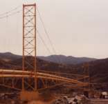
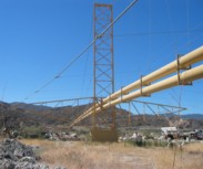
(pipeline bridge)
Canyon Country, California, USA - Soledad Canyon
| Bridgemeister ID: | 1259 (added 2004-03-06) |
| Name: | (pipeline bridge) |
| Location: | Canyon Country, California, USA |
| Crossing: | Soledad Canyon |
| Coordinates: | 34.43219 N 118.39074 W |
| Maps: | Acme, GeoHack, Google, OpenStreetMap |
| Use: | Pipeline |
| Status: | In use (last checked: 2007) |
| Main Cables: | Wire (steel) |
| Suspended Spans: | 2 |
| Main Span: | 1 x 187.5 meters (615 feet) estimated |
| Side Span: | 1 |
Image Sets:
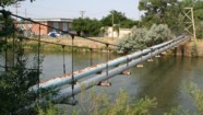
(pipeline bridge)
Casper, Wyoming, USA - North Platte River
| Bridgemeister ID: | 2107 (added 2006-09-03) |
| Name: | (pipeline bridge) |
| Location: | Casper, Wyoming, USA |
| Crossing: | North Platte River |
| Coordinates: | 42.859117 N 106.327517 W |
| Maps: | Acme, GeoHack, Google, OpenStreetMap |
| Use: | Pipeline |
| Status: | Extant (last checked: 2006) |
| Main Cables: | Wire (steel) |
| Suspended Spans: | 1 |
| Main Span: | 1 x 61 meters (200 feet) estimated |
Image Sets:
(pipeline bridge)
Castaic vicinity, California, USA - Castaic Creek
| Bridgemeister ID: | 2329 (added 2007-07-04) |
| Name: | (pipeline bridge) |
| Location: | Castaic vicinity, California, USA |
| Crossing: | Castaic Creek |
| Coordinates: | 34.47552 N 118.61212 W |
| Maps: | Acme, GeoHack, Google, OpenStreetMap |
| Use: | Pipeline |
| Status: | Extant (last checked: 2007) |
| Main Cables: | Wire (steel) |
| Suspended Spans: | 2 |
| Side Spans: | 2 |
Image Sets:
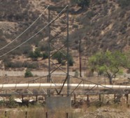
(pipeline bridge)
Central Sauzal vicinity, Machali, Chile - Cachapoal River
| Bridgemeister ID: | 8019 (added 2023-12-10) |
| Name: | (pipeline bridge) |
| Location: | Central Sauzal vicinity, Machali, Chile |
| Crossing: | Cachapoal River |
| Coordinates: | 34.269139 S 70.584722 W |
| Maps: | Acme, GeoHack, Google, OpenStreetMap |
| Use: | Pipeline |
| Status: | Extant (last checked: 2023) |
| Main Cables: | Wire (steel) |
| Suspended Spans: | 2 |
| Main Span: | 1 x 97 meters (318.2 feet) estimated |
| Side Span: | 1 x 50 meters (164 feet) estimated |
External Links:
(pipeline bridge)
Chalat, Gilgit-Baltistan, Pakistan - Hunza River
| Bridgemeister ID: | 6395 (added 2021-07-27) |
| Name: | (pipeline bridge) |
| Location: | Chalat, Gilgit-Baltistan, Pakistan |
| Crossing: | Hunza River |
| Coordinates: | 36.256315 N 74.351727 E |
| Maps: | Acme, GeoHack, Google, OpenStreetMap |
| Use: | Pipeline |
| Status: | Extant (last checked: 2021) |
| Main Span: | 1 x 144.5 meters (474 feet) estimated |
(pipeline bridge)
Charleston, Tennessee, USA - Hiwassee River
| Bridgemeister ID: | 2036 (added 2006-05-01) |
| Name: | (pipeline bridge) |
| Location: | Charleston, Tennessee, USA |
| Crossing: | Hiwassee River |
| Principals: | John A. Roebling's Sons Co., Pittsburgh Bridge & Iron Co. |
| Use: | Pipeline |
| Main Cables: | Wire (steel) |
Notes:
- Built to connect Blaw-Knox chemical plan to nearby Bowaters Southern Paper Corp. Described in Roebling ad in March 1963 issue of Civil Engineering.
(pipeline bridge)
Chula Vista vicinity, California, USA - Otay River
| Bridgemeister ID: | 1573 (added 2004-12-11) |
| Name: | (pipeline bridge) |
| Location: | Chula Vista vicinity, California, USA |
| Crossing: | Otay River |
| Coordinates: | 32.6003 N 116.92888 W |
| Maps: | Acme, GeoHack, Google, OpenStreetMap |
| Use: | Pipeline |
| Status: | In use (last checked: 2004) |
| Main Cables: | Wire (steel) |
| Suspended Spans: | 1 |
(pipeline bridge)
Council Bluffs, Iowa, USA - Mosquito Creek
| Bridgemeister ID: | 2268 (added 2007-04-21) |
| Name: | (pipeline bridge) |
| Location: | Council Bluffs, Iowa, USA |
| Crossing: | Mosquito Creek |
| Coordinates: | 41.20985 N 95.82730 W |
| Maps: | Acme, GeoHack, Google, OpenStreetMap |
| Use: | Pipeline |
| Status: | Extant (last checked: 2010) |
| Main Cables: | Wire (steel) |
Notes:
- Patrick S. O'Donnell estimated the main span of this bridge at roughly 550 feet.
(pipeline bridge)
Covington, Virginia, USA - Potts Creek
| Bridgemeister ID: | 1413 (added 2004-07-04) |
| Name: | (pipeline bridge) |
| Location: | Covington, Virginia, USA |
| Crossing: | Potts Creek |
| Coordinates: | 37.75240 N 79.99713 W |
| Maps: | Acme, GeoHack, Google, OpenStreetMap |
| Use: | Pipeline |
| Status: | In use (last checked: 2008) |
| Main Cables: | Wire (steel) |
| Suspended Spans: | 1 |
| Main Span: | 1 x 61 meters (200 feet) estimated |
Notes:
- Just barely visible to the north as your cross over Potts Creek on VA18 heading into Covington.
Image Sets:
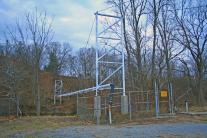
| Bridgemeister ID: | 7939 (added 2023-10-29) |
| Name: | (pipeline bridge) |
| Location: | Cremona, Cremona, Italy |
| Crossing: | Po River |
| Coordinates: | 45.127917 N 9.995194 E |
| Maps: | Acme, GeoHack, Google, OpenStreetMap |
| Use: | Pipeline and Footbridge |
| Status: | Removed |
| Main Cables: | Wire (steel) |
| Suspended Spans: | 3 |
| Main Span: | 1 |
| Side Spans: | 2 |
Notes:
- Built at some point in the 1960s. Removed prior to 2003, but likely much earlier. Main span was likely 225-235 meters.
Image Sets:
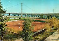
(pipeline bridge)
Curtis vicinity, Arkansas, USA - South Boat Ditch
| Bridgemeister ID: | 2432 (added 2008-04-22) |
| Name: | (pipeline bridge) |
| Location: | Curtis vicinity, Arkansas, USA |
| Crossing: | South Boat Ditch |
| Use: | Pipeline |
| Status: | Extant (last checked: 2008) |
| Main Cables: | Wire (steel) |
| Suspended Spans: | 1 |
Image Sets:
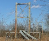
(pipeline bridge)
Dahimal, Gilgit-Baltistan, Pakistan - Gilgit River
| Bridgemeister ID: | 6696 (added 2021-10-02) |
| Name: | (pipeline bridge) |
| Location: | Dahimal, Gilgit-Baltistan, Pakistan |
| Crossing: | Gilgit River |
| Coordinates: | 36.201420 N 73.246198 E |
| Maps: | Acme, GeoHack, Google, OpenStreetMap |
| Use: | Pipeline |
| Status: | Extant (last checked: 2021) |
| Main Cables: | Wire (steel) |
| Suspended Spans: | 1 |
| Main Span: | 1 x 42.7 meters (140 feet) estimated |
Notes:
- Built at some point after mid-2017. Immediately adjacent to a drooping suspension footbridge that is not included in the inventory.
External Links:
- Mild Steel Pipe over Ghizer River - Facebook. Appears to actually cross the Gilgit River despite the caption.
(pipeline bridge)
Dayton Lakes vicinity, Texas, USA - Trinity River
| Bridgemeister ID: | 3326 (added 2019-12-01) |
| Name: | (pipeline bridge) |
| Location: | Dayton Lakes vicinity, Texas, USA |
| Crossing: | Trinity River |
| Coordinates: | 30.213426 N 94.825076 W |
| Maps: | Acme, GeoHack, Google, OpenStreetMap |
| Use: | Pipeline |
| Status: | Extant (last checked: 2019) |
| Main Cables: | Wire (steel) |
(pipeline bridge)
Dearborn, Michigan, USA - Rouge River
| Bridgemeister ID: | 7125 (added 2022-06-17) |
| Name: | (pipeline bridge) |
| Location: | Dearborn, Michigan, USA |
| Crossing: | Rouge River |
| Coordinates: | 42.290501 N 83.166260 W |
| Maps: | Acme, GeoHack, Google, OpenStreetMap |
| Use: | Pipeline |
| Status: | Extant (last checked: 2022) |
| Main Cables: | Wire (steel) |
| Main Span: | 1 x 76 meters (249.3 feet) estimated |
Image Sets:
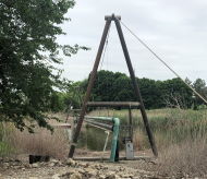
(pipeline bridge)
Deyangan, Magelang Regency and Bumiharjo, Magelang Regency, Central Java, Indonesia - Progo River
| Bridgemeister ID: | 8974 (added 2024-12-20) |
| Name: | (pipeline bridge) |
| Location: | Deyangan, Magelang Regency and Bumiharjo, Magelang Regency, Central Java, Indonesia |
| Crossing: | Progo River |
| Coordinates: | 7.591917 S 110.208889 E |
| Maps: | Acme, GeoHack, Google, OpenStreetMap |
| Use: | Pipeline |
| Status: | Extant (last checked: 2023) |
| Main Cables: | Wire (iron) |
| Suspended Spans: | 3 |
| Main Span: | 1 x 50 meters (164 feet) estimated |
| Side Spans: | 2 |
(pipeline bridge)
Duncan and North Cowichan, British Columbia, Canada
| Bridgemeister ID: | 8986 (added 2024-12-23) |
| Name: | (pipeline bridge) |
| Location: | Duncan and North Cowichan, British Columbia, Canada |
| Coordinates: | 48.773444 N 123.752306 W |
| Maps: | Acme, GeoHack, Google, OpenStreetMap |
| Use: | Pipeline |
| Status: | Extant (last checked: 2024) |
| Main Span: | 1 x 90 meters (295.3 feet) estimated |
(pipeline bridge)
Durkee, Worland vicinity, Wyoming, USA - Big Horn River
| Bridgemeister ID: | 2108 (added 2006-09-03) |
| Name: | (pipeline bridge) |
| Location: | Durkee, Worland vicinity, Wyoming, USA |
| Crossing: | Big Horn River |
| Coordinates: | 44.125767 N 107.927817 W |
| Maps: | Acme, GeoHack, Google, OpenStreetMap |
| Use: | Pipeline |
| Status: | Extant (last checked: 2006) |
| Main Cables: | Wire (steel) |
| Suspended Spans: | 1 |
Notes:
Image Sets:
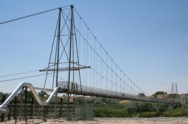
(pipeline bridge)
Durkee, Worland vicinity, Wyoming, USA - Big Horn River
| Bridgemeister ID: | 2601 (added 2014-04-14) |
| Name: | (pipeline bridge) |
| Location: | Durkee, Worland vicinity, Wyoming, USA |
| Crossing: | Big Horn River |
| Coordinates: | 44.126801 N 107.928528 W |
| Maps: | Acme, GeoHack, Google, OpenStreetMap |
| Use: | Pipeline |
| Status: | Removed |
| Main Cables: | Wire |
| Main Span: | 1 |
Notes:
- Appears to have been removed at some point after 2007.
- Near (pipeline bridge) - Durkee, Worland vicinity, Wyoming, USA.
Image Sets:
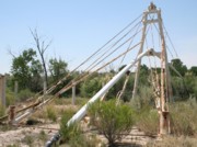
(pipeline bridge)
Eagle Creek Township and Keener Township, Indiana, USA - Kankakee River
| Bridgemeister ID: | 8412 (added 2024-03-03) |
| Name: | (pipeline bridge) |
| Location: | Eagle Creek Township and Keener Township, Indiana, USA |
| Crossing: | Kankakee River |
| Coordinates: | 41.220361 N 87.270806 W |
| Maps: | Acme, GeoHack, Google, OpenStreetMap |
| Use: | Pipeline |
| Status: | Extant (last checked: 2023) |
| Main Spans: | 1 x 72 meters (236.2 feet) estimated, 1 x 25 meters (82 feet) estimated |
Notes:
- One of six short suspended pipelines along a five mile stretch of, what appears to be, the same pipeline. This one, crossing the Kankakee River is the longest of the group by far.
- Connects to (pipeline bridge) - Eagle Creek Township, Indiana, USA.
- Connects to (pipeline bridge) - Eagle Creek Township, Indiana, USA.
- Connects to (pipeline bridge) - Eagle Creek Township, Indiana, USA.
- Connects to (pipeline bridge) - Keener Township, Indiana, USA.
- Connects to (pipeline bridge) - Keener Township, Indiana, USA.
- All past and present bridges at this location.
(pipeline bridge)
Eagle Creek Township, Indiana, USA - Singleton Ditch
| Bridgemeister ID: | 8409 (added 2024-03-03) |
| Name: | (pipeline bridge) |
| Location: | Eagle Creek Township, Indiana, USA |
| Crossing: | Singleton Ditch |
| Coordinates: | 41.260667 N 87.300861 W |
| Maps: | Acme, GeoHack, Google, OpenStreetMap |
| Use: | Pipeline |
| Status: | Extant (last checked: 2023) |
| Suspended Spans: | 1 |
| Main Span: | 1 x 20 meters (65.6 feet) estimated |
Notes:
- One of six short suspended pipelines along a five mile stretch of, what appears to be, the same pipeline.
- Connects to (pipeline bridge) - Eagle Creek Township and Keener Township, Indiana, USA.
- Connects to (pipeline bridge) - Eagle Creek Township, Indiana, USA.
- Connects to (pipeline bridge) - Eagle Creek Township, Indiana, USA.
- Connects to (pipeline bridge) - Keener Township, Indiana, USA.
- Connects to (pipeline bridge) - Keener Township, Indiana, USA.
- All past and present bridges at this location.
Image Sets:
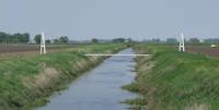
(pipeline bridge)
Eagle Creek Township, Indiana, USA - Little Ditch
| Bridgemeister ID: | 8410 (added 2024-03-03) |
| Name: | (pipeline bridge) |
| Location: | Eagle Creek Township, Indiana, USA |
| Crossing: | Little Ditch |
| Coordinates: | 41.257639 N 87.298583 W |
| Maps: | Acme, GeoHack, Google, OpenStreetMap |
| Use: | Pipeline |
| Status: | Extant (last checked: 2023) |
| Suspended Spans: | 1 |
| Main Span: | 1 x 21 meters (68.9 feet) estimated |
Notes:
- One of six short suspended pipelines along a five mile stretch of, what appears to be, the same pipeline.
- Connects to (pipeline bridge) - Eagle Creek Township and Keener Township, Indiana, USA.
- Connects to (pipeline bridge) - Eagle Creek Township, Indiana, USA.
- Connects to (pipeline bridge) - Eagle Creek Township, Indiana, USA.
- Connects to (pipeline bridge) - Keener Township, Indiana, USA.
- Connects to (pipeline bridge) - Keener Township, Indiana, USA.
- All past and present bridges at this location.
Image Sets:

(pipeline bridge)
Eagle Creek Township, Indiana, USA - Brown Ditch
| Bridgemeister ID: | 8411 (added 2024-03-03) |
| Name: | (pipeline bridge) |
| Location: | Eagle Creek Township, Indiana, USA |
| Crossing: | Brown Ditch |
| Coordinates: | 41.239583 N 87.285444 W |
| Maps: | Acme, GeoHack, Google, OpenStreetMap |
| Use: | Pipeline |
| Status: | Extant (last checked: 2023) |
| Suspended Spans: | 1 |
| Main Span: | 1 x 16 meters (52.5 feet) estimated |
Notes:
- One of six short suspended pipelines along a five mile stretch of, what appears to be, the same pipeline.
- Connects to (pipeline bridge) - Eagle Creek Township and Keener Township, Indiana, USA.
- Connects to (pipeline bridge) - Eagle Creek Township, Indiana, USA.
- Connects to (pipeline bridge) - Eagle Creek Township, Indiana, USA.
- Connects to (pipeline bridge) - Keener Township, Indiana, USA.
- Connects to (pipeline bridge) - Keener Township, Indiana, USA.
- All past and present bridges at this location.
(pipeline bridge)
Eccles, Worland vicinity, Wyoming, USA - Big Horn River
| Bridgemeister ID: | 2109 (added 2006-09-03) |
| Name: | (pipeline bridge) |
| Location: | Eccles, Worland vicinity, Wyoming, USA |
| Crossing: | Big Horn River |
| Coordinates: | 44.15685 N 107.928117 W |
| Maps: | Acme, GeoHack, Google, OpenStreetMap |
| Use: | Pipeline |
| Status: | Extant (last checked: 2006) |
| Main Cables: | Wire (steel) |
| Suspended Spans: | 1 |
Notes:
- Patrick S. O'Donnell estimates the main span at 400 feet based on aerial imagery.
Image Sets:
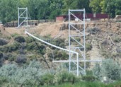
(pipeline bridge)
El Doce vicinity, Colombia - Cauca River
| Bridgemeister ID: | 7731 (added 2023-07-07) |
| Name: | (pipeline bridge) |
| Location: | El Doce vicinity, Colombia |
| Crossing: | Cauca River |
| Coordinates: | 7.459880 N 75.316432 W |
| Maps: | Acme, GeoHack, Google, OpenStreetMap |
| Use: | Pipeline |
| Status: | Extant (last checked: 2022) |
| Main Cables: | Wire |
(pipeline bridge)
Elk, California, USA - Greenwood Creek
| Bridgemeister ID: | 5685 (added 2021-03-26) |
| Name: | (pipeline bridge) |
| Location: | Elk, California, USA |
| Crossing: | Greenwood Creek |
| Coordinates: | 39.126247 N 123.714382 W |
| Maps: | Acme, GeoHack, Google, OpenStreetMap |
| Principals: | Elk County Water District |
| Use: | Pipeline |
| Status: | In use (last checked: 2021) |
| Main Cables: | Wire (steel) |
(pipeline bridge)
Escobal, Alajuela and San Pablo, San José Province, Costa Rica - Rio Tárcoles
| Bridgemeister ID: | 7768 (added 2023-08-17) |
| Name: | (pipeline bridge) |
| Location: | Escobal, Alajuela and San Pablo, San José Province, Costa Rica |
| Crossing: | Rio Tárcoles |
| Coordinates: | 9.922923 N 84.430955 W |
| Maps: | Acme, GeoHack, Google, OpenStreetMap |
| Use: | Pipeline |
| Status: | Extant (last checked: 2022) |
| Main Span: | 1 |
(pipeline bridge)
Eugene vicinity, Oregon, USA - McKenzie River
| Bridgemeister ID: | 2148 (added 2006-11-18) |
| Name: | (pipeline bridge) |
| Location: | Eugene vicinity, Oregon, USA |
| Crossing: | McKenzie River |
| At or Near Feature: | Armitage State Park vicinity |
| Coordinates: | 44.11456 N 123.05380 W |
| Maps: | Acme, GeoHack, Google, OpenStreetMap |
| Use: | Pipeline |
| Status: | Extant (last checked: 2006) |
| Main Cables: | Wire |
Notes:
(pipeline bridge)
Fortalecillas, Colombia - Magdalena River
| Bridgemeister ID: | 3609 (added 2019-12-31) |
| Name: | (pipeline bridge) |
| Location: | Fortalecillas, Colombia |
| Crossing: | Magdalena River |
| Coordinates: | 3.028211 N 75.259552 W |
| Maps: | Acme, GeoHack, Google, OpenStreetMap |
| Use: | Pipeline |
| Status: | Extant (last checked: 2019) |
| Main Cables: | Wire (steel) |
(pipeline bridge)
Fortalecillas, Colombia - Magdalena River
| Bridgemeister ID: | 3610 (added 2019-12-31) |
| Name: | (pipeline bridge) |
| Location: | Fortalecillas, Colombia |
| Crossing: | Magdalena River |
| Coordinates: | 3.028217 N 75.259089 W |
| Maps: | Acme, GeoHack, Google, OpenStreetMap |
| Use: | Pipeline |
| Status: | Extant (last checked: 2019) |
| Main Cables: | Wire (iron) |
| Bridgemeister ID: | 1820 (added 2005-05-21) |
| Name: | (pipeline bridge) |
| Location: | Fulton, Arkansas, USA |
| Crossing: | Red River |
| Coordinates: | 33.60368 N 93.81316 W |
| Maps: | Acme, GeoHack, Google, OpenStreetMap |
| Use: | Pipeline |
| Status: | Extant (last checked: 2007) |
| Main Cables: | Wire (steel) |
| Suspended Spans: | 3 |
| Main Span: | 1 |
| Side Spans: | 2 |
Notes:
- Call numbers ECD0860-1 and ECD0860-2 of the Arkansas History Commission's image archives show this large pipeline bridge.
External Links:
- Historic Bridges of the United States - Fulton Pipeline Bridge - Hempstead County, Arkansas, and Miller County, Arkansas
- Structurae - Structure ID 20050818
Image Sets:
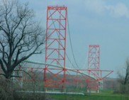
(pipeline bridge)
Gary, Indiana, USA - Grand Calumet River
| Bridgemeister ID: | 7122 (added 2022-06-17) |
| Name: | (pipeline bridge) |
| Location: | Gary, Indiana, USA |
| Crossing: | Grand Calumet River |
| Coordinates: | 41.608340 N 87.349447 W |
| Maps: | Acme, GeoHack, Google, OpenStreetMap |
| Use: | Pipeline |
| Status: | Extant (last checked: 2022) |
| Main Cables: | Wire (steel) |
| Main Span: | 1 x 61 meters (200.1 feet) estimated |
Notes:
(pipeline bridge)
Gary, Indiana, USA - Grand Calumet River
| Bridgemeister ID: | 7123 (added 2022-06-17) |
| Name: | (pipeline bridge) |
| Location: | Gary, Indiana, USA |
| Crossing: | Grand Calumet River |
| Coordinates: | 41.608436 N 87.349509 W |
| Maps: | Acme, GeoHack, Google, OpenStreetMap |
| Use: | Pipeline |
| Status: | Extant (last checked: 2022) |
| Main Cables: | Wire (steel) |
| Main Span: | 1 x 74 meters (242.8 feet) estimated |
Notes:
(pipeline bridge)
Gary, Indiana, USA - Grand Calumet River
| Bridgemeister ID: | 7124 (added 2022-06-17) |
| Name: | (pipeline bridge) |
| Location: | Gary, Indiana, USA |
| Crossing: | Grand Calumet River |
| Coordinates: | 41.608849 N 87.348776 W |
| Maps: | Acme, GeoHack, Google, OpenStreetMap |
| Use: | Pipeline |
| Status: | Extant |
| Main Cables: | Wire (steel) |
| Main Span: | 1 |
Notes:
(pipeline bridge)
Gelsenkirchen, North Rhine-Westphalia, Germany
(pipeline bridge)
Glenwood Springs, Colorado, USA - Colorado River
| Bridgemeister ID: | 2225 (added 2007-03-18) |
| Name: | (pipeline bridge) |
| Location: | Glenwood Springs, Colorado, USA |
| Crossing: | Colorado River |
| Coordinates: | 39.55085 N 107.31878 W |
| Maps: | Acme, GeoHack, Google, OpenStreetMap |
| Use: | Pipeline |
| Status: | Extant (last checked: 2006) |
| Main Cables: | Wire (steel) |
| Suspended Spans: | 1 |
| Main Span: | 1 x 61 meters (200 feet) estimated |
Notes:
- Span length of approximately 200 feet is for the suspended pipeline. Patrick O'Donnell estimates the anchorage-to-anchorage distance is 450 feet.
Image Sets:
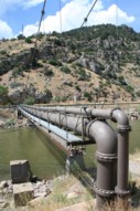
| Bridgemeister ID: | 7869 (added 2023-09-17) |
| Name: | (pipeline bridge) |
| Location: | Grassobbio, Bergamo, Italy |
| Crossing: | Serio |
| Coordinates: | 45.657637 N 9.732027 E |
| Maps: | Acme, GeoHack, Google, OpenStreetMap |
| Use: | Pipeline |
| Status: | Extant (last checked: 2023) |
| Main Cables: | Wire (steel) |
| Suspended Spans: | 3 |
| Main Span: | 1 x 101 meters (331.4 feet) estimated |
| Side Spans: | 2 |
| Bridgemeister ID: | 3975 (added 2020-03-22) |
| Name: | (pipeline bridge) |
| Location: | Greåker, Sarpsborg, Viken, Norway |
| Crossing: | Visterflo |
| Coordinates: | 59.26354 N 11.02993 E |
| Maps: | Acme, GeoHack, Google, kart.1881.no, OpenStreetMap |
| Use: | Pipeline |
| Status: | Extant (last checked: 2018) |
| Suspended Spans: | 1 |
| Main Span: | 1 x 60 meters (196.9 feet) estimated |
(pipeline bridge)
Halle, Germany - Saale River
| Bridgemeister ID: | 2966 (added 2019-10-12) |
| Name: | (pipeline bridge) |
| Location: | Halle, Germany |
| Crossing: | Saale River |
| Coordinates: | 51.520727 N 11.938966 E |
| Maps: | Acme, GeoHack, Google, OpenStreetMap |
| Use: | Pipeline |
| Status: | Extant (last checked: 2019) |
| Main Cables: | Wire (steel) |
(pipeline bridge)
Helper vicinity, Utah, USA - Price River
| Bridgemeister ID: | 2215 (added 2007-02-13) |
| Name: | (pipeline bridge) |
| Location: | Helper vicinity, Utah, USA |
| Crossing: | Price River |
| Coordinates: | 39.70666 N 110.86906 W |
| Maps: | Acme, GeoHack, Google, OpenStreetMap |
| Use: | Pipeline |
| Status: | Extant (last checked: 2006) |
| Main Cables: | Wire |
| Suspended Spans: | 1 |
| Main Span: | 1 x 45.7 meters (150 feet) estimated |
Image Sets:
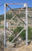
(pipeline bridge)
Hidakagawa, Wakayama, Japan - Hidaka River
| Bridgemeister ID: | 4432 (added 2020-04-19) |
| Name: | (pipeline bridge) |
| Location: | Hidakagawa, Wakayama, Japan |
| Crossing: | Hidaka River |
| Coordinates: | 33.970918 N 135.360611 E |
| Maps: | Acme, GeoHack, Google, OpenStreetMap |
| Use: | Pipeline |
| Status: | Extant (last checked: 2014) |
| Main Cables: | Wire (steel) |
| Suspended Spans: | 1 |
Notes:
- Small-diameter pipeline suspended adjacent to current (2020) through arch vehicular crossing.
- Near former location of (suspension bridge) - Hidakagawa, Wakayama, Japan.
(pipeline bridge)
Hominy, Oklahoma, USA - Hominy Creek
| Bridgemeister ID: | 3621 (added 2019-12-31) |
| Name: | (pipeline bridge) |
| Location: | Hominy, Oklahoma, USA |
| Crossing: | Hominy Creek |
| Coordinates: | 36.473875 N 96.378850 W |
| Maps: | Acme, GeoHack, Google, OpenStreetMap |
| Use: | Pipeline |
| Status: | Extant (last checked: 2019) |
| Main Cables: | Wire (steel) |
| Suspended Spans: | 1 |
Mail | Facebook | X (Twitter) | Bluesky