Inventory Search Results (1-100 of 2,055)
2,055 suspension bridges were found for search criteria: "(footbridge)". Bridges 1 through 100 (of 2,055 total) appear below. Click the Bridgemeister ID number to isolate the bridge on its own page. If you don't see what you were looking for, try an image search with the same criteria: "(footbridge)". This will find the bridge if it is pictured on the site, but is not a catenary suspension bridge.
Related:
1822: (footbridge)
Annonay, Ardèche, France - Cance River
| Bridgemeister ID: | 375 (added before 2003) |
| Year Completed: | 1822 |
| Name: | (footbridge) |
| Location: | Annonay, Ardèche, France |
| Crossing: | Cance River |
| Principals: | Marc Seguin, Camille Seguin, Jules Seguin, Paul Seguin, Charles Seguin |
| References: | AAJ, BBR, GHD, LAB, TTSB |
| Use: | Footbridge |
| Status: | Removed |
| Main Cables: | Wire (iron) |
| Suspended Spans: | 1 |
| Main Span: | 1 x 18 meters (59.1 feet) |
Notes:
- Test structure, but recognized as first wire bridge in France.
- See 1865 Moulin - Vernosc-lès-Annonay, Ardèche, France.
External Links:
1826: (footbridge)
Milford, England, United Kingdom - River Derwent
| Bridgemeister ID: | 5550 (added 2020-12-14) |
| Year Completed: | 1826 |
| Name: | (footbridge) |
| Location: | Milford, England, United Kingdom |
| Crossing: | River Derwent |
| Coordinates: | 53.000982 N 1.479285 W |
| Maps: | Acme, GeoHack, Google, OpenStreetMap |
| Principals: | William Strutt |
| Use: | Footbridge |
| Status: | Removed, 1946 |
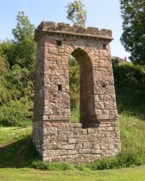
1827: (footbridge)
Denholm, Scotland, United Kingdom - River Teviot
| Bridgemeister ID: | 1555 (added 2004-11-24) |
| Year Completed: | 1827 |
| Name: | (footbridge) |
| Location: | Denholm, Scotland, United Kingdom |
| Crossing: | River Teviot |
| Coordinates: | 55.460001 N 2.686394 W |
| Maps: | Acme, GeoHack, Google, OpenStreetMap |
| Use: | Footbridge |
| Status: | Only towers remain, since 1875 (last checked: 2009) |
| Main Cables: | Chain (iron) |
Image Sets:
1835: (footbridge)
Alipore, Kolkata, West Bengal, India - Tolly's Nullah (Adi Ganga)
| Bridgemeister ID: | 3551 (added 2019-12-26) |
| Year Completed: | 1835 |
| Name: | (footbridge) |
| Location: | Alipore, Kolkata, West Bengal, India |
| Crossing: | Tolly's Nullah (Adi Ganga) |
| Principals: | Captain John Thomson |
| References: | ISB |
| Use: | Footbridge |
| Status: | Removed |
| Main Cables: | Chain (iron) |
Notes:
- Described in ISB as located: "at the north side of the Great Jail of Alipoor, opposite the road leading from the General Hospital to the European Burying Ground."
1842: (footbridge)
London, England, United Kingdom - Regent's Canal
| Bridgemeister ID: | 5088 (added 2020-09-04) |
| Year Completed: | 1842 |
| Name: | (footbridge) |
| Location: | London, England, United Kingdom |
| Crossing: | Regent's Canal |
| At or Near Feature: | Regent's Park |
| Principals: | James Dredge |
| References: | AAJ |
| Use: | Footbridge |
| Status: | Removed |
| Main Cables: | Rod (iron) |
| Suspended Spans: | 1 |
| Main Span: | 1 x 22.9 meters (75 feet) |
Notes:
- Built as part of same project as 1842 (footbridge) - London, England, United Kingdom.
- Built as part of same project as 1842 (footbridge) - London, England, United Kingdom.
- Built as part of same project as 1842 (footbridge) - London, England, United Kingdom.
- Built as part of same project as 1842 (footbridge) - London, England, United Kingdom.
Image Sets:
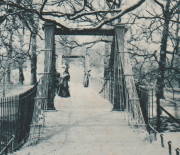
1842: (footbridge)
London, England, United Kingdom - Regent's Canal
| Bridgemeister ID: | 5089 (added 2020-09-04) |
| Year Completed: | 1842 |
| Name: | (footbridge) |
| Location: | London, England, United Kingdom |
| Crossing: | Regent's Canal |
| At or Near Feature: | Regent's Park |
| Principals: | James Dredge |
| References: | AAJ |
| Use: | Footbridge |
| Status: | Removed |
| Main Cables: | Rod (iron) |
| Suspended Spans: | 1 |
| Main Span: | 1 x 22.9 meters (75 feet) |
Notes:
- Built as part of same project as 1842 (footbridge) - London, England, United Kingdom.
- Built as part of same project as 1842 (footbridge) - London, England, United Kingdom.
- Built as part of same project as 1842 (footbridge) - London, England, United Kingdom.
- Built as part of same project as 1842 (footbridge) - London, England, United Kingdom.
Image Sets:

1842: (footbridge)
London, England, United Kingdom
| Bridgemeister ID: | 5090 (added 2020-09-04) |
| Year Completed: | 1842 |
| Name: | (footbridge) |
| Location: | London, England, United Kingdom |
| At or Near Feature: | Regent's Park |
| Principals: | James Dredge |
| References: | AAJ |
| Use: | Footbridge |
| Status: | Removed |
| Main Cables: | Rod (iron) |
| Main Span: | 1 x 45.7 meters (150 feet) |
Notes:
- Built as part of same project as 1842 (footbridge) - London, England, United Kingdom.
- Built as part of same project as 1842 (footbridge) - London, England, United Kingdom.
- Built as part of same project as 1842 (footbridge) - London, England, United Kingdom.
- Built as part of same project as 1842 (footbridge) - London, England, United Kingdom.
Image Sets:

1842: (footbridge)
London, England, United Kingdom
| Bridgemeister ID: | 5091 (added 2020-09-04) |
| Year Completed: | 1842 |
| Name: | (footbridge) |
| Location: | London, England, United Kingdom |
| At or Near Feature: | Regent's Park |
| Principals: | James Dredge |
| References: | AAJ |
| Use: | Footbridge |
| Status: | Removed |
| Main Cables: | Rod (iron) |
Notes:
- Built as part of same project as 1842 (footbridge) - London, England, United Kingdom.
- Built as part of same project as 1842 (footbridge) - London, England, United Kingdom.
- Built as part of same project as 1842 (footbridge) - London, England, United Kingdom.
- Built as part of same project as 1842 (footbridge) - London, England, United Kingdom.
Image Sets:

1842: (footbridge)
London, England, United Kingdom
| Bridgemeister ID: | 5092 (added 2020-09-04) |
| Year Completed: | 1842 |
| Name: | (footbridge) |
| Location: | London, England, United Kingdom |
| At or Near Feature: | Regent's Park |
| Principals: | James Dredge |
| References: | AAJ |
| Use: | Footbridge |
| Status: | Removed |
| Main Cables: | Rod (iron) |
Notes:
- Built as part of same project as 1842 (footbridge) - London, England, United Kingdom.
- Built as part of same project as 1842 (footbridge) - London, England, United Kingdom.
- Built as part of same project as 1842 (footbridge) - London, England, United Kingdom.
- Built as part of same project as 1842 (footbridge) - London, England, United Kingdom.
Image Sets:

1845: (footbridge)
Caledon, County Tyrone, Northern Ireland, United Kingdom - River Blackwater
| Bridgemeister ID: | 2424 (added 2008-03-12) |
| Year Completed: | 1845 |
| Name: | (footbridge) |
| Location: | Caledon, County Tyrone, Northern Ireland, United Kingdom |
| Crossing: | River Blackwater |
| Coordinates: | 54.34608 N 6.83276 W |
| Maps: | Acme, GeoHack, Google, OpenStreetMap |
| Principals: | James Dredge |
| References: | AAJ |
| Use: | Footbridge |
| Status: | Extant (last checked: 2021) |
| Main Cables: | Rod (iron) |
| Suspended Spans: | 1 |
| Main Span: | 1 x 22.6 meters (74 feet) |
Notes:
- This distinctly Dredge bridge is currently sitting atop modern concrete piers.
External Links:
1850: (footbridge)
Brahesborg Estate, Assens, Denmark
1862: (footbridge)
Greystead, England, United Kingdom - River North Tyne
| Bridgemeister ID: | 1252 (added 2004-02-21) |
| Year Completed: | 1862 |
| Name: | (footbridge) |
| Location: | Greystead, England, United Kingdom |
| Crossing: | River North Tyne |
| Coordinates: | 55.169017 N 2.353408 W |
| Maps: | Acme, GeoHack, Google, OpenStreetMap |
| Use: | Footbridge |
| Status: | Extant (last checked: 2019) |
| Main Cables: | Chain |
| Suspended Spans: | 1 |
Notes:
- Footbridge with large stone towers. Near Tarset Burn.
- Several sources suggest this bridge was completed in 1862.
- Similar to 1878 Sedgwick (Low Park Woods, New Sedgwick) - Sedgwick and Sizergh, England, United Kingdom.
External Links:
- Bridges on the Tyne. "Built to connect with Thorneyburn station on the Border Counties Railway."
1869: (footbridge)
Salado, Texas, USA - Salado Creek
| Bridgemeister ID: | 920 (added 2003-10-18) |
| Year Completed: | 1869 |
| Name: | (footbridge) |
| Location: | Salado, Texas, USA |
| Crossing: | Salado Creek |
| At or Near Feature: | Salado College |
| Use: | Footbridge |
| Status: | Destroyed, 1913 |
| Main Cables: | Wire (iron) |
Notes:
- Destroyed by flood, 1913.
1870: (footbridge)
Rockford, Illinois, USA - Kent Creek
| Bridgemeister ID: | 594 (added 2003-01-11) |
| Year Completed: | 1870 |
| Name: | (footbridge) |
| Location: | Rockford, Illinois, USA |
| Crossing: | Kent Creek |
| At or Near Feature: | Tinker Swiss Cottage Museum |
| Principals: | Robert Tinker |
| Use: | Footbridge |
| Status: | Removed, 1976 |
Notes:
- Ground broken on replacement, October 6, 2004.
- Later at same location 2005 (footbridge) - Rockford, Illinois, USA.
- All past and present bridges at this location.
1886: (footbridge)
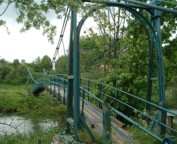
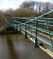
Huttons Ambo, North Yorkshire, England, United Kingdom - River Derwent
| Bridgemeister ID: | 417 (added before 2003) |
| Year Completed: | 1886 |
| Name: | (footbridge) |
| Location: | Huttons Ambo, North Yorkshire, England, United Kingdom |
| Crossing: | River Derwent |
| Coordinates: | 54.09975 N 0.8311 W |
| Maps: | Acme, GeoHack, Google, OpenStreetMap |
| References: | NTB |
| Use: | Footbridge |
| Status: | In use (last checked: 2014) |
| Main Cables: | Wire |
| Suspended Spans: | 1 |
| Main Span: | 1 x 29 meters (95 feet) |
Image Sets:
1887: (footbridge)
Offord, England, United Kingdom - Great Northern Railway track
| Bridgemeister ID: | 5084 (added 2020-09-04) |
| Year Completed: | 1887 |
| Name: | (footbridge) |
| Location: | Offord, England, United Kingdom |
| Crossing: | Great Northern Railway track |
| Principals: | John Harper, Harpers Limited |
| References: | HARPER |
| Use: | Footbridge |
| Status: | Removed |
| Main Cables: | Wire |
| Suspended Spans: | 1 |
External Links:
1890: (footbridge)
Hittisau, Austria - Bolgenach River
| Bridgemeister ID: | 1168 (added 2004-01-21) |
| Year Completed: | 1890 |
| Name: | (footbridge) |
| Location: | Hittisau, Austria |
| Crossing: | Bolgenach River |
| Coordinates: | 47.461957 N 9.970007 E |
| Maps: | Acme, GeoHack, Google, OpenStreetMap |
| Use: | Footbridge |
| Status: | In use (last checked: 2019) |
| Main Cables: | Wire |
| Suspended Spans: | 1 |
Notes:
- Rebuilt 1985.
External Links:
1890: (footbridge)
Lincoln, England, United Kingdom - Great Northern Railway track
| Bridgemeister ID: | 5083 (added 2020-09-02) |
| Year Completed: | 1890 |
| Name: | (footbridge) |
| Location: | Lincoln, England, United Kingdom |
| Crossing: | Great Northern Railway track |
| Principals: | Louis Harper |
| References: | HARPER |
| Use: | Footbridge |
| Status: | Removed |
| Main Cables: | Wire |
| Main Span: | 1 x 21.3 meters (70 feet) |
Notes:
- HARPER: Likely located at Pelham Street, just east of the present-day (2020) Lincoln train station.
| Bridgemeister ID: | 264 (added before 2003) |
| Year Completed: | 1891 |
| Name: | (footbridge) |
| Location: | Lewiston, Maine, USA |
| At or Near Feature: | Island Garden Amusement Park |
| Use: | Footbridge |
| Status: | Dismantled, 1903 |
| Main Cables: | Wire |
| Suspended Spans: | 1 |
Notes:
- Nancy Fraser writes: "The pedestrian suspension bridge [was] located at Island Garden Amusement Park in Lewiston, Maine. It started at the water gate house that you can see and led to an island over the water falls where they had entertainment. It was in existence in Lewiston from 1891 to 1903. It was later sold to Amos Gerald of Fairfield, Maine to be used for the trolley line leading to Casco Castle and Amusement Park in South Freeport, Maine."
- Moved to (footbridge) - South Freeport, Maine, USA.
Image Sets:

1892: (footbridge)
Anderson, Indiana, USA - White River
| Bridgemeister ID: | 6467 (added 2021-08-13) |
| Year Completed: | 1892 |
| Name: | (footbridge) |
| Location: | Anderson, Indiana, USA |
| Crossing: | White River |
| Use: | Footbridge |
| Status: | Destroyed, March 27, 1921 |
| Main Cables: | Wire (steel) |
| Suspended Spans: | 3 |
| Main Span: | 1 |
| Side Spans: | 2 |
Annotated Citations:
- Jackson, Stephen T. "If the River Could Talk: Bridges at 27 sites." The Herald Bulletin., 3 July 2016, www.heraldbulletin.com/community/if-the-river-could-talk-bridges-at-27-sites/article_0141fb64-6416-526d-baa4-752e97f65b95.html
"Opened March 7, 1892, in what would today be the shadow of the Eisenhower Bridge, was a suspension bridge built to carry pedestrian traffic from Anderson to Park Place. Twin support towers at each end of the bridge held the suspension span in between… The fun lasted until a flood brought it down March 27, 1921."
External Links:
1894: (footbridge)
Grimsby, England, United Kingdom - River Freshney
| Bridgemeister ID: | 5079 (added 2020-08-30) |
| Year Completed: | 1894 |
| Name: | (footbridge) |
| Location: | Grimsby, England, United Kingdom |
| Crossing: | River Freshney |
| Coordinates: | 53.570454 N 0.095989 W |
| Maps: | Acme, GeoHack, Google, OpenStreetMap |
| Principals: | Harper & Co. |
| References: | HARPER |
| Use: | Footbridge |
| Status: | Only towers remain (last checked: 2014) |
| Main Cables: | Wire |
| Suspended Spans: | 1 |
| Main Span: | 1 x 10.7 meters (35 feet) |
Notes:
- Replaced, but elements of the suspension bridge were retained in the new structure which is now (2020) boarded up.
- Built as part of same project as 1894 (footbridge) - Grimsby, England, United Kingdom.
- Built as part of same project as 1894 (footbridge) - Grimsby, England, United Kingdom.
1894: (footbridge)
Grimsby, England, United Kingdom - River Freshney
| Bridgemeister ID: | 5080 (added 2020-08-30) |
| Year Completed: | 1894 |
| Name: | (footbridge) |
| Location: | Grimsby, England, United Kingdom |
| Crossing: | River Freshney |
| Coordinates: | 53.569623 N 0.094252 W |
| Maps: | Acme, GeoHack, Google, OpenStreetMap |
| Principals: | Harper & Co. |
| References: | HARPER |
| Use: | Footbridge |
| Status: | Replaced |
| Main Cables: | Wire |
| Suspended Spans: | 1 |
| Main Span: | 1 x 15.2 meters (50 feet) |
Notes:
- Coordinates are for likely location of this bridge, since replaced.
- Built as part of same project as 1894 (footbridge) - Grimsby, England, United Kingdom.
- Built as part of same project as 1894 (footbridge) - Grimsby, England, United Kingdom.
1894: (footbridge)
Grimsby, England, United Kingdom - River Freshney
| Bridgemeister ID: | 5081 (added 2020-08-30) |
| Year Completed: | 1894 |
| Name: | (footbridge) |
| Location: | Grimsby, England, United Kingdom |
| Crossing: | River Freshney |
| Coordinates: | 53.568240 N 0.092003 W |
| Maps: | Acme, GeoHack, Google, OpenStreetMap |
| Principals: | Harper & Co. |
| References: | HARPER |
| Use: | Footbridge |
| Status: | Replaced |
| Main Cables: | Wire |
| Suspended Spans: | 1 |
| Main Span: | 1 x 15.2 meters (50 feet) |
Notes:
- Coordinates are for likely location of this bridge, since replaced.
- Built as part of same project as 1894 (footbridge) - Grimsby, England, United Kingdom.
- Built as part of same project as 1894 (footbridge) - Grimsby, England, United Kingdom.
1897: (footbridge)
Addingham, England, United Kingdom - River Wharfe
| Bridgemeister ID: | 1207 (added 2004-02-07) |
| Year Completed: | 1897 |
| Name: | (footbridge) |
| Location: | Addingham, England, United Kingdom |
| Crossing: | River Wharfe |
| Use: | Footbridge |
| Status: | Destroyed, 1936 |
| Main Cables: | Wire |
Notes:
- Destroyed by flood, 1936.
- Replaced by (footbridge) - Addingham, England, United Kingdom.
- All past and present bridges at this location.
1898: (footbridge)
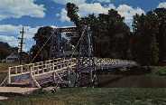
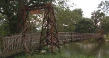
Pontiac, Illinois, USA - Vermilion River
| Bridgemeister ID: | 312 (added before 2003) |
| Year Completed: | 1898 |
| Name: | (footbridge) |
| Location: | Pontiac, Illinois, USA |
| Crossing: | Vermilion River |
| At or Near Feature: | Chautauqua Park |
| Coordinates: | 40.87696 N 88.62358 W |
| Maps: | Acme, GeoHack, Google, OpenStreetMap |
| Principals: | Joliet Bridge and Iron Co. |
| Use: | Footbridge |
| Status: | In use (last checked: 2005) |
| Main Cables: | Wire |
| Suspended Spans: | 2 |
| Main Span: | 1 |
| Side Span: | 1 |
Notes:
Image Sets:
1898: (footbridge)
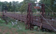
Pontiac, Illinois, USA - Vermilion River
| Bridgemeister ID: | 1862 (added 2005-07-31) |
| Year Completed: | 1898 |
| Name: | (footbridge) |
| Location: | Pontiac, Illinois, USA |
| Crossing: | Vermilion River |
| At or Near Feature: | Chautauqua Park |
| Coordinates: | 40.87554 N 88.62279 W |
| Maps: | Acme, GeoHack, Google, OpenStreetMap |
| Principals: | Joliet Bridge and Iron Co. |
| Use: | Footbridge |
| Status: | In use (last checked: 2005) |
| Main Cables: | Wire |
| Main Span: | 1 |
| Side Span: | 1 |
Notes:
Image Sets:
1899: (footbridge)
Bhiri (भीरी), Uttarakhand, India - Mandakini River
| Bridgemeister ID: | 7004 (added 2022-05-14) |
| Year Completed: | 1899 |
| Name: | (footbridge) |
| Location: | Bhiri (भीरी), Uttarakhand, India |
| Crossing: | Mandakini River |
| Coordinates: | 30.468578 N 79.074367 E |
| Maps: | Acme, GeoHack, Google, OpenStreetMap |
| Status: | In use (last checked: 2016) |
| Main Cables: | Wire (steel) |
| Main Span: | 1 |
External Links:
- Bridge over Mandakini near Bhiri a risk to lives - The Tribune India. Residents of Bhiri town in Rudprayag district are irked over the dilapidated condition of a footbridge over the Mandakini, which is on the verge of collapse. "The British constructed the bridge in1889 on the old Kedaranth trek route, near Bhiri, in Rudraprayag district."
1902: (footbridge)
Littleton, New Hampshire, USA - Ammonoosuc River
| Bridgemeister ID: | 2917 (added 2019-09-15) |
| Year Completed: | 1902 |
| Name: | (footbridge) |
| Location: | Littleton, New Hampshire, USA |
| Crossing: | Ammonoosuc River |
| Status: | Destroyed, 1938 |
| Main Cables: | Wire |
| Suspended Spans: | 1 |
Notes:
- Destroyed during the Great New England Hurricane, 1938.
- Replaced by 1939 Curran - Littleton, New Hampshire, USA.
- All past and present bridges at this location.
1904: (footbridge)
Conwy, Wales, United Kingdom - River Conwy
| Bridgemeister ID: | 512 (added before 2003) |
| Year Completed: | 1904 |
| Name: | (footbridge) |
| Location: | Conwy, Wales, United Kingdom |
| Crossing: | River Conwy |
| Coordinates: | 53.280346 N 3.823733 W |
| Maps: | Acme, GeoHack, Google, OpenStreetMap |
| Principals: | Alfred Thorne |
| Use: | Footbridge |
| Status: | Removed |
| Main Cables: | Wire (steel) |
| Suspended Spans: | 1 |
Notes:
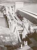
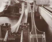
- This entry refers to the steel suspension footbridge nestled between Telford's suspension bridge and Stephenson's rail bridge. Click the photo to get a better view of this bridge. According to Susan Ellis, Senior Archivist of the Conwy County Borough Council, the bridge was built on the recommendation of John J. Webster who was hired to inspect Telford's suspension bridge in 1902 "following fears about the safety of its condition. He reported back making various recommendation for strengthening the bridge, including that a separate footbridge be constructed."
- This footbridge was in existence until at least 1957.
- Next to 1826 Conwy (Conway) - Conwy, Wales, United Kingdom.
- All past and present bridges at this location.
Annotated Citations:
- "Conway Suspension Bridge." The Engineer, 20 May 1904.
This detailed account of the 1904 reinforcement of Telford's adjacent bridge does not mention the existence of, or building of, an additional footbridge. It does describe adding a cantilevered walkway to one side of Telford's bridge. This walkway was, indeed, built, and can be seen in the linked image on the left side of the older bridge. Thus, it is not entirely clear whether this bridge was actually constructed in 1904 and the work of Alfred Thorne (who was very much associated with the Telford bridge reinforcement project)
Image Sets:
1905: (footbridge)
Peradeniya, Sri Lanka - Mahaweli Ganga
| Bridgemeister ID: | 2446 (added 2008-04-23) |
| Year Completed: | 1905 |
| Name: | (footbridge) |
| Location: | Peradeniya, Sri Lanka |
| Crossing: | Mahaweli Ganga |
| At or Near Feature: | Royal Botanical Gardens |
| Coordinates: | 7.276585 N 80.593782 E |
| Maps: | Acme, GeoHack, Google, OpenStreetMap |
| Use: | Footbridge |
| Status: | In use (last checked: 2022) |
| Main Cables: | Wire (steel) |
| Suspended Spans: | 3 |
| Main Span: | 1 |
| Side Spans: | 2 |
External Links:
1907: (footbridge)
Hooversville, Pennsylvania, USA - Stony Creek
| Bridgemeister ID: | 1569 (added 2004-12-05) |
| Year Completed: | 1907 |
| Name: | (footbridge) |
| Location: | Hooversville, Pennsylvania, USA |
| Crossing: | Stony Creek |
| Coordinates: | 40.147818 N 78.913939 W |
| Maps: | Acme, GeoHack, Google, OpenStreetMap |
| Use: | Footbridge |
| Status: | Destroyed, 1996 |
| Main Cables: | Wire |
Notes:
- Destroyed by flood, January 19, 1996.
- Replaced by 1996 (footbridge) - Hooversville, Pennsylvania, USA.
- All past and present bridges at this location.
1915: (footbridge)
Chiwaukum vicinity, Washington, USA - Wenatchee River
| Bridgemeister ID: | 1424 (added 2004-07-18) |
| Year Completed: | 1915 |
| Name: | (footbridge) |
| Location: | Chiwaukum vicinity, Washington, USA |
| Crossing: | Wenatchee River |
| Principals: | National Forest Service |
| References: | AAJ, PTS2 |
| Use: | Footbridge |
| Main Cables: | Wire (steel) |
| Suspended Spans: | 1 |
| Main Span: | 1 x 57.9 meters (190 feet) |
1918: (footbridge)
Wakefield vicinity, New Zealand - Dove River
| Bridgemeister ID: | 700 (added 2003-03-08) |
| Year Completed: | 1918 |
| Name: | (footbridge) |
| Location: | Wakefield vicinity, New Zealand |
| Crossing: | Dove River |
| References: | GAP |
| Use: | Footbridge |
1920: (footbridge)
Follebu, Innlandet, Norway
| Bridgemeister ID: | 1564 (added 2004-11-27) |
| Year Completed: | 1920 |
| Name: | (footbridge) |
| Location: | Follebu, Innlandet, Norway |
| Coordinates: | 61.2153 N 10.269267 E |
| Maps: | Acme, GeoHack, Google, kart.1881.no, OpenStreetMap |
| Use: | Footbridge |
| Status: | In use (last checked: 2004) |
| Main Cables: | Wire |
Notes:
- Restored, 1977 and 1995.
1921: (footbridge)
Oregon City and West Linn, Oregon, USA - Willamette River
| Bridgemeister ID: | 4954 (added 2020-08-08) |
| Year Completed: | 1921 |
| Name: | (footbridge) |
| Location: | Oregon City and West Linn, Oregon, USA |
| Crossing: | Willamette River |
| Use: | Footbridge |
| Status: | Removed, 1922 |
| Main Cables: | Wire (steel) |
Notes:
- See 1888 Oregon City - Oregon City and West Linn, Oregon, USA. The 1921 structure appears to have been a temporary, but large, footbridge constructed during the construction of the replacement of the older Oregon City suspension bridge.
External Links:
1922: (footbridge)
Bexley, Ohio, USA - Alum Creek
| Bridgemeister ID: | 819 (added 2003-05-31) |
| Year Completed: | 1922 |
| Name: | (footbridge) |
| Location: | Bexley, Ohio, USA |
| Crossing: | Alum Creek |
| At or Near Feature: | Wolfe Park |
| Coordinates: | 39.963831 N 82.947491 W |
| Maps: | Acme, GeoHack, Google, OpenStreetMap |
| References: | AAJ, PTS2 |
| Use: | Footbridge |
| Status: | In use (last checked: 2016) |
| Main Cables: | Wire (steel) |
| Suspended Spans: | 1 |
| Deck width: | 6.25 feet |
Notes:
- Closed 2013 for major refurbishment including a new deck. Reopened March. 2014.
- April 2015: Two main cables snap, causing a partial collapse of the bridge deck. Repaired and reopened August 5, 2016. Failure speculated to have been caused by the weight of the new deck installed 2013-2014.
Image Sets:
1923: (footbridge)
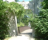
Kirschbaumwasen, Germany - Murg River
| Bridgemeister ID: | 1882 (added 2005-09-24) |
| Year Completed: | 1923 |
| Name: | (footbridge) |
| Location: | Kirschbaumwasen, Germany |
| Crossing: | Murg River |
| Coordinates: | 48.6233 N 8.354967 E |
| Maps: | Acme, GeoHack, Google, OpenStreetMap |
| Use: | Footbridge |
| Status: | In use (last checked: 2005) |
| Suspended Spans: | 1 |
Image Sets:
1924: (footbridge)
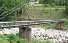
Oklahoma, USA - Baron Fork Creek
| Bridgemeister ID: | 1804 (added 2005-05-18) |
| Year Completed: | 1924 |
| Name: | (footbridge) |
| Location: | Oklahoma, USA |
| Crossing: | Baron Fork Creek |
| Use: | Footbridge |
| Main Cables: | Wire (steel) |
| Main Span: | 1 x 48.8 meters (160 feet) |
Image Sets:
1927: (footbridge)
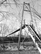
Forst, Germany - Lusatian Neisse River
| Bridgemeister ID: | 5562 (added 2020-12-19) |
| Year Completed: | 1927 |
| Name: | (footbridge) |
| Location: | Forst, Germany |
| Crossing: | Lusatian Neisse River |
| Coordinates: | 51.748356 N 14.659815 E |
| Maps: | Acme, GeoHack, Google, OpenStreetMap |
| References: | AAJ |
| Use: | Footbridge |
| Status: | Removed |
| Main Cables: | Eyebar (steel) |
| Suspended Spans: | 3 |
| Main Span: | 1 x 39.6 meters (129.89 feet) |
| Side Spans: | 2 x 19.8 meters (64.94 feet) |
Notes:
- Coordinates are for likely alignment of this former bridge, with at least one pier remaining (as of 2020).
1927: (footbridge)
Töpeln and Wöllsdorf, Saxony, Germany - Zschopau River
| Bridgemeister ID: | 2301 (added 2007-04-26) |
| Year Completed: | 1927 |
| Name: | (footbridge) |
| Location: | Töpeln and Wöllsdorf, Saxony, Germany |
| Crossing: | Zschopau River |
| Use: | Footbridge |
| Status: | Destroyed, 2002, by flood |
| Main Cables: | Wire (steel) |
| Suspended Spans: | 1 |
Notes:
- Replaced by a cable-stayed bridge April, 2004.
1930: (footbridge)
Grey Valley, Slaty Creek vicinity, New Zealand - Big River
| Bridgemeister ID: | 734 (added 2003-03-08) |
| Year Completed: | 1930 |
| Name: | (footbridge) |
| Location: | Grey Valley, Slaty Creek vicinity, New Zealand |
| Crossing: | Big River |
| References: | GAP |
| Use: | Footbridge |
1930: (footbridge)
Hartola, Finland - Tainionvirta
| Bridgemeister ID: | 5544 (added 2020-12-13) |
| Year Completed: | 1930 |
| Name: | (footbridge) |
| Location: | Hartola, Finland |
| Crossing: | Tainionvirta |
| Coordinates: | 61.568078 N 26.019536 E |
| Maps: | Acme, GeoHack, Google, OpenStreetMap |
| Use: | Footbridge |
| Status: | In use (last checked: 2020) |
| Main Cables: | Wire (steel) |
| Suspended Spans: | 1 |
1933: (footbridge)
Buhølen, Lindesnes, Agder, Norway - Skarpesvingen
| Bridgemeister ID: | 4392 (added 2020-04-18) |
| Year Completed: | 1933 |
| Name: | (footbridge) |
| Location: | Buhølen, Lindesnes, Agder, Norway |
| Crossing: | Skarpesvingen |
| Coordinates: | 58.118716 N 7.341573 E |
| Maps: | Acme, GeoHack, Google, kart.1881.no, OpenStreetMap |
| Use: | Footbridge |
| Status: | Removed |
| Main Cables: | Wire (steel) |
| Suspended Spans: | 1 |
| Main Span: | 1 x 40 meters (131.2 feet) estimated |
Notes:
- Likely completed in 1933 or soon after. The bridge was built to provide access to a school built in 1933.
- Based on historic aerial images, removed at some point in time frame 1968-2004.
| Bridgemeister ID: | 178 (added before 2003) |
| Year Completed: | 1933 |
| Name: | (footbridge) |
| Location: | Palatka, Florida, USA |
| At or Near Feature: | Ravine Gardens State Park |
| Coordinates: | 29.63481 N 81.64594 W |
| Maps: | Acme, GeoHack, Google, OpenStreetMap |
| Use: | Footbridge |
| Status: | In use (last checked: 2021) |
| Main Cables: | Wire (steel) |
| Suspended Spans: | 1 |
| Main Span: | 1 |
Notes:
- Near 1933 (footbridge) - Palatka, Florida, USA. There are two nearby footbridges in this park. It is not clear if both were constructed in 1933.
| Bridgemeister ID: | 2425 (added before 2003) |
| Year Completed: | 1933 |
| Name: | (footbridge) |
| Location: | Palatka, Florida, USA |
| At or Near Feature: | Ravine Gardens State Park |
| Coordinates: | 29.63343 N 81.64323 W |
| Maps: | Acme, GeoHack, Google, OpenStreetMap |
| Use: | Footbridge |
| Status: | In use (last checked: 2018) |
| Main Cables: | Wire (steel) |
| Suspended Spans: | 1 |
Notes:
- Near 1933 (footbridge) - Palatka, Florida, USA. There are two nearby footbridges in this park. It is not clear if both were constructed in 1933.
Image Sets:
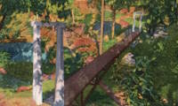
1934: (footbridge)
Green Valley vicinity, California, USA - Bouquet Reservoir
| Bridgemeister ID: | 1890 (added 2005-10-01) |
| Year Completed: | 1934 |
| Name: | (footbridge) |
| Location: | Green Valley vicinity, California, USA |
| Crossing: | Bouquet Reservoir |
| References: | CE193408 |
| Use: | Footbridge |
| Status: | Removed |
| Main Cables: | Wire (steel) |
| Main Span: | 1 x 61 meters (200 feet) |
Notes:
- CE193408: "A bridge 276 ft long, consisting of a 200-ft suspension span and two equal shore spans, connects the [gate control] tower with the shore. The suspended span is supported by two prestressed cable strands and by arc-welded structural steel stiffening trusses." Article includes photo of the bridge and tower.
- Access bridge for the Bouquet Reservoir gate control tower. Likely completed 1933 or 1934.
1934: (footbridge)
Grey Valley, New Zealand - Slaty Creek
| Bridgemeister ID: | 750 (added 2003-03-08) |
| Year Completed: | 1934 |
| Name: | (footbridge) |
| Location: | Grey Valley, New Zealand |
| Crossing: | Slaty Creek |
| Use: | Footbridge |
1934: (footbridge)
Ilkley, England, United Kingdom - River Wharfe
| Bridgemeister ID: | 1261 (added 2004-03-13) |
| Year Completed: | 1934 |
| Name: | (footbridge) |
| Location: | Ilkley, England, United Kingdom |
| Crossing: | River Wharfe |
| Coordinates: | 53.93241 N 1.81483 W |
| Maps: | Acme, GeoHack, Google, OpenStreetMap |
| Principals: | David Rowell & Co. |
| Use: | Footbridge |
| Status: | In use (last checked: 2022) |
| Main Cables: | Wire (steel) |
| Suspended Spans: | 1 |
Notes:
- Refurbished, 2001.
Image Sets:
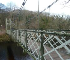
1934: (footbridge)
Rollag, Viken, Norway - Numedalslågen
| Bridgemeister ID: | 4099 (added 2020-04-05) |
| Year Completed: | 1934 |
| Name: | (footbridge) |
| Location: | Rollag, Viken, Norway |
| Crossing: | Numedalslågen |
| Coordinates: | 60.017909 N 9.276293 E |
| Maps: | Acme, GeoHack, Google, kart.1881.no, OpenStreetMap |
| Use: | Footbridge |
| Status: | In use (last checked: 2019) |
| Main Cables: | Wire (steel) |
| Suspended Spans: | 1 |
| Main Span: | 1 x 88 meters (288.7 feet) estimated |
| Deck width: | 1.5 meters |
1936: (footbridge)
Gisborne vicinity, New Zealand - Waimata River
| Bridgemeister ID: | 752 (added 2003-03-08) |
| Year Completed: | 1936 |
| Name: | (footbridge) |
| Location: | Gisborne vicinity, New Zealand |
| Crossing: | Waimata River |
| References: | GAP |
| Use: | Footbridge |
1936: (footbridge)
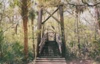
Hillsborough River State Park, Florida, USA - Hillsborough River
| Bridgemeister ID: | 285 (added before 2003) |
| Year Completed: | 1936 |
| Name: | (footbridge) |
| Location: | Hillsborough River State Park, Florida, USA |
| Crossing: | Hillsborough River |
| Coordinates: | 28.1499 N 82.23203 W |
| Maps: | Acme, GeoHack, Google, OpenStreetMap |
| Principals: | CCC |
| Use: | Footbridge |
| Status: | In use (last checked: 2004) |
| Main Cables: | Wire (steel) |
| Main Span: | 1 |
Image Sets:
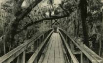
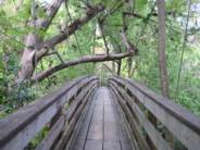
1936: (footbridge)
Motumote, Southland, New Zealand - Waiau River
| Bridgemeister ID: | 754 (added 2003-03-08) |
| Year Completed: | 1936 |
| Name: | (footbridge) |
| Location: | Motumote, Southland, New Zealand |
| Crossing: | Waiau River |
| References: | GAP |
| Use: | Footbridge |
1936: (footbridge)
Tower Lakes, Illinois, USA - Tower Lake
| Bridgemeister ID: | 1306 (added 2004-04-10) |
| Year Completed: | 1936 |
| Name: | (footbridge) |
| Location: | Tower Lakes, Illinois, USA |
| Crossing: | Tower Lake |
| Coordinates: | 42.230815 N 88.154552 W |
| Maps: | Acme, GeoHack, Google, OpenStreetMap |
| Use: | Footbridge |
| Status: | Extant (last checked: 2019) |
| Suspended Spans: | 3 |
| Main Spans: | 3 |
Notes:
- There is at least one other suspension footbridge in the Tower Lakes area, but this 1936 3-span bridge appears to be the largest and the only one with a level deck.
1936: (footbridge)
Waikino, New Zealand - Ohinemuri River
| Bridgemeister ID: | 755 (added 2003-03-08) |
| Year Completed: | 1936 |
| Name: | (footbridge) |
| Location: | Waikino, New Zealand |
| Crossing: | Ohinemuri River |
| Principals: | L.E. Shaw |
| References: | GAP |
| Use: | Footbridge |
| Status: | Destroyed, 1981 |
| Main Cables: | Wire |
| Main Span: | 1 x 42.1 meters (138.1 feet) |
Notes:
- GAP: Damaged by flood, 1964. Repaired. Destroyed by flood, 1981.
External Links:
1937: (footbridge)
Bruce property, New Zealand - Maruia River
| Bridgemeister ID: | 757 (added 2003-03-08) |
| Year Completed: | 1937 |
| Name: | (footbridge) |
| Location: | Bruce property, New Zealand |
| Crossing: | Maruia River |
| References: | GAP |
| Use: | Footbridge |
1939: (footbridge)
Dannevirke vicinity, New Zealand - Mangatoro Stream
| Bridgemeister ID: | 766 (added 2003-03-08) |
| Year Completed: | 1939 |
| Name: | (footbridge) |
| Location: | Dannevirke vicinity, New Zealand |
| Crossing: | Mangatoro Stream |
| References: | GAP |
| Use: | Footbridge |
1939: (footbridge)
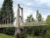
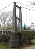
Masterton, Wairarapa District, New Zealand - Waipoua River
| Bridgemeister ID: | 742 (added 2003-03-08) |
| Year Completed: | 1939 |
| Name: | (footbridge) |
| Location: | Masterton, Wairarapa District, New Zealand |
| Crossing: | Waipoua River |
| At or Near Feature: | Queen Elizabeth Park |
| Coordinates: | 40.947982 S 175.669994 E |
| Maps: | Acme, GeoHack, Google, OpenStreetMap |
| References: | GAP |
| Use: | Footbridge |
| Status: | In use (last checked: 2023) |
| Main Cables: | Wire (steel) |
| Suspended Spans: | 3 |
| Main Span: | 1 |
| Side Spans: | 2 |
Notes:
- Appears to have replaced a suspension bridge of similar design, but slightly narrower towers.
External Links:
Image Sets:
1939: (footbridge)
West Bank, New Zealand - Maruia River
| Bridgemeister ID: | 768 (added 2003-03-08) |
| Year Completed: | 1939 |
| Name: | (footbridge) |
| Location: | West Bank, New Zealand |
| Crossing: | Maruia River |
| References: | GAP |
| Use: | Footbridge |
1947: (footbridge)
Driva, Oppdal, Trøndelag, Norway - Driva River
| Bridgemeister ID: | 3905 (added 2020-03-14) |
| Year Completed: | 1947 |
| Name: | (footbridge) |
| Location: | Driva, Oppdal, Trøndelag, Norway |
| Crossing: | Driva River |
| Coordinates: | 62.53715 N 9.61297 E |
| Maps: | Acme, GeoHack, Google, kart.1881.no, OpenStreetMap |
| Use: | Footbridge |
| Status: | Destroyed, 2003 |
| Main Span: | 1 x 57.5 meters (188.6 feet) estimated |
Notes:
- Destroyed by flood, 2003.
- Replaced by 2013 (footbridge) - Driva, Oppdal, Trøndelag, Norway.
- All past and present bridges at this location.
| Bridgemeister ID: | 6106 (added 2021-07-04) |
| Year Completed: | 1947 |
| Name: | (footbridge) |
| Location: | Krzyżanowice, Proszówki vicinity, Poland |
| Crossing: | Raba |
| Coordinates: | 50.008323 N 20.434253 E |
| Maps: | Acme, GeoHack, Google, OpenStreetMap |
| Use: | Footbridge |
| Status: | In use (last checked: 2021) |
| Main Cables: | Wire (steel) |
| Suspended Spans: | 1 |
1948: (footbridge)
Chattanooga, Tennessee, USA - South Chickamauga Creek
| Bridgemeister ID: | 248 (added before 2003) |
| Year Completed: | 1948 |
| Name: | (footbridge) |
| Location: | Chattanooga, Tennessee, USA |
| Crossing: | South Chickamauga Creek |
| At or Near Feature: | Elise Chapin Wildlife Sanctuary |
| Coordinates: | 34.99694 N 85.18442 W |
| Maps: | Acme, GeoHack, Google, OpenStreetMap |
| Use: | Footbridge |
| Status: | Destroyed, July 16, 2000 |
Notes:
- Destroyed by falling tree, July 16, 2000.
- Replaced by 2001 (footbridge) - Chattanooga, Tennessee, USA.
- All past and present bridges at this location.
1948: (footbridge)
Stockport and Columbiaville, New York, USA - Kinderhook Creek
| Bridgemeister ID: | 8793 (added 2024-09-13) |
| Year Completed: | 1948 |
| Name: | (footbridge) |
| Location: | Stockport and Columbiaville, New York, USA |
| Crossing: | Kinderhook Creek |
| Coordinates: | 42.317444 N 73.746083 W |
| Maps: | Acme, GeoHack, Google, OpenStreetMap |
| Use: | Footbridge |
| Status: | Collapsed, 2010 |
| Main Cables: | Wire (steel) |
Notes:
- Crossed Kinderhook Creek just a few feet north of the confluence of Kinderhook, Claverack, and Stockport Creeks. Said to have replaced multiple prior suspension bridges built in the 1914, the 1920s, and 1938.
- 1983: Closed.
- 2010, February: Collapsed due to snow and ice accumulation.
External Links:
- Saturday, June 27, 2009 Along Stockport Creek - UpstateEarth.blogspot.com. Blog post with images of the derelict bridge prior to the 2010 collapse. Dated June 27, 2009.
- Suspension Bridge Collapses - DailyGazette.com. Article dated February 24, 2010 covering the bridge's collapse.
| Bridgemeister ID: | 2087 (added 2006-06-24) |
| Year Completed: | 1949 |
| Name: | (footbridge) |
| Location: | Minneapolis, Minnesota, USA |
| At or Near Feature: | University of Minnesota |
| Principals: | Joseph A. Wise, Mid-West Engineering Inc. |
| Use: | Footbridge |
| Status: | Dismantled |
| Main Cables: | Wire |
| Suspended Spans: | 1 |
Notes:
- Crossed railroad tracks near Bierman Field on University of Minnesota campus.
- Moved to Dinkytown (M Bridge) - Minneapolis, Minnesota, USA. The bridge was moved to another location on the University of Minnesota campus.
1949: (footbridge)
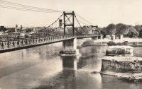
Valence, Drôme and Guilherand-Granges, Ardèche, France - Rhône River
| Bridgemeister ID: | 6517 (added 2021-08-27) |
| Year Completed: | 1949 |
| Name: | (footbridge) |
| Location: | Valence, Drôme and Guilherand-Granges, Ardèche, France |
| Crossing: | Rhône River |
| Coordinates: | 44.931773 N 4.883700 E |
| Maps: | Acme, GeoHack, Google, OpenStreetMap |
| Use: | Footbridge |
| Status: | Removed, 1960s |
| Main Cables: | Wire (steel) |
| Main Spans: | 2 |
Notes:
- At former location of 1830 Valence - Valence, Drôme and Guilherand-Granges, Ardèche, France.
- All past and present bridges at this location.
Image Sets:
1950: (footbridge)
Ellamore, West Virginia, USA - Middle Fork River
| Bridgemeister ID: | 1186 (added 2004-01-24) |
| Year Completed: | 1950 |
| Name: | (footbridge) |
| Location: | Ellamore, West Virginia, USA |
| Crossing: | Middle Fork River |
| At or Near Feature: | Boy Scout Camp Mahonegon |
| Coordinates: | 38.950796 N 80.073675 W |
| Maps: | Acme, GeoHack, Google, OpenStreetMap |
| Use: | Footbridge |
| Status: | In use (last checked: 2007) |
| Main Cables: | Wire |
Image Sets:
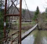
1950: (footbridge)
New Hamburg vicinity, Ontario, Canada - Nith River
| Bridgemeister ID: | 803 (added 2003-03-30) |
| Year Completed: | 1950 |
| Name: | (footbridge) |
| Location: | New Hamburg vicinity, Ontario, Canada |
| Crossing: | Nith River |
| Coordinates: | 43.398709 N 80.707671 W |
| Maps: | Acme, GeoHack, Google, OpenStreetMap |
| Use: | Footbridge |
| Status: | Extant (last checked: 2020) |
| Main Cables: | Wire |
| Suspended Spans: | 3 |
| Main Span: | 1 |
| Side Spans: | 2 |
1953: (footbridge)
Forgaria nel Friuli, Udine, Italy - Torrente Arzino
| Bridgemeister ID: | 5180 (added 2020-10-04) |
| Year Completed: | 1953 |
| Name: | (footbridge) |
| Location: | Forgaria nel Friuli, Udine, Italy |
| Crossing: | Torrente Arzino |
| Coordinates: | 46.225500 N 12.958499 E |
| Maps: | Acme, GeoHack, Google, OpenStreetMap |
| Use: | Footbridge |
| Status: | In use (last checked: 2020) |
| Main Cables: | Wire (steel) |
| Suspended Spans: | 1 |
| Bridgemeister ID: | 5823 (added 2021-04-14) |
| Year Completed: | 1953 |
| Name: | (footbridge) |
| Location: | Ivanovo (Иваново), Ivanovo Oblast, Russia |
| Crossing: | Reka Uvod |
| Coordinates: | 57.003389 N 40.980845 E |
| Maps: | Acme, GeoHack, Google, OpenStreetMap |
| Use: | Footbridge |
| Status: | In use (last checked: 2021) |
| Main Cables: | Wire (steel) |
| Suspended Spans: | 1 |
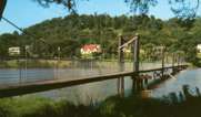
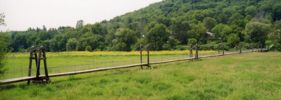
1953: (footbridge)
Richland Center, Wisconsin, USA - Pine Creek
| Bridgemeister ID: | 263 (added before 2003) |
| Year Completed: | 1953 |
| Name: | (footbridge) |
| Location: | Richland Center, Wisconsin, USA |
| Crossing: | Pine Creek |
| Coordinates: | 43.33931 N 90.39205 W |
| Maps: | Acme, GeoHack, Google, OpenStreetMap |
| Use: | Footbridge |
| Status: | In use (last checked: 2020) |
| Main Cables: | Wire (steel) |
| Suspended Spans: | 10 |
| Main Spans: | 8 x 22.9 meters (75 feet) estimated |
| Side Spans: | 1 x 9.8 meters (32 feet), 1 x 10.4 meters (34 feet) |
Notes:
- Long low-level footbridge across marshy Pine Creek. Larry Beranek writes: "A flood in Spring 1951, just after I was born, washed out the original bridge. The [current bridge pictured here] was built in 1953. The dam [mentioned here] is gone now so the river remains a trickle til heavy rains or snow melt beef it up as happened in September of [2007]. The water was up to the stringer which supports the walking surface and the police had it taped off so no one would go on it."
Image Sets:
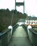
1954: (footbridge)
Bad Kreuznach, Rheinland-Pfalz, Germany - Nahe River
| Bridgemeister ID: | 1132 (added 2004-01-16) |
| Year Completed: | 1954 |
| Name: | (footbridge) |
| Location: | Bad Kreuznach, Rheinland-Pfalz, Germany |
| Crossing: | Nahe River |
| Coordinates: | 49.838188 N 7.851235 E |
| Maps: | Acme, GeoHack, Google, OpenStreetMap |
| Use: | Footbridge |
| Status: | In use (last checked: 2019) |
| Main Cables: | Wire (steel) |
| Suspended Spans: | 1 |
| Main Span: | 1 x 56 meters (183.7 feet) |
| Deck width: | 1.8 meters |
Notes:
- Replaced Bad Kreuznach - Bad Kreuznach, Rheinland-Pfalz, Germany.
- All past and present bridges at this location.
External Links:
Image Sets:
1955: (footbridge)
Jersey Shore vicinity, Pennsylvania, USA - Pine Creek
| Bridgemeister ID: | 591 (added 2003-01-05) |
| Year Completed: | 1955 |
| Name: | (footbridge) |
| Location: | Jersey Shore vicinity, Pennsylvania, USA |
| Crossing: | Pine Creek |
| At or Near Feature: | Boy Scouts Camp Kline |
| Coordinates: | 41.273683 N 77.323883 W |
| Maps: | Acme, GeoHack, Google, OpenStreetMap |
| Principals: | Williamsport Technical Institute students |
| Use: | Footbridge |
| Status: | Destroyed, 1972 |
| Main Cables: | Wire |
Notes:
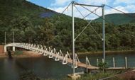
- The postcard (postmarked 1961) showing the bridge says, "The largest foot-suspension bridge in the East crosses Pine Creek at the Boy Scouts' Camp Kline, north of Jersey Shore, Pa. Built in 1955 by Williamsport Technical Institute students with materials donated by area industries. Valued over $25,000, the 409-foot span has concrete anchors and a 14-ton capacity. For 35 years previous, boats were used to reach the popular 360-acre camp-site, donated to the Scouts in 1920 by James N. Kline, a Williamsport merchant." It's doubtful this was anywhere close to being a 409-foot bridge.
- The message written on the postcard is amusing (though unrelated to the bridge): "Hi Mom and Dad, I had a fine time up here. I went on a boat trip Monday around the island. We got half way around and Tiny tiped [sic] his boat then we tiped ours. I didn't get to sleep until 2:00 Monday night. I am going to try to swim a mile today. I don't do nothing but lay in my bunk and listen to records. Ken."
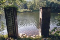
- Patrick O'Donnell is familiar with this area and notes that the bridge is gone, but the concrete footings are still visible. He suspects 1972's Hurricane Agnes brought down this bridge. Denny Keller confirms Patrick's suspicion with a firsthand account of Hurricane Agnes' impact on this bridge: "21 June 1972 is a date that I will never forget. I along with 340+ kids and adults were at Camp Kline during our yearly 4-H camp. I was the very last (along with the National Guard that performed the rescue) to leave and walk across the bridge that once stood at 11PM on the evening of June 21st. I along with two other senior 4-H counselors. I can remember the last trip across the bridge while mobile homes, trees, and all type of debris were floating down the creek and hitting the bridge underneath."
Image Sets:
1956: (footbridge)
Bousse and Richemont, Moselle, France - Moselle River
| Bridgemeister ID: | 8577 (added 2024-05-04) |
| Year Completed: | 1956 |
| Name: | (footbridge) |
| Location: | Bousse and Richemont, Moselle, France |
| Crossing: | Moselle River |
| Coordinates: | 49.280667 N 6.189139 E |
| Maps: | Acme, GeoHack, Google, OpenStreetMap |
| Use: | Footbridge |
| Status: | Dismantled, 2002 |
| Main Cables: | Wire (steel) |
| Suspended Spans: | 1 |
1956: (footbridge)
Waldbreitbach, Rheinland-Pfalz, Germany - Wied River
| Bridgemeister ID: | 2205 (added 2007-02-11) |
| Year Completed: | 1956 |
| Name: | (footbridge) |
| Location: | Waldbreitbach, Rheinland-Pfalz, Germany |
| Crossing: | Wied River |
| Coordinates: | 50.553032 N 7.426243 E |
| Maps: | Acme, GeoHack, Google, OpenStreetMap |
| Use: | Footbridge |
| Status: | Demolished, 1987 |
| Main Cables: | Wire (steel) |
| Suspended Spans: | 1 |
Notes:
- Replaced (footbridge) - Waldbreitbach, Rheinland-Pfalz, Germany.
- Replaced by 1987 (footbridge) - Waldbreitbach, Rheinland-Pfalz, Germany.
- All past and present bridges at this location.
Image Sets:

1957: (footbridge)
Bella Coola, British Columbia, Canada - Bella Coola River
| Bridgemeister ID: | 2437 (added 2008-04-22) |
| Year Completed: | 1957 |
| Name: | (footbridge) |
| Location: | Bella Coola, British Columbia, Canada |
| Crossing: | Bella Coola River |
| Principals: | Allison Logging Co. |
| Use: | Footbridge |
| Main Cables: | Wire |
Notes:
1958: (footbridge)
Glanamman, Ammanford, Wales, United Kingdom - Amman River
| Bridgemeister ID: | 1398 (added 2004-07-04) |
| Year Completed: | 1958 |
| Name: | (footbridge) |
| Location: | Glanamman, Ammanford, Wales, United Kingdom |
| Crossing: | Amman River |
| Coordinates: | 51.8007 N 3.95425 W |
| Maps: | Acme, GeoHack, Google, OpenStreetMap |
| Principals: | David Rowell & Co. |
| Use: | Footbridge |
| Status: | In use (last checked: 2013) |
| Main Cables: | Wire (steel) |
| Suspended Spans: | 1 |
Notes:
- Allan Agate writes: "I was the Project Engineer for this footbridge and can therefore confirm it was designed and built by David Rowell Ltd and almost certainly the last suspension bridge they built. It was a hybrid of earlier bridges making use of new bolted hot rolled sections instead of riveted composite tower construction. The date was about 1962/3." I am not sure of the provenance of the 1958 date associated with this bridge and I don't have reason to question Mr. Agate's recollection of the bridge completed a few years later.
Image Sets:
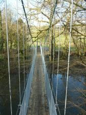
1958: (footbridge)
Santa Rosa del Valle de Calamuchita, Cordoba, Argentina - Rio Santa Rosa
| Bridgemeister ID: | 1211 (added 2004-02-07) |
| Year Completed: | 1958 |
| Name: | (footbridge) |
| Location: | Santa Rosa del Valle de Calamuchita, Cordoba, Argentina |
| Crossing: | Rio Santa Rosa |
| Coordinates: | 32.068913 S 64.541461 W |
| Maps: | Acme, GeoHack, Google, OpenStreetMap |
| Use: | Footbridge |
| Status: | In use (last checked: 2022) |
| Main Cables: | Wire (steel) |
| Suspended Spans: | 2 |
| Main Span: | 1 |
| Side Span: | 1 |
1959: (footbridge)
Gornye Kliuchi (Горные Ключи), Primorsky Krai, Russia - Ussuri River
| Bridgemeister ID: | 5239 (added 2020-10-25) |
| Year Completed: | 1959 |
| Name: | (footbridge) |
| Location: | Gornye Kliuchi (Горные Ключи), Primorsky Krai, Russia |
| Crossing: | Ussuri River |
| Coordinates: | 45.243029 N 133.510776 E |
| Maps: | Acme, GeoHack, Google, OpenStreetMap |
| Use: | Footbridge |
| Status: | In use (last checked: 2023) |
| Main Cables: | Wire (steel) |
| Suspended Spans: | 1 |
Notes:
1960: (footbridge)
Hrabusice vicinity, Slovakia - Hornád River
| Bridgemeister ID: | 3087 (added 2019-10-27) |
| Year Completed: | 1960 |
| Name: | (footbridge) |
| Location: | Hrabusice vicinity, Slovakia |
| Crossing: | Hornád River |
| At or Near Feature: | Slovakian Paradise National Park |
| Coordinates: | 48.953117 N 20.422883 E |
| Maps: | Acme, GeoHack, Google, OpenStreetMap |
| Use: | Footbridge |
| Status: | In use (last checked: 2018) |
| Main Cables: | Wire (steel) |
1960: (footbridge)
Palazzolo dello Stella, Italy
| Bridgemeister ID: | 1740 (added 2005-04-20) |
| Year Completed: | 1962 |
| Name: | (footbridge) |
| Location: | Henningsmoen, Dalsbygda vicinity, Os, Innlandet, Norway |
| Crossing: | Vangrøfta |
| Coordinates: | 62.514033 N 11.12585 E |
| Maps: | Acme, GeoHack, Google, kart.1881.no, OpenStreetMap |
| Use: | Footbridge |
| Status: | In use (last checked: 2005) |
| Main Cables: | Wire |
| Suspended Spans: | 1 |
| Main Span: | 1 x 38 meters (124.7 feet) estimated |
| Deck width: | 2.4 meters (estimated) |
External Links:
1964: (footbridge)
Wilmot vicinity and Dillsboro vicinity, North Carolina, USA - Tuckaseigee River
| Bridgemeister ID: | 218 (added before 2003) |
| Year Completed: | 1964 |
| Name: | (footbridge) |
| Location: | Wilmot vicinity and Dillsboro vicinity, North Carolina, USA |
| Crossing: | Tuckaseigee River |
| Coordinates: | 35.40421 N 83.29348 W |
| Maps: | Acme, GeoHack, Google, OpenStreetMap |
| Principals: | Roanoke Bridge Co. |
| Use: | Footbridge |
| Status: | In use (last checked: 2002) |
| Main Cables: | Wire (steel) |
| Suspended Spans: | 2 |
| Main Spans: | 1 x 42.4 meters (139 feet), 1 x 41.8 meters (137 feet) |
Notes:
- A 4/4/2002 article in The Sylva Herald And Ruralite ("Repairing Last Swinging Bridge") notes this bridge was completed 1964, but Patrick S. O'Donnell sent me a photo of a 1906 Roanoke Bridge Co. builder's plate attached to one of the towers.
Image Sets:
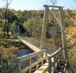
1966: (footbridge)
Indiana Beach, Indiana, USA - Lake Shafer
| Bridgemeister ID: | 879 (added 2003-09-01) |
| Year Completed: | 1966 |
| Name: | (footbridge) |
| Location: | Indiana Beach, Indiana, USA |
| Crossing: | Lake Shafer |
| Coordinates: | 40.787346 N 86.770724 W |
| Maps: | Acme, GeoHack, Google, OpenStreetMap |
| Use: | Footbridge |
| Status: | Extant (last checked: 2019) |
| Main Cables: | Wire (steel) |
Notes:
- Large multi-span footbridge that serves as entrance to Indiana Beach amusement park.
Image Sets:
1968: (footbridge)
Kriznica, Pitomaca vicinity, Croatia - Drava River
| Bridgemeister ID: | 4601 (added 2020-06-06) |
| Year Completed: | 1968 |
| Name: | (footbridge) |
| Location: | Kriznica, Pitomaca vicinity, Croatia |
| Crossing: | Drava River |
| Coordinates: | 45.959868 N 17.311073 E |
| Maps: | Acme, GeoHack, Google, OpenStreetMap |
| Use: | Footbridge |
| Status: | In use (last checked: 2019) |
| Main Cables: | Wire (steel) |
| Suspended Spans: | 1 |
| Main Span: | 1 x 164 meters (538.1 feet) |
External Links:
| Bridgemeister ID: | 4693 (added 2020-06-20) |
| Year Completed: | 1968 |
| Name: | (footbridge) |
| Location: | Zagórze Śląskie, Poland |
| Crossing: | Bystrzyca |
| Coordinates: | 50.752005 N 16.418261 E |
| Maps: | Acme, GeoHack, Google, OpenStreetMap |
| Use: | Footbridge |
| Status: | Demolished, 2017-2019 |
| Main Cables: | Wire (steel) |
| Suspended Spans: | 1 |
Notes:
- Replaced in time frame 2017-2019.
External Links:
1969: (footbridge)
Mošnov, Czechia - Lubina River
| Bridgemeister ID: | 4642 (added 2020-06-16) |
| Year Completed: | 1969 |
| Name: | (footbridge) |
| Location: | Mošnov, Czechia |
| Crossing: | Lubina River |
| Coordinates: | 49.681695 N 18.128000 E |
| Maps: | Acme, GeoHack, Google, OpenStreetMap |
| Use: | Footbridge |
| Status: | In use (last checked: 2015) |
| Main Cables: | Wire (steel) |
| Suspended Spans: | 1 |
1973: (footbridge)
Lincoln, Illinois, USA - Kickapoo Creek
| Bridgemeister ID: | 909 (added 2003-10-11) |
| Year Completed: | 1973 |
| Name: | (footbridge) |
| Location: | Lincoln, Illinois, USA |
| Crossing: | Kickapoo Creek |
| At or Near Feature: | Kickapoo Creek County Park |
| Coordinates: | 40.17338 N 89.37623 W |
| Maps: | Acme, GeoHack, Google, OpenStreetMap |
| Use: | Footbridge |
| Status: | In use (last checked: 2005) |
| Main Cables: | Wire |
| Suspended Spans: | 1 |
| Main Span: | 1 |
1973: (footbridge)
Newtown, Wales, United Kingdom - River Severn
| Bridgemeister ID: | 4616 (added 2020-06-07) |
| Year Completed: | 1973 |
| Name: | (footbridge) |
| Location: | Newtown, Wales, United Kingdom |
| Crossing: | River Severn |
| At or Near Feature: | Dolerw Park |
| Coordinates: | 52.514964 N 3.319958 W |
| Maps: | Acme, GeoHack, Google, OpenStreetMap |
| Use: | Footbridge |
| Status: | In use (last checked: 2018) |
| Main Cables: | Wire (steel) |
| Suspended Spans: | 1 |
External Links:
1974: (footbridge)
Hayfork, California, USA - Hayfork Creek
| Bridgemeister ID: | 6707 (added 2021-10-05) |
| Year Completed: | 1974 |
| Name: | (footbridge) |
| Location: | Hayfork, California, USA |
| Crossing: | Hayfork Creek |
| At or Near Feature: | Bar 717 Ranch |
| Coordinates: | 40.628631 N 123.371112 W |
| Maps: | Acme, GeoHack, Google, OpenStreetMap |
| Principals: | Paul Wills, Willy Wills, Ed Clark |
| Use: | Footbridge |
| Status: | In use (last checked: 2021) |
| Main Cables: | Wire (steel) |
| Main Span: | 1 |
1976: (footbridge)
Alexeyevka, Belgorod Oblast, Russia - Reka Tikhaya Sosna
| Bridgemeister ID: | 6960 (added 2022-02-19) |
| Year Completed: | 1976 |
| Name: | (footbridge) |
| Location: | Alexeyevka, Belgorod Oblast, Russia |
| Crossing: | Reka Tikhaya Sosna |
| Coordinates: | 50.629171 N 38.684831 E |
| Maps: | Acme, GeoHack, Google, OpenStreetMap |
| Use: | Footbridge |
| Status: | In use (last checked: 2022) |
| Suspended Spans: | 1 |
| Main Span: | 1 x 80 meters (262.5 feet) estimated |
1976: (footbridge)
Brest, Belarus - Mukhovets River
| Bridgemeister ID: | 6207 (added 2021-07-16) |
| Year Completed: | 1976 |
| Name: | (footbridge) |
| Location: | Brest, Belarus |
| Crossing: | Mukhovets River |
| Coordinates: | 52.084229 N 23.668432 E |
| Maps: | Acme, GeoHack, Google, OpenStreetMap |
| Use: | Footbridge |
| Status: | In use (last checked: 2021) |
| Main Cables: | Wire (steel) |
| Suspended Spans: | 1 |
| Main Span: | 1 x 86 meters (282.2 feet) estimated |
1976: (footbridge)
Lampasas, Texas, USA - Sulphur Creek
| Bridgemeister ID: | 1258 (added 2004-03-06) |
| Year Completed: | 1976 |
| Name: | (footbridge) |
| Location: | Lampasas, Texas, USA |
| Crossing: | Sulphur Creek |
| Coordinates: | 31.05598 N 98.18108 W |
| Maps: | Acme, GeoHack, Google, OpenStreetMap |
| Use: | Footbridge |
| Status: | In use (last checked: 2004) |
| Main Cables: | Rod |
| Suspended Spans: | 1 |
| Main Span: | 1 x 19.8 meters (65 feet) |
Notes:
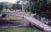
- It is doubtful that this is a true suspension bridge. Follow the picture for more on this observation.
Image Sets:
1978: (footbridge)
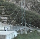
Avegno vicinity, Ticino, Switzerland - Maggia River
| Bridgemeister ID: | 1796 (added 2005-05-17) |
| Year Completed: | 1978 |
| Name: | (footbridge) |
| Location: | Avegno vicinity, Ticino, Switzerland |
| Crossing: | Maggia River |
| At or Near Feature: | Valle Maggia |
| Coordinates: | 46.215524 N 8.744706 E |
| Maps: | Acme, GeoHack, Google, OpenStreetMap |
| Use: | Footbridge |
| Status: | In use (last checked: 2014) |
| Main Cables: | Wire (steel) |
| Suspended Spans: | 2 |
| Main Span: | 1 x 100 meters (328.1 feet) |
| Side Span: | 1 x 24 meters (78.7 feet) |
| Deck width: | 1.3 meters |
Notes:
- The side without a side span is anchored directly into rock.
External Links:
Image Sets:
1978: (footbridge)
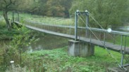
Kloster Ehrenstein vicinity, Rheinland-Pfalz, Germany - Wied River
| Bridgemeister ID: | 2211 (added 2007-02-11) |
| Year Completed: | 1978 |
| Name: | (footbridge) |
| Location: | Kloster Ehrenstein vicinity, Rheinland-Pfalz, Germany |
| Crossing: | Wied River |
| Coordinates: | 50.61750 N 7.45082 E |
| Maps: | Acme, GeoHack, Google, OpenStreetMap |
| Use: | Footbridge |
| Status: | In use (last checked: 2006) |
| Main Cables: | Wire (steel) |
| Suspended Spans: | 1 |
| Main Span: | 1 x 30.1 meters (98.8 feet) |
| Deck width: | 0.9 meters between side rails, 1.4 meters total |
Image Sets:
1978: (footbridge)
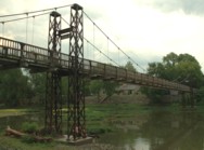
Pontiac, Illinois, USA - Vermilion River
| Bridgemeister ID: | 1710 (added 2005-04-02) |
| Year Completed: | 1978 |
| Name: | (footbridge) |
| Location: | Pontiac, Illinois, USA |
| Crossing: | Vermilion River |
| At or Near Feature: | Humiston Riverside Park |
| Coordinates: | 40.876867 N 88.63325 W |
| Maps: | Acme, GeoHack, Google, OpenStreetMap |
| Use: | Footbridge |
| Status: | In use (last checked: 2005) |
| Main Cables: | Wire (steel) |
| Suspended Spans: | 3 |
| Main Span: | 1 |
| Side Spans: | 2 |
Image Sets:
1982: (footbridge)
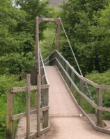
Glen Nevis vicinity, Scotland, United Kingdom - River Nevis
| Bridgemeister ID: | 1458 (added 2004-08-21) |
| Year Completed: | 1982 |
| Name: | (footbridge) |
| Location: | Glen Nevis vicinity, Scotland, United Kingdom |
| Crossing: | River Nevis |
| Coordinates: | 56.811717 N 5.076033 W |
| Maps: | Acme, GeoHack, Google, OpenStreetMap |
| Use: | Footbridge |
| Status: | In use (last checked: 2009) |
| Main Cables: | Wire (steel) |
| Suspended Spans: | 1 |
| Main Span: | 1 x 32.6 meters (107 feet) |
Notes:
- This is not the popular wire rope crossing at Glen Nevis which is literally three ropes -- two to hold onto and one to walk on. Instead, this listing is a traditional suspension footbridge just north of Glen Nevis.
- Don McGillivray worked on this bridge and sent information about its construction.
"The Suspension bridge was principally built by five Royal Engineers from 15 Field Support Squadron Royal Engineers in the summer of 1982. They were Sapper Terry Bradley (Metal workworker) Sapper Paul Brookes (Draughtsman), Sapper Ian Duggan (Surveyor), Sapper Taff Green (Draughtsman) Sapper Don McGillivray (Blacksmith).
"The pier footings and anchorages were excavated by hand as the plant machines were being used on another project at Caol and upriver at the priority bridge opposite the YMCA.The Accrow shuttering and Re-bar was humped and Concrete was pumped across the river over a series of aluminium Mk4 assualt boats. Once the concrete cured, the steel work, provided by Highland Engineering was manhandled across the river using the same boats. The steel uprights and main cable were raised and positioned using a block and tackle from a wooden Gyn. The main cables were anchored on the east bank and were tensioned on the west bank using two tirfor winches. The hangers and stringers were strung out from the west bank in a series like stepping stones until the decking could be positioned.
"The Bridge took five weeks start to finish the best part of the build was the weather which was hot and as we were constantly dropping tools etc. in the river, you had to jump in after it. We later moved up to finish the two span through deck bridge at the YMCA. This bridge replaced an old narrow bridge that used to be a part of a WW2 Mulberry Harbour section."
Image Sets:
| Bridgemeister ID: | 7793 (added 2023-08-21) |
| Year Completed: | 1982 |
| Name: | (footbridge) |
| Location: | Zhytomyr (Житомир), Zhytomyr Oblast, Ukraine |
| Crossing: | Teteriv |
| At or Near Feature: | Gagarin Park |
| Coordinates: | 50.243169 N 28.662776 E |
| Maps: | Acme, GeoHack, Google, OpenStreetMap |
| Use: | Footbridge |
| Status: | In use (last checked: 2021) |
| Main Cables: | Wire (steel) |
| Suspended Spans: | 1 |
| Main Span: | 1 x 159 meters (521.7 feet) estimated |
External Links:
1983: (footbridge)
Glenlivet, Scotland, United Kingdom - River Livet
| Bridgemeister ID: | 2638 (added 2019-03-02) |
| Year Completed: | 1983 |
| Name: | (footbridge) |
| Location: | Glenlivet, Scotland, United Kingdom |
| Crossing: | River Livet |
| At or Near Feature: | Speyside Way - Tomintoul Spur |
| Coordinates: | 57.347297 N 3.331187 W |
| Maps: | Acme, GeoHack, Google, OpenStreetMap |
| Use: | Footbridge |
| Status: | In use (last checked: 2014) |
| Main Cables: | Wire (steel) |
| Suspended Spans: | 1 |
Image Sets:
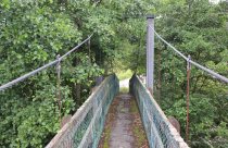
| Bridgemeister ID: | 1866 (added 2005-08-02) |
| Year Completed: | 1984 |
| Name: | (footbridge) |
| Location: | Martensdale vicinity, Iowa, USA |
| At or Near Feature: | Zo-El Annett Woods |
| Coordinates: | 41.395367 N 93.698733 W |
| Maps: | Acme, GeoHack, Google, OpenStreetMap |
| Principals: | Iowa Youth Conservation Corp |
| Use: | Footbridge |
| Status: | In use (last checked: 2007) |
| Main Cables: | Wire (steel) |
| Suspended Spans: | 1 |
| Main Span: | 1 x 36.6 meters (120 feet) estimated |
Notes:
- Lisa Youngblut writes: "My husband and his summer crew, the Iowa Youth Conservation Corp, built this bridge in the summer 1984. They used spades, shovels, hammers and nails, a handsaw and a brace and bit. Half of the materials, including 4 yards of concrete, were shipped to the other side of the ravine on a zip line. The cement was bucket brigaded from the zip line to the piling and the anchors."
Image Sets:
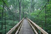
1985: (footbridge)
Salina, Kansas, USA - Smoky Hill River
| Bridgemeister ID: | 1847 (added 2005-07-16) |
| Year Completed: | 1985 |
| Name: | (footbridge) |
| Location: | Salina, Kansas, USA |
| Crossing: | Smoky Hill River |
| At or Near Feature: | Oakdale Park |
| Coordinates: | 38.833167 N 97.6041 W |
| Maps: | Acme, GeoHack, Google, OpenStreetMap |
| Principals: | Frank R. Weinhold |
| Use: | Footbridge |
| Status: | In use (last checked: 2010) |
| Main Cables: | Wire |
| Suspended Spans: | 3 |
| Main Span: | 1 x 27.4 meters (90 feet) estimated |
| Side Spans: | 2 x 13.7 meters (45 feet) estimated |
1987: (footbridge)
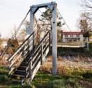
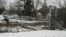
Criglersville, Virginia, USA - Robinson River
| Bridgemeister ID: | 1331 (added 2004-04-30) |
| Year Completed: | 1987 |
| Name: | (footbridge) |
| Location: | Criglersville, Virginia, USA |
| Crossing: | Robinson River |
| Coordinates: | 38.4633 N 78.309933 W |
| Maps: | Acme, GeoHack, Google, OpenStreetMap |
| Principals: | VDOT |
| Use: | Footbridge |
| Status: | In use (last checked: 2021) |
| Main Cables: | Wire (steel) |
| Suspended Spans: | 1 |
| Main Span: | 1 x 36.6 meters (120 feet) estimated |
Notes:
- There are two suspension footbridges across the Robinson River at Criglersville. This one is visible from county road 670 just west of Criglersville.
- Near Lindsay Lane - Criglersville, Virginia, USA.
Image Sets:
Mail | Facebook | X (Twitter) | Bluesky