Undated/Unnamed Suspension Non-footbridges (1-100 of 2,348)
This is a list of bridges 1 through 100 (of 2,348 total) in the suspension bridge inventory that are undated, unnamed, and whose primary use is other than footbridge. Wherever you see a Bridgemeister ID number click it to isolate the bridge on its own page.
Related Lists:
(conveyor bridge)
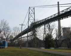
Beverly vicinity, Ohio, USA - Muskingum River
| Bridgemeister ID: | 2572 (added 2012-11-17) |
| Name: | (conveyor bridge) |
| Location: | Beverly vicinity, Ohio, USA |
| Crossing: | Muskingum River |
| At or Near Feature: | Muskingum River Power Plant |
| Coordinates: | 39.59230 N 81.68519 W |
| Maps: | Acme, GeoHack, Google, OpenStreetMap |
| Use: | Conveyor |
| Status: | Removed, c. 2015-2021 |
| Main Cables: | Wire (steel) |
| Suspended Spans: | 1 |
Notes:
- Approaches were dismantled by 2015. Another portion of the beltway collapsed during preparations for demolition in December 2015 killing the CEO of the demolition company. Unclear if the suspension span was completely demolished at this time.
- By 2021, the bridge appears to have been completely demolished.
External Links:
Image Sets:
(conveyor bridge)
Gary vicinity, West Virginia, USA - Tug Fork
| Bridgemeister ID: | 6681 (added 2021-09-12) |
| Name: | (conveyor bridge) |
| Location: | Gary vicinity, West Virginia, USA |
| Crossing: | Tug Fork |
| Coordinates: | 37.373622 N 81.558375 W |
| Maps: | Acme, GeoHack, Google, OpenStreetMap |
| Use: | Conveyor |
| Status: | Extant (last checked: 2021) |
| Main Cables: | Wire (steel) |
(conveyor bridge)
Gary, West Virginia, USA
| Bridgemeister ID: | 7391 (added 2022-11-25) |
| Name: | (conveyor bridge) |
| Location: | Gary, West Virginia, USA |
| Coordinates: | 37.373762 N 81.558262 W |
| Maps: | Acme, GeoHack, Google, OpenStreetMap |
| Use: | Conveyor |
| Status: | Extant (last checked: 2020) |
| Main Cables: | Wire (steel) |
| Main Span: | 1 x 179 meters (587.3 feet) estimated |
(conveyor bridge)
Joliet, Illinois, USA - Des Plaines River
| Bridgemeister ID: | 2574 (added 2012-11-18) |
| Name: | (conveyor bridge) |
| Location: | Joliet, Illinois, USA |
| Crossing: | Des Plaines River |
| At or Near Feature: | Joliet 29 Generating Station |
| Coordinates: | 41.494281 N 88.119729 W |
| Maps: | Acme, GeoHack, Google, OpenStreetMap |
| Use: | Conveyor |
| Status: | Extant (last checked: 2012) |
| Main Cables: | Wire (steel) |
(conveyor bridge)
Loisy, Meurthe-et-Moselle, France - Moselle/Mosel River
| Bridgemeister ID: | 4716 (added 2020-06-26) |
| Name: | (conveyor bridge) |
| Location: | Loisy, Meurthe-et-Moselle, France |
| Crossing: | Moselle/Mosel River |
| Coordinates: | 48.874604 N 6.095162 E |
| Maps: | Acme, GeoHack, Google, OpenStreetMap |
| Use: | Conveyor |
| Status: | Extant (last checked: 2019) |
| Main Cables: | Wire (steel) |
| Suspended Spans: | 2 |
| Main Spans: | 2 x 115 meters (377.3 feet) estimated |
External Links:
(conveyor bridge)
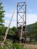
Starbrick, Pennsylvania, USA - Allegheny River
| Bridgemeister ID: | 1951 (added 2005-11-04) |
| Name: | (conveyor bridge) |
| Location: | Starbrick, Pennsylvania, USA |
| Crossing: | Allegheny River |
| Coordinates: | 41.837083 N 79.20475 W |
| Maps: | Acme, GeoHack, Google, OpenStreetMap |
| Use: | Conveyor |
| Status: | Removed (last checked: 2008) |
| Main Cables: | Wire (steel) |
| Suspended Spans: | 1 |
| Main Span: | 1 x 115.8 meters (380 feet) estimated |
Notes:
- Crossed a portion of the Allegheny River to Mead Island.
- Appears to have been removed 2006-2008. Jason Oliphant writes in early 2009: "The north shore suspension supports still exist but the bridge doesn't. I have no idea when it was taken down but I can say that it wasn't there in summer 2008."
Image Sets:
(conveyor bridge)
Takahashi, Okayama, Japan - Nariwa River
| Bridgemeister ID: | 6062 (added 2021-07-03) |
| Name: | (conveyor bridge) |
| Location: | Takahashi, Okayama, Japan |
| Crossing: | Nariwa River |
| Coordinates: | 34.786127 N 133.479621 E |
| Maps: | Acme, GeoHack, Google, OpenStreetMap |
| Use: | Conveyor |
| Status: | Extant (last checked: 2014) |
| Main Cables: | Wire (steel) |
| Main Span: | 1 x 122 meters (400.3 feet) estimated |
(conveyor bridge)
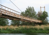
Thornton, Colorado, USA - South Platte River
| Bridgemeister ID: | 1615 (added 2005-02-22) |
| Name: | (conveyor bridge) |
| Location: | Thornton, Colorado, USA |
| Crossing: | South Platte River |
| Coordinates: | 39.86809 N 104.92068 W |
| Maps: | Acme, GeoHack, Google, OpenStreetMap |
| Use: | Pipeline and Footbridge |
| Status: | Derelict (last checked: 2007) |
| Main Cables: | Wire (steel) |
| Suspended Spans: | 1 |
| Main Span: | 1 x 121.9 meters (400 feet) estimated |
Notes:
Image Sets:
(conveyor bridge)
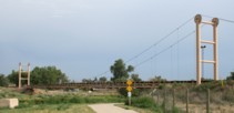
Thornton, Colorado, USA - South Platte River
| Bridgemeister ID: | 1630 (added 2005-03-11) |
| Name: | (conveyor bridge) |
| Location: | Thornton, Colorado, USA |
| Crossing: | South Platte River |
| Coordinates: | 39.87968 N 104.90335 W |
| Maps: | Acme, GeoHack, Google, OpenStreetMap |
| Use: | Conveyor and Footbridge |
| Status: | In use (last checked: 2007) |
| Main Cables: | Wire (steel) |
| Suspended Spans: | 1 |
| Main Span: | 1 x 106.7 meters (350 feet) |
Notes:
Image Sets:
(flume bridge)
Grovane vicinity, Vennesla, Agder, Norway
| Bridgemeister ID: | 2971 (added 2019-10-12) |
| Name: | (flume bridge) |
| Location: | Grovane vicinity, Vennesla, Agder, Norway |
| Coordinates: | 58.309513 N 7.966079 E |
| Maps: | Acme, GeoHack, Google, kart.1881.no, OpenStreetMap |
| Use: | Flume |
| Status: | Extant (last checked: 2019) |
| Main Cables: | Wire (steel) |
| Suspended Spans: | 1 |
Notes:
(flume bridge)
Grovane vicinity, Vennesla, Agder, Norway
| Bridgemeister ID: | 2977 (added 2019-10-12) |
| Name: | (flume bridge) |
| Location: | Grovane vicinity, Vennesla, Agder, Norway |
| Coordinates: | 58.317199 N 7.953377 E |
| Maps: | Acme, GeoHack, Google, kart.1881.no, OpenStreetMap |
| Use: | Flume |
| Status: | Extant (last checked: 2016) |
| Main Cables: | Wire (steel) |
| Suspended Spans: | 1 |
Notes:
(flume bridge)
Nissedal vicinity, Vestfold Og Telemark, Norway - Fyresdalsåna
| Bridgemeister ID: | 4103 (added 2020-04-05) |
| Name: | (flume bridge) |
| Location: | Nissedal vicinity, Vestfold Og Telemark, Norway |
| Crossing: | Fyresdalsåna |
| Coordinates: | 58.948861 N 8.375068 E |
| Maps: | Acme, GeoHack, Google, kart.1881.no, OpenStreetMap |
| Use: | Flume |
| Status: | Removed |
| Main Cables: | Wire |
| Main Span: | 1 x 115 meters (377.3 feet) estimated |
Notes:
- Based on historic aerial images built prior to 1972 and removed between 1980 and 2004.
| Bridgemeister ID: | 4200 (added 2020-04-08) |
| Name: | (flume bridge) |
| Location: | Notodden, Vestfold Og Telemark, Norway |
| Crossing: | Tinnåa |
| At or Near Feature: | Svelgfoss Gorge |
| Coordinates: | 59.583446 N 9.267132 E |
| Maps: | Acme, GeoHack, Google, kart.1881.no, OpenStreetMap |
| Use: | Flume |
| Status: | Extant (last checked: 2019) |
| Main Span: | 1 x 45 meters (147.6 feet) estimated |
Notes:
- Spans a cove of Tinnåa.
- Connects to (flume bridge) - Notodden, Vestfold Og Telemark, Norway.
- All past and present bridges at this location.
| Bridgemeister ID: | 4201 (added 2020-04-08) |
| Name: | (flume bridge) |
| Location: | Notodden, Vestfold Og Telemark, Norway |
| Crossing: | Tinnåa |
| At or Near Feature: | Svelgfossjuvet |
| Coordinates: | 59.589983 N 9.271374 E |
| Maps: | Acme, GeoHack, Google, kart.1881.no, OpenStreetMap |
| Use: | Flume |
| Status: | Extant (last checked: 2019) |
| Main Span: | 1 x 70 meters (229.7 feet) estimated |
Notes:
(flume bridge)
Proctor, Vermont, USA - Otter Creek
| Bridgemeister ID: | 1692 (added 2005-03-27) |
| Name: | (flume bridge) |
| Location: | Proctor, Vermont, USA |
| Crossing: | Otter Creek |
| At or Near Feature: | Sutherland Falls |
| Use: | Flume |
| Status: | Removed |
| Main Cables: | Wire |
Notes:
- The postcard presented here doesn't show much, but other photos show a large wood-shingled tower at one end of the bridge. The bridge was likely completed in the late 1800s.
- Robert Ratti provided the following information: "it was a carrier of marble slurry from the Vermont Marble Co. and ended in the swamp nearby... In 1936, I lived right at the end of the swamp and climbed on that waste carrier many times."
Image Sets:

| Bridgemeister ID: | 4468 (added 2020-04-26) |
| Name: | (flume bridge) |
| Location: | Skotfoss, Skien, Vestfold og Telemark, Norway |
| Crossing: | Meierelva |
| Coordinates: | 59.207814 N 9.527592 E |
| Maps: | Acme, GeoHack, Google, kart.1881.no, OpenStreetMap |
| Use: | Flume |
| Status: | Removed |
| Main Cables: | Wire |
| Main Spans: | 2 |
Notes:
- Large flume bridge with at least two main spans visible in photos, taken in 1897, of the industrial complex at this location. Removed at some point before 1965.
- Next to (flume bridge) - Skotfoss, Skien, Vestfold og Telemark, Norway.
- All past and present bridges at this location.
External Links:
| Bridgemeister ID: | 4469 (added 2020-04-26) |
| Name: | (flume bridge) |
| Location: | Skotfoss, Skien, Vestfold og Telemark, Norway |
| Crossing: | Meierelva |
| Coordinates: | 59.207638 N 9.527812 E |
| Maps: | Acme, GeoHack, Google, kart.1881.no, OpenStreetMap |
| Use: | Flume |
| Status: | Removed |
| Main Cables: | Wire (steel) |
| Main Spans: | 1 x 100 meters (328.1 feet) estimated, 1 x 70 meters (229.7 feet) estimated |
Notes:
- Removed at some point before 1965.
- Next to (flume bridge) - Skotfoss, Skien, Vestfold og Telemark, Norway.
- All past and present bridges at this location.
External Links:
| Bridgemeister ID: | 5148 (added 2020-09-07) |
| Name: | (pipeline bridge) |
| Location: | Aizuwakamatsu, Fukushima, Japan |
| Crossing: | Aga River |
| Coordinates: | 37.403093 N 139.923350 E |
| Maps: | Acme, GeoHack, Google, OpenStreetMap |
| Use: | Pipeline |
| Status: | Extant (last checked: 2014) |
| Main Cables: | Wire (steel) |
| Suspended Spans: | 1 |
| Main Span: | 1 x 124 meters (406.8 feet) estimated |
(pipeline bridge)
Albasuyoc, Echarate, La Convención, Peru
(pipeline bridge)
Alsip, Illinois, USA - Calumet Sag Channel
| Bridgemeister ID: | 3246 (added 2019-11-16) |
| Name: | (pipeline bridge) |
| Location: | Alsip, Illinois, USA |
| Crossing: | Calumet Sag Channel |
| Coordinates: | 41.651809 N 87.699943 W |
| Maps: | Acme, GeoHack, Google, OpenStreetMap |
| Use: | Pipeline |
| Status: | Extant (last checked: 2019) |
| Main Cables: | Wire (steel) |
Notes:
- Next to (pipeline bridge) - Alsip, Illinois, USA.
- Next to (pipeline bridge) - Alsip, Illinois, USA.
- Next to (pipeline bridge) - Alsip, Illinois, USA.
- All past and present bridges at this location.
External Links:
(pipeline bridge)
Alsip, Illinois, USA - Calumet Sag Channel
| Bridgemeister ID: | 3247 (added 2019-11-16) |
| Name: | (pipeline bridge) |
| Location: | Alsip, Illinois, USA |
| Crossing: | Calumet Sag Channel |
| Coordinates: | 41.651663 N 87.703783 W |
| Maps: | Acme, GeoHack, Google, OpenStreetMap |
| Use: | Pipeline |
| Status: | Extant (last checked: 2019) |
| Main Cables: | Wire (steel) |
Notes:
- Next to (pipeline bridge) - Alsip, Illinois, USA.
- Next to (pipeline bridge) - Alsip, Illinois, USA.
- Next to (pipeline bridge) - Alsip, Illinois, USA.
- All past and present bridges at this location.
External Links:
(pipeline bridge)
Alsip, Illinois, USA - Calumet Sag Channel
| Bridgemeister ID: | 3248 (added 2019-11-16) |
| Name: | (pipeline bridge) |
| Location: | Alsip, Illinois, USA |
| Crossing: | Calumet Sag Channel |
| Coordinates: | 41.651633 N 87.706524 W |
| Maps: | Acme, GeoHack, Google, OpenStreetMap |
| Use: | Pipeline |
| Status: | Extant (last checked: 2019) |
| Main Cables: | Wire (steel) |
Notes:
- Next to (pipeline bridge) - Alsip, Illinois, USA.
- Next to (pipeline bridge) - Alsip, Illinois, USA.
- Next to (pipeline bridge) - Alsip, Illinois, USA.
- All past and present bridges at this location.
External Links:
(pipeline bridge)
Alsip, Illinois, USA - Calumet Sag Channel
| Bridgemeister ID: | 3249 (added 2019-11-16) |
| Name: | (pipeline bridge) |
| Location: | Alsip, Illinois, USA |
| Crossing: | Calumet Sag Channel |
| Coordinates: | 41.651614 N 87.713846 W |
| Maps: | Acme, GeoHack, Google, OpenStreetMap |
| Use: | Pipeline |
| Status: | Extant (last checked: 2019) |
| Main Cables: | Wire (steel) |
Notes:
- Next to (pipeline bridge) - Alsip, Illinois, USA.
- Next to (pipeline bridge) - Alsip, Illinois, USA.
- Next to (pipeline bridge) - Alsip, Illinois, USA.
- All past and present bridges at this location.
External Links:
(pipeline bridge)
Antioch vicinity, Texas, USA - Trinity River
| Bridgemeister ID: | 3327 (added 2019-12-01) |
| Name: | (pipeline bridge) |
| Location: | Antioch vicinity, Texas, USA |
| Crossing: | Trinity River |
| Coordinates: | 31.061728 N 95.651119 W |
| Maps: | Acme, GeoHack, Google, OpenStreetMap |
| Use: | Pipeline |
| Status: | Extant (last checked: 2019) |
| Main Cables: | Wire (steel) |
Notes:
- 2019: Appears to be flood damaged.
(pipeline bridge)
Argancy, Moselle, France - Moselle/Mosel River
| Bridgemeister ID: | 4688 (added 2020-06-20) |
| Name: | (pipeline bridge) |
| Location: | Argancy, Moselle, France |
| Crossing: | Moselle/Mosel River |
| Coordinates: | 49.193081 N 6.194095 E |
| Maps: | Acme, GeoHack, Google, OpenStreetMap |
| Use: | Pipeline |
| Status: | Extant (last checked: 2019) |
| Main Cables: | Wire (steel) |
| Suspended Spans: | 1 |
External Links:
(pipeline bridge)
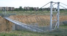
Aurora, Colorado, USA - Cherry Creek Reservoir spillway
| Bridgemeister ID: | 1588 (added 2005-01-24) |
| Name: | (pipeline bridge) |
| Location: | Aurora, Colorado, USA |
| Crossing: | Cherry Creek Reservoir spillway |
| Coordinates: | 39.65919 N 104.82509 W |
| Maps: | Acme, GeoHack, Google, OpenStreetMap |
| Use: | Pipeline |
| Status: | Extant (last checked: 2006) |
| Main Cables: | Wire (steel) |
| Suspended Spans: | 1 |
Notes:
- Carrys a 66-inch water pipeline. Patrick O'Donnell estimates the length of the suspended portion of the span at 250 feet.
Image Sets:
(pipeline bridge)
Babahoyo, Los Rios, Ecuador - Babahoyo River
| Bridgemeister ID: | 7229 (added 2022-07-16) |
| Name: | (pipeline bridge) |
| Location: | Babahoyo, Los Rios, Ecuador |
| Crossing: | Babahoyo River |
| Coordinates: | 1.797178 S 79.533913 W |
| Maps: | Acme, GeoHack, Google, OpenStreetMap |
| Use: | Pipeline |
| Status: | Extant (last checked: 2015) |
| Main Cables: | Wire (steel) |
| Suspended Spans: | 1 |
| Main Span: | 1 x 171 meters (561 feet) estimated |
Notes:
- Next to El Salto - Babahoyo, Los Rios, Ecuador.
- Near (footbridge) - Babahoyo, Los Rios, Ecuador.
- All past and present bridges at this location.
External Links:
(pipeline bridge)
Benson, Arizona, USA - San Pedro River
| Bridgemeister ID: | 2328 (added 2007-06-11) |
| Name: | (pipeline bridge) |
| Location: | Benson, Arizona, USA |
| Crossing: | San Pedro River |
| Coordinates: | 31.975290 N 110.278883 W |
| Maps: | Acme, GeoHack, Google, OpenStreetMap |
| Use: | Pipeline |
| Status: | Extant (last checked: 2019) |
| Main Cables: | Wire (steel) |
Notes:
- Likely several pipeline suspension bridges across the San Pedro near Benson.
- Next to (pipeline bridge) - Benson, Arizona, USA.
- Near (pipeline bridge) - Benson, Arizona, USA.
- All past and present bridges at this location.
(pipeline bridge)
Benson, Arizona, USA - San Pedro River
| Bridgemeister ID: | 3303 (added 2019-11-28) |
| Name: | (pipeline bridge) |
| Location: | Benson, Arizona, USA |
| Crossing: | San Pedro River |
| Coordinates: | 31.980649 N 110.281095 W |
| Maps: | Acme, GeoHack, Google, OpenStreetMap |
| Use: | Pipeline |
| Status: | Extant (last checked: 2019) |
| Main Cables: | Wire (steel) |
Notes:
(pipeline bridge)
Benson, Arizona, USA - San Pedro River
| Bridgemeister ID: | 3304 (added 2019-11-28) |
| Name: | (pipeline bridge) |
| Location: | Benson, Arizona, USA |
| Crossing: | San Pedro River |
| Coordinates: | 31.974698 N 110.278894 W |
| Maps: | Acme, GeoHack, Google, OpenStreetMap |
| Use: | Pipeline |
| Status: | Extant (last checked: 2019) |
| Main Cables: | Wire (steel) |
Notes:
(pipeline bridge)
Benteng, Bogor Regency and Rancabungur, Bogor Regency, West Java, Indonesia - Cisadane River
| Bridgemeister ID: | 7663 (added 2023-06-11) |
| Name: | (pipeline bridge) |
| Location: | Benteng, Bogor Regency and Rancabungur, Bogor Regency, West Java, Indonesia |
| Crossing: | Cisadane River |
| Coordinates: | 6.536846 S 106.699151 E |
| Maps: | Acme, GeoHack, Google, OpenStreetMap |
| Use: | Pipeline |
| Status: | Extant (last checked: 2022) |
| Main Cables: | Wire (steel) |
Notes:
- Small pipeline suspension bridge between two road bridges.
(pipeline bridge)
Billère and Jurançon, Pyrénées-Atlantiques, France - Ousse River
| Bridgemeister ID: | 4564 (added 2020-06-02) |
| Name: | (pipeline bridge) |
| Location: | Billère and Jurançon, Pyrénées-Atlantiques, France |
| Crossing: | Ousse River |
| Coordinates: | 43.293272 N 0.395823 W |
| Maps: | Acme, GeoHack, Google, OpenStreetMap |
| Use: | Pipeline |
| Status: | Extant (last checked: 2019) |
| Main Cables: | Wire (steel) |
| Suspended Spans: | 1 |
External Links:
(pipeline bridge)
Blénod-lès-Pont-à-Mousson and Loisy, Meurthe-et-Moselle, France - Moselle/Mosel River
| Bridgemeister ID: | 4731 (added 2020-06-27) |
| Name: | (pipeline bridge) |
| Location: | Blénod-lès-Pont-à-Mousson and Loisy, Meurthe-et-Moselle, France |
| Crossing: | Moselle/Mosel River |
| Coordinates: | 48.878972 N 6.087439 E |
| Maps: | Acme, GeoHack, Google, OpenStreetMap |
| Use: | Pipeline |
| Status: | Extant (last checked: 2016) |
| Main Cables: | Wire (steel) |
| Main Spans: | 2 |
External Links:
(pipeline bridge)
Blythe, California and Ehrenberg, Arizona, USA - Colorado River
| Bridgemeister ID: | 2522 (added 2010-01-02) |
| Name: | (pipeline bridge) |
| Location: | Blythe, California and Ehrenberg, Arizona, USA |
| Crossing: | Colorado River |
| Coordinates: | 33.60182 N 114.53324 W |
| Maps: | Acme, GeoHack, Google, OpenStreetMap |
| Use: | Pipeline |
| Status: | Extant (last checked: 2010) |
| Main Cables: | Wire (steel) |
| Suspended Spans: | 1 |
| Bridgemeister ID: | 6788 (added 2021-10-29) |
| Name: | (pipeline bridge) |
| Location: | Bogor, West Java, Indonesia |
| Crossing: | Ciliwung |
| At or Near Feature: | Bogor Botanical Gardens |
| Coordinates: | 6.601567 S 106.801665 E |
| Maps: | Acme, GeoHack, Google, OpenStreetMap |
| Use: | Pipeline |
| Status: | Extant (last checked: 2020) |
| Main Cables: | Wire |
| Suspended Spans: | 1 |
Notes:
(pipeline bridge)
Bradford, Pennsylvania, USA
| Bridgemeister ID: | 4827 (added 2020-07-05) |
| Name: | (pipeline bridge) |
| Location: | Bradford, Pennsylvania, USA |
| Coordinates: | 41.967963 N 78.625340 W |
| Maps: | Acme, GeoHack, Google, OpenStreetMap |
| Use: | Pipeline |
| Status: | Extant (last checked: 2020) |
| Main Cables: | Wire (steel) |
| Suspended Spans: | 1 |
(pipeline bridge)
Bradford, Pennsylvania, USA - Tunungwant Creek
| Bridgemeister ID: | 4828 (added 2020-07-05) |
| Name: | (pipeline bridge) |
| Location: | Bradford, Pennsylvania, USA |
| Crossing: | Tunungwant Creek |
| Coordinates: | 41.967349 N 78.629287 W |
| Maps: | Acme, GeoHack, Google, OpenStreetMap |
| Use: | Pipeline |
| Status: | Extant (last checked: 2020) |
| Main Cables: | Wire (steel) |
| Suspended Spans: | 1 |
(pipeline bridge)
Bungin, Tana Toraja Regency, South Sulawesi, Indonesia - Sadang River
| Bridgemeister ID: | 8929 (added 2024-11-27) |
| Name: | (pipeline bridge) |
| Location: | Bungin, Tana Toraja Regency, South Sulawesi, Indonesia |
| Crossing: | Sadang River |
| Coordinates: | 3.061556 S 119.858583 E |
| Maps: | Acme, GeoHack, Google, OpenStreetMap |
| Use: | Pipeline |
| Status: | Extant (last checked: 2023) |
| Main Cables: | Wire (steel) |
Notes:
(pipeline bridge)
Burbank, California, USA - Los Angeles River
| Bridgemeister ID: | 2523 (added 2010-01-02) |
| Name: | (pipeline bridge) |
| Location: | Burbank, California, USA |
| Crossing: | Los Angeles River |
| Coordinates: | 34.15051 N 118.32908 W |
| Maps: | Acme, GeoHack, Google, OpenStreetMap |
| Use: | Pipeline |
| Status: | Extant (last checked: 2009) |
| Main Cables: | Wire |
| Suspended Spans: | 1 |
(pipeline bridge)
Burgess Falls, Sparta vicinity, Tennessee, USA - Falling Water River
| Bridgemeister ID: | 2346 (added 2007-08-12) |
| Name: | (pipeline bridge) |
| Location: | Burgess Falls, Sparta vicinity, Tennessee, USA |
| Crossing: | Falling Water River |
| At or Near Feature: | Burgess Falls State Park |
| Use: | Pipeline |
| Status: | Derelict (last checked: 2007) |
| Main Cables: | Wire |
Notes:
- Likely constructed in 1920s as part of the dam and powerhouse project at Burgess Falls. There may have been two of these bridges at this location. The current map for Burgess Falls State Park shows two historical "pipeline bridges." I have only seen images of one derelict suspension bridge.
(pipeline bridge)
Burstall vicinity, Alberta, Canada - South Saskatchewan River
| Bridgemeister ID: | 2048 (added 2006-05-13) |
| Name: | (pipeline bridge) |
| Location: | Burstall vicinity, Alberta, Canada |
| Crossing: | South Saskatchewan River |
| Use: | Pipeline |
| Status: | Extant |
| Main Cables: | Wire (steel) |
Notes:
- Burstall is in Saskatchewan, but the bridge appears to be located west of Burstall in Alberta.
(pipeline bridge)
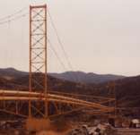
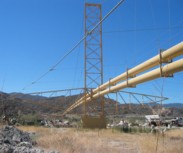
Canyon Country, California, USA - Soledad Canyon
| Bridgemeister ID: | 1259 (added 2004-03-06) |
| Name: | (pipeline bridge) |
| Location: | Canyon Country, California, USA |
| Crossing: | Soledad Canyon |
| Coordinates: | 34.43219 N 118.39074 W |
| Maps: | Acme, GeoHack, Google, OpenStreetMap |
| Use: | Pipeline |
| Status: | In use (last checked: 2007) |
| Main Cables: | Wire (steel) |
| Suspended Spans: | 2 |
| Main Span: | 1 x 187.5 meters (615 feet) estimated |
| Side Span: | 1 |
Image Sets:
(pipeline bridge)
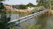
Casper, Wyoming, USA - North Platte River
| Bridgemeister ID: | 2107 (added 2006-09-03) |
| Name: | (pipeline bridge) |
| Location: | Casper, Wyoming, USA |
| Crossing: | North Platte River |
| Coordinates: | 42.859117 N 106.327517 W |
| Maps: | Acme, GeoHack, Google, OpenStreetMap |
| Use: | Pipeline |
| Status: | Extant (last checked: 2006) |
| Main Cables: | Wire (steel) |
| Suspended Spans: | 1 |
| Main Span: | 1 x 61 meters (200 feet) estimated |
Image Sets:
(pipeline bridge)
Castaic vicinity, California, USA - Castaic Creek
| Bridgemeister ID: | 2329 (added 2007-07-04) |
| Name: | (pipeline bridge) |
| Location: | Castaic vicinity, California, USA |
| Crossing: | Castaic Creek |
| Coordinates: | 34.47552 N 118.61212 W |
| Maps: | Acme, GeoHack, Google, OpenStreetMap |
| Use: | Pipeline |
| Status: | Extant (last checked: 2007) |
| Main Cables: | Wire (steel) |
| Suspended Spans: | 2 |
| Side Spans: | 2 |
Image Sets:
(pipeline bridge)
Central Sauzal vicinity, Machali, Chile - Cachapoal River
| Bridgemeister ID: | 8019 (added 2023-12-10) |
| Name: | (pipeline bridge) |
| Location: | Central Sauzal vicinity, Machali, Chile |
| Crossing: | Cachapoal River |
| Coordinates: | 34.269139 S 70.584722 W |
| Maps: | Acme, GeoHack, Google, OpenStreetMap |
| Use: | Pipeline |
| Status: | Extant (last checked: 2023) |
| Main Cables: | Wire (steel) |
| Suspended Spans: | 2 |
| Main Span: | 1 x 97 meters (318.2 feet) estimated |
| Side Span: | 1 x 50 meters (164 feet) estimated |
External Links:
(pipeline bridge)
Chalat, Gilgit-Baltistan, Pakistan - Hunza River
| Bridgemeister ID: | 6395 (added 2021-07-27) |
| Name: | (pipeline bridge) |
| Location: | Chalat, Gilgit-Baltistan, Pakistan |
| Crossing: | Hunza River |
| Coordinates: | 36.256315 N 74.351727 E |
| Maps: | Acme, GeoHack, Google, OpenStreetMap |
| Use: | Pipeline |
| Status: | Extant (last checked: 2021) |
| Main Span: | 1 x 144.5 meters (474 feet) estimated |
(pipeline bridge)
Charleston, Tennessee, USA - Hiwassee River
| Bridgemeister ID: | 2036 (added 2006-05-01) |
| Name: | (pipeline bridge) |
| Location: | Charleston, Tennessee, USA |
| Crossing: | Hiwassee River |
| Principals: | John A. Roebling's Sons Co., Pittsburgh Bridge & Iron Co. |
| Use: | Pipeline |
| Main Cables: | Wire (steel) |
Notes:
- Built to connect Blaw-Knox chemical plan to nearby Bowaters Southern Paper Corp. Described in Roebling ad in March 1963 issue of Civil Engineering.
(pipeline bridge)
Chula Vista vicinity, California, USA - Otay River
| Bridgemeister ID: | 1573 (added 2004-12-11) |
| Name: | (pipeline bridge) |
| Location: | Chula Vista vicinity, California, USA |
| Crossing: | Otay River |
| Coordinates: | 32.6003 N 116.92888 W |
| Maps: | Acme, GeoHack, Google, OpenStreetMap |
| Use: | Pipeline |
| Status: | In use (last checked: 2004) |
| Main Cables: | Wire (steel) |
| Suspended Spans: | 1 |
(pipeline bridge)
Council Bluffs, Iowa, USA - Mosquito Creek
| Bridgemeister ID: | 2268 (added 2007-04-21) |
| Name: | (pipeline bridge) |
| Location: | Council Bluffs, Iowa, USA |
| Crossing: | Mosquito Creek |
| Coordinates: | 41.20985 N 95.82730 W |
| Maps: | Acme, GeoHack, Google, OpenStreetMap |
| Use: | Pipeline |
| Status: | Extant (last checked: 2010) |
| Main Cables: | Wire (steel) |
Notes:
- Patrick S. O'Donnell estimated the main span of this bridge at roughly 550 feet.
(pipeline bridge)
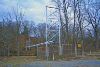
Covington, Virginia, USA - Potts Creek
| Bridgemeister ID: | 1413 (added 2004-07-04) |
| Name: | (pipeline bridge) |
| Location: | Covington, Virginia, USA |
| Crossing: | Potts Creek |
| Coordinates: | 37.75240 N 79.99713 W |
| Maps: | Acme, GeoHack, Google, OpenStreetMap |
| Use: | Pipeline |
| Status: | In use (last checked: 2008) |
| Main Cables: | Wire (steel) |
| Suspended Spans: | 1 |
| Main Span: | 1 x 61 meters (200 feet) estimated |
Notes:
- Just barely visible to the north as your cross over Potts Creek on VA18 heading into Covington.
Image Sets:
| Bridgemeister ID: | 7939 (added 2023-10-29) |
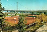
| Name: | (pipeline bridge) |
| Location: | Cremona, Cremona, Italy |
| Crossing: | Po River |
| Coordinates: | 45.127917 N 9.995194 E |
| Maps: | Acme, GeoHack, Google, OpenStreetMap |
| Use: | Pipeline and Footbridge |
| Status: | Removed |
| Main Cables: | Wire (steel) |
| Suspended Spans: | 3 |
| Main Span: | 1 |
| Side Spans: | 2 |
Notes:
- Built at some point in the 1960s. Removed prior to 2003, but likely much earlier. Main span was likely 225-235 meters.
Image Sets:
(pipeline bridge)
Curtis vicinity, Arkansas, USA - South Boat Ditch
| Bridgemeister ID: | 2432 (added 2008-04-22) |
| Name: | (pipeline bridge) |
| Location: | Curtis vicinity, Arkansas, USA |
| Crossing: | South Boat Ditch |
| Use: | Pipeline |
| Status: | Extant (last checked: 2008) |
| Main Cables: | Wire (steel) |
| Suspended Spans: | 1 |
Image Sets:
(pipeline bridge)
Dahimal, Gilgit-Baltistan, Pakistan - Gilgit River
| Bridgemeister ID: | 6696 (added 2021-10-02) |
| Name: | (pipeline bridge) |
| Location: | Dahimal, Gilgit-Baltistan, Pakistan |
| Crossing: | Gilgit River |
| Coordinates: | 36.201420 N 73.246198 E |
| Maps: | Acme, GeoHack, Google, OpenStreetMap |
| Use: | Pipeline |
| Status: | Extant (last checked: 2021) |
| Main Cables: | Wire (steel) |
| Suspended Spans: | 1 |
| Main Span: | 1 x 42.7 meters (140 feet) estimated |
Notes:
- Built at some point after mid-2017. Immediately adjacent to a drooping suspension footbridge that is not included in the inventory.
External Links:
- Mild Steel Pipe over Ghizer River - Facebook. Appears to actually cross the Gilgit River despite the caption.
(pipeline bridge)
Dayton Lakes vicinity, Texas, USA - Trinity River
| Bridgemeister ID: | 3326 (added 2019-12-01) |
| Name: | (pipeline bridge) |
| Location: | Dayton Lakes vicinity, Texas, USA |
| Crossing: | Trinity River |
| Coordinates: | 30.213426 N 94.825076 W |
| Maps: | Acme, GeoHack, Google, OpenStreetMap |
| Use: | Pipeline |
| Status: | Extant (last checked: 2019) |
| Main Cables: | Wire (steel) |
(pipeline bridge)
Dearborn, Michigan, USA - Rouge River
| Bridgemeister ID: | 7125 (added 2022-06-17) |
| Name: | (pipeline bridge) |
| Location: | Dearborn, Michigan, USA |
| Crossing: | Rouge River |
| Coordinates: | 42.290501 N 83.166260 W |
| Maps: | Acme, GeoHack, Google, OpenStreetMap |
| Use: | Pipeline |
| Status: | Extant (last checked: 2022) |
| Main Cables: | Wire (steel) |
| Main Span: | 1 x 76 meters (249.3 feet) estimated |
Image Sets:
(pipeline bridge)
Deyangan, Magelang Regency and Bumiharjo, Magelang Regency, Central Java, Indonesia - Progo River
| Bridgemeister ID: | 8974 (added 2024-12-20) |
| Name: | (pipeline bridge) |
| Location: | Deyangan, Magelang Regency and Bumiharjo, Magelang Regency, Central Java, Indonesia |
| Crossing: | Progo River |
| Coordinates: | 7.591917 S 110.208889 E |
| Maps: | Acme, GeoHack, Google, OpenStreetMap |
| Use: | Pipeline |
| Status: | Extant (last checked: 2023) |
| Main Cables: | Wire (iron) |
| Suspended Spans: | 3 |
| Main Span: | 1 x 50 meters (164 feet) estimated |
| Side Spans: | 2 |
(pipeline bridge)
Duncan and North Cowichan, British Columbia, Canada
| Bridgemeister ID: | 8986 (added 2024-12-23) |
| Name: | (pipeline bridge) |
| Location: | Duncan and North Cowichan, British Columbia, Canada |
| Coordinates: | 48.773444 N 123.752306 W |
| Maps: | Acme, GeoHack, Google, OpenStreetMap |
| Use: | Pipeline |
| Status: | Extant (last checked: 2024) |
| Main Span: | 1 x 90 meters (295.3 feet) estimated |
(pipeline bridge)
Durkee, Worland vicinity, Wyoming, USA - Big Horn River
| Bridgemeister ID: | 2108 (added 2006-09-03) |
| Name: | (pipeline bridge) |
| Location: | Durkee, Worland vicinity, Wyoming, USA |
| Crossing: | Big Horn River |
| Coordinates: | 44.125767 N 107.927817 W |
| Maps: | Acme, GeoHack, Google, OpenStreetMap |
| Use: | Pipeline |
| Status: | Extant (last checked: 2006) |
| Main Cables: | Wire (steel) |
| Suspended Spans: | 1 |
Notes:
Image Sets:
(pipeline bridge)
Durkee, Worland vicinity, Wyoming, USA - Big Horn River
| Bridgemeister ID: | 2601 (added 2014-04-14) |
| Name: | (pipeline bridge) |
| Location: | Durkee, Worland vicinity, Wyoming, USA |
| Crossing: | Big Horn River |
| Coordinates: | 44.126801 N 107.928528 W |
| Maps: | Acme, GeoHack, Google, OpenStreetMap |
| Use: | Pipeline |
| Status: | Removed |
| Main Cables: | Wire |
| Main Span: | 1 |
Notes:
- Appears to have been removed at some point after 2007.
- Near (pipeline bridge) - Durkee, Worland vicinity, Wyoming, USA.
Image Sets:
(pipeline bridge)
Eagle Creek Township and Keener Township, Indiana, USA - Kankakee River
| Bridgemeister ID: | 8412 (added 2024-03-03) |
| Name: | (pipeline bridge) |
| Location: | Eagle Creek Township and Keener Township, Indiana, USA |
| Crossing: | Kankakee River |
| Coordinates: | 41.220361 N 87.270806 W |
| Maps: | Acme, GeoHack, Google, OpenStreetMap |
| Use: | Pipeline |
| Status: | Extant (last checked: 2023) |
| Main Spans: | 1 x 72 meters (236.2 feet) estimated, 1 x 25 meters (82 feet) estimated |
Notes:
- One of six short suspended pipelines along a five mile stretch of, what appears to be, the same pipeline. This one, crossing the Kankakee River is the longest of the group by far.
- Connects to (pipeline bridge) - Eagle Creek Township, Indiana, USA.
- Connects to (pipeline bridge) - Eagle Creek Township, Indiana, USA.
- Connects to (pipeline bridge) - Eagle Creek Township, Indiana, USA.
- Connects to (pipeline bridge) - Keener Township, Indiana, USA.
- Connects to (pipeline bridge) - Keener Township, Indiana, USA.
- All past and present bridges at this location.
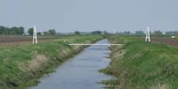
(pipeline bridge)
Eagle Creek Township, Indiana, USA - Singleton Ditch
| Bridgemeister ID: | 8409 (added 2024-03-03) |
| Name: | (pipeline bridge) |
| Location: | Eagle Creek Township, Indiana, USA |
| Crossing: | Singleton Ditch |
| Coordinates: | 41.260667 N 87.300861 W |
| Maps: | Acme, GeoHack, Google, OpenStreetMap |
| Use: | Pipeline |
| Status: | Extant (last checked: 2023) |
| Suspended Spans: | 1 |
| Main Span: | 1 x 20 meters (65.6 feet) estimated |
Notes:
- One of six short suspended pipelines along a five mile stretch of, what appears to be, the same pipeline.
- Connects to (pipeline bridge) - Eagle Creek Township and Keener Township, Indiana, USA.
- Connects to (pipeline bridge) - Eagle Creek Township, Indiana, USA.
- Connects to (pipeline bridge) - Eagle Creek Township, Indiana, USA.
- Connects to (pipeline bridge) - Keener Township, Indiana, USA.
- Connects to (pipeline bridge) - Keener Township, Indiana, USA.
- All past and present bridges at this location.
Image Sets:
(pipeline bridge)
Eagle Creek Township, Indiana, USA - Little Ditch
| Bridgemeister ID: | 8410 (added 2024-03-03) |
| Name: | (pipeline bridge) |
| Location: | Eagle Creek Township, Indiana, USA |
| Crossing: | Little Ditch |
| Coordinates: | 41.257639 N 87.298583 W |
| Maps: | Acme, GeoHack, Google, OpenStreetMap |
| Use: | Pipeline |
| Status: | Extant (last checked: 2023) |
| Suspended Spans: | 1 |
| Main Span: | 1 x 21 meters (68.9 feet) estimated |
Notes:
- One of six short suspended pipelines along a five mile stretch of, what appears to be, the same pipeline.
- Connects to (pipeline bridge) - Eagle Creek Township and Keener Township, Indiana, USA.
- Connects to (pipeline bridge) - Eagle Creek Township, Indiana, USA.
- Connects to (pipeline bridge) - Eagle Creek Township, Indiana, USA.
- Connects to (pipeline bridge) - Keener Township, Indiana, USA.
- Connects to (pipeline bridge) - Keener Township, Indiana, USA.
- All past and present bridges at this location.
Image Sets:

(pipeline bridge)
Eagle Creek Township, Indiana, USA - Brown Ditch
| Bridgemeister ID: | 8411 (added 2024-03-03) |
| Name: | (pipeline bridge) |
| Location: | Eagle Creek Township, Indiana, USA |
| Crossing: | Brown Ditch |
| Coordinates: | 41.239583 N 87.285444 W |
| Maps: | Acme, GeoHack, Google, OpenStreetMap |
| Use: | Pipeline |
| Status: | Extant (last checked: 2023) |
| Suspended Spans: | 1 |
| Main Span: | 1 x 16 meters (52.5 feet) estimated |
Notes:
- One of six short suspended pipelines along a five mile stretch of, what appears to be, the same pipeline.
- Connects to (pipeline bridge) - Eagle Creek Township and Keener Township, Indiana, USA.
- Connects to (pipeline bridge) - Eagle Creek Township, Indiana, USA.
- Connects to (pipeline bridge) - Eagle Creek Township, Indiana, USA.
- Connects to (pipeline bridge) - Keener Township, Indiana, USA.
- Connects to (pipeline bridge) - Keener Township, Indiana, USA.
- All past and present bridges at this location.
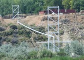
(pipeline bridge)
Eccles, Worland vicinity, Wyoming, USA - Big Horn River
| Bridgemeister ID: | 2109 (added 2006-09-03) |
| Name: | (pipeline bridge) |
| Location: | Eccles, Worland vicinity, Wyoming, USA |
| Crossing: | Big Horn River |
| Coordinates: | 44.15685 N 107.928117 W |
| Maps: | Acme, GeoHack, Google, OpenStreetMap |
| Use: | Pipeline |
| Status: | Extant (last checked: 2006) |
| Main Cables: | Wire (steel) |
| Suspended Spans: | 1 |
Notes:
- Patrick S. O'Donnell estimates the main span at 400 feet based on aerial imagery.
Image Sets:
(pipeline bridge)
El Doce vicinity, Colombia - Cauca River
| Bridgemeister ID: | 7731 (added 2023-07-07) |
| Name: | (pipeline bridge) |
| Location: | El Doce vicinity, Colombia |
| Crossing: | Cauca River |
| Coordinates: | 7.459880 N 75.316432 W |
| Maps: | Acme, GeoHack, Google, OpenStreetMap |
| Use: | Pipeline |
| Status: | Extant (last checked: 2022) |
| Main Cables: | Wire |
(pipeline bridge)
Elk, California, USA - Greenwood Creek
| Bridgemeister ID: | 5685 (added 2021-03-26) |
| Name: | (pipeline bridge) |
| Location: | Elk, California, USA |
| Crossing: | Greenwood Creek |
| Coordinates: | 39.126247 N 123.714382 W |
| Maps: | Acme, GeoHack, Google, OpenStreetMap |
| Principals: | Elk County Water District |
| Use: | Pipeline |
| Status: | In use (last checked: 2021) |
| Main Cables: | Wire (steel) |
(pipeline bridge)
Escobal, Alajuela and San Pablo, San José Province, Costa Rica - Rio Tárcoles
| Bridgemeister ID: | 7768 (added 2023-08-17) |
| Name: | (pipeline bridge) |
| Location: | Escobal, Alajuela and San Pablo, San José Province, Costa Rica |
| Crossing: | Rio Tárcoles |
| Coordinates: | 9.922923 N 84.430955 W |
| Maps: | Acme, GeoHack, Google, OpenStreetMap |
| Use: | Pipeline |
| Status: | Extant (last checked: 2022) |
| Main Span: | 1 |
(pipeline bridge)
Eugene vicinity, Oregon, USA - McKenzie River
| Bridgemeister ID: | 2148 (added 2006-11-18) |
| Name: | (pipeline bridge) |
| Location: | Eugene vicinity, Oregon, USA |
| Crossing: | McKenzie River |
| At or Near Feature: | Armitage State Park vicinity |
| Coordinates: | 44.11456 N 123.05380 W |
| Maps: | Acme, GeoHack, Google, OpenStreetMap |
| Use: | Pipeline |
| Status: | Extant (last checked: 2006) |
| Main Cables: | Wire |
Notes:
(pipeline bridge)
Fortalecillas, Colombia - Magdalena River
| Bridgemeister ID: | 3609 (added 2019-12-31) |
| Name: | (pipeline bridge) |
| Location: | Fortalecillas, Colombia |
| Crossing: | Magdalena River |
| Coordinates: | 3.028211 N 75.259552 W |
| Maps: | Acme, GeoHack, Google, OpenStreetMap |
| Use: | Pipeline |
| Status: | Extant (last checked: 2019) |
| Main Cables: | Wire (steel) |
(pipeline bridge)
Fortalecillas, Colombia - Magdalena River
| Bridgemeister ID: | 3610 (added 2019-12-31) |
| Name: | (pipeline bridge) |
| Location: | Fortalecillas, Colombia |
| Crossing: | Magdalena River |
| Coordinates: | 3.028217 N 75.259089 W |
| Maps: | Acme, GeoHack, Google, OpenStreetMap |
| Use: | Pipeline |
| Status: | Extant (last checked: 2019) |
| Main Cables: | Wire (iron) |
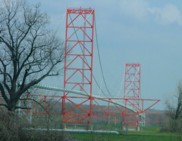
| Bridgemeister ID: | 1820 (added 2005-05-21) |
| Name: | (pipeline bridge) |
| Location: | Fulton, Arkansas, USA |
| Crossing: | Red River |
| Coordinates: | 33.60368 N 93.81316 W |
| Maps: | Acme, GeoHack, Google, OpenStreetMap |
| Use: | Pipeline |
| Status: | Extant (last checked: 2007) |
| Main Cables: | Wire (steel) |
| Suspended Spans: | 3 |
| Main Span: | 1 |
| Side Spans: | 2 |
Notes:
- Call numbers ECD0860-1 and ECD0860-2 of the Arkansas History Commission's image archives show this large pipeline bridge.
External Links:
- Historic Bridges of the United States - Fulton Pipeline Bridge - Hempstead County, Arkansas, and Miller County, Arkansas
- Structurae - Structure ID 20050818
Image Sets:
(pipeline bridge)
Gary, Indiana, USA - Grand Calumet River
| Bridgemeister ID: | 7122 (added 2022-06-17) |
| Name: | (pipeline bridge) |
| Location: | Gary, Indiana, USA |
| Crossing: | Grand Calumet River |
| Coordinates: | 41.608340 N 87.349447 W |
| Maps: | Acme, GeoHack, Google, OpenStreetMap |
| Use: | Pipeline |
| Status: | Extant (last checked: 2022) |
| Main Cables: | Wire (steel) |
| Main Span: | 1 x 61 meters (200.1 feet) estimated |
Notes:
(pipeline bridge)
Gary, Indiana, USA - Grand Calumet River
| Bridgemeister ID: | 7123 (added 2022-06-17) |
| Name: | (pipeline bridge) |
| Location: | Gary, Indiana, USA |
| Crossing: | Grand Calumet River |
| Coordinates: | 41.608436 N 87.349509 W |
| Maps: | Acme, GeoHack, Google, OpenStreetMap |
| Use: | Pipeline |
| Status: | Extant (last checked: 2022) |
| Main Cables: | Wire (steel) |
| Main Span: | 1 x 74 meters (242.8 feet) estimated |
Notes:
(pipeline bridge)
Gary, Indiana, USA - Grand Calumet River
| Bridgemeister ID: | 7124 (added 2022-06-17) |
| Name: | (pipeline bridge) |
| Location: | Gary, Indiana, USA |
| Crossing: | Grand Calumet River |
| Coordinates: | 41.608849 N 87.348776 W |
| Maps: | Acme, GeoHack, Google, OpenStreetMap |
| Use: | Pipeline |
| Status: | Extant |
| Main Cables: | Wire (steel) |
| Main Span: | 1 |
Notes:
(pipeline bridge)
Gelsenkirchen, North Rhine-Westphalia, Germany
(pipeline bridge)
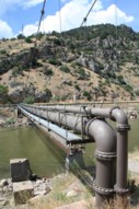
Glenwood Springs, Colorado, USA - Colorado River
| Bridgemeister ID: | 2225 (added 2007-03-18) |
| Name: | (pipeline bridge) |
| Location: | Glenwood Springs, Colorado, USA |
| Crossing: | Colorado River |
| Coordinates: | 39.55085 N 107.31878 W |
| Maps: | Acme, GeoHack, Google, OpenStreetMap |
| Use: | Pipeline |
| Status: | Extant (last checked: 2006) |
| Main Cables: | Wire (steel) |
| Suspended Spans: | 1 |
| Main Span: | 1 x 61 meters (200 feet) estimated |
Notes:
- Span length of approximately 200 feet is for the suspended pipeline. Patrick O'Donnell estimates the anchorage-to-anchorage distance is 450 feet.
Image Sets:
| Bridgemeister ID: | 7869 (added 2023-09-17) |
| Name: | (pipeline bridge) |
| Location: | Grassobbio, Bergamo, Italy |
| Crossing: | Serio |
| Coordinates: | 45.657637 N 9.732027 E |
| Maps: | Acme, GeoHack, Google, OpenStreetMap |
| Use: | Pipeline |
| Status: | Extant (last checked: 2023) |
| Main Cables: | Wire (steel) |
| Suspended Spans: | 3 |
| Main Span: | 1 x 101 meters (331.4 feet) estimated |
| Side Spans: | 2 |
| Bridgemeister ID: | 3975 (added 2020-03-22) |
| Name: | (pipeline bridge) |
| Location: | Greåker, Sarpsborg, Viken, Norway |
| Crossing: | Visterflo |
| Coordinates: | 59.26354 N 11.02993 E |
| Maps: | Acme, GeoHack, Google, kart.1881.no, OpenStreetMap |
| Use: | Pipeline |
| Status: | Extant (last checked: 2018) |
| Suspended Spans: | 1 |
| Main Span: | 1 x 60 meters (196.9 feet) estimated |
(pipeline bridge)
Halle, Germany - Saale River
| Bridgemeister ID: | 2966 (added 2019-10-12) |
| Name: | (pipeline bridge) |
| Location: | Halle, Germany |
| Crossing: | Saale River |
| Coordinates: | 51.520727 N 11.938966 E |
| Maps: | Acme, GeoHack, Google, OpenStreetMap |
| Use: | Pipeline |
| Status: | Extant (last checked: 2019) |
| Main Cables: | Wire (steel) |
(pipeline bridge)
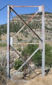
Helper vicinity, Utah, USA - Price River
| Bridgemeister ID: | 2215 (added 2007-02-13) |
| Name: | (pipeline bridge) |
| Location: | Helper vicinity, Utah, USA |
| Crossing: | Price River |
| Coordinates: | 39.70666 N 110.86906 W |
| Maps: | Acme, GeoHack, Google, OpenStreetMap |
| Use: | Pipeline |
| Status: | Extant (last checked: 2006) |
| Main Cables: | Wire |
| Suspended Spans: | 1 |
| Main Span: | 1 x 45.7 meters (150 feet) estimated |
Image Sets:
(pipeline bridge)
Hidakagawa, Wakayama, Japan - Hidaka River
| Bridgemeister ID: | 4432 (added 2020-04-19) |
| Name: | (pipeline bridge) |
| Location: | Hidakagawa, Wakayama, Japan |
| Crossing: | Hidaka River |
| Coordinates: | 33.970918 N 135.360611 E |
| Maps: | Acme, GeoHack, Google, OpenStreetMap |
| Use: | Pipeline |
| Status: | Extant (last checked: 2014) |
| Main Cables: | Wire (steel) |
| Suspended Spans: | 1 |
Notes:
- Small-diameter pipeline suspended adjacent to current (2020) through arch vehicular crossing.
- Near former location of (suspension bridge) - Hidakagawa, Wakayama, Japan.
(pipeline bridge)
Hominy, Oklahoma, USA - Hominy Creek
| Bridgemeister ID: | 3621 (added 2019-12-31) |
| Name: | (pipeline bridge) |
| Location: | Hominy, Oklahoma, USA |
| Crossing: | Hominy Creek |
| Coordinates: | 36.473875 N 96.378850 W |
| Maps: | Acme, GeoHack, Google, OpenStreetMap |
| Use: | Pipeline |
| Status: | Extant (last checked: 2019) |
| Main Cables: | Wire (steel) |
| Suspended Spans: | 1 |
(pipeline bridge)
Hope, British Columbia, Canada - Fraser River
| Bridgemeister ID: | 8990 (added 2024-12-23) |
| Name: | (pipeline bridge) |
| Location: | Hope, British Columbia, Canada |
| Crossing: | Fraser River |
| Coordinates: | 49.374250 N 121.504472 W |
| Maps: | Acme, GeoHack, Google, OpenStreetMap |
| Use: | Pipeline |
| Status: | Extant (last checked: 2024) |
| Main Cables: | Wire (steel) |
| Main Span: | 1 x 447 meters (1,466.5 feet) estimated |
(pipeline bridge)
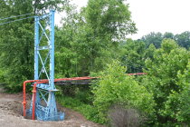
Huntington, West Virginia, USA - Guyandotte River
| Bridgemeister ID: | 2686 (added 2019-05-26) |
| Name: | (pipeline bridge) |
| Location: | Huntington, West Virginia, USA |
| Crossing: | Guyandotte River |
| Coordinates: | 38.412309 N 82.386252 W |
| Maps: | Acme, GeoHack, Google, OpenStreetMap |
| Use: | Pipeline |
| Status: | Removed, c. 2017-2019 |
| Main Cables: | Wire (steel) |
| Suspended Spans: | 1 |
Notes:
- The bridge was adjacent to, and clearly visible from, the Washington Boulevard bridge. It was removed at some point between 2017 and 2019.
Image Sets:
(pipeline bridge)
Iijima, Nagano, Japan - Tenryu River
| Bridgemeister ID: | 8259 (added 2024-02-08) |
| Name: | (pipeline bridge) |
| Location: | Iijima, Nagano, Japan |
| Crossing: | Tenryu River |
| Coordinates: | 35.682028 N 137.948333 E |
| Maps: | Acme, GeoHack, Google, OpenStreetMap |
| Use: | Pipeline |
| Status: | Extant (last checked: 2023) |
| Main Cables: | Wire (steel) |
(pipeline bridge)
Jauja, Peru - Mantaro River
| Bridgemeister ID: | 5964 (added 2021-06-30) |
| Name: | (pipeline bridge) |
| Location: | Jauja, Peru |
| Crossing: | Mantaro River |
| Coordinates: | 11.819608 S 75.506841 W |
| Maps: | Acme, GeoHack, Google, OpenStreetMap |
| Use: | Pipeline |
| Status: | Extant (last checked: 2021) |
| Main Cables: | Wire (steel) |
Notes:
- The structure(s) at this location may be two separate but adjacent suspended pipelines.
(pipeline bridge)
Jefferson vicinity, South Dakota and Ponca State Park, Nebraska, USA - Missouri River
| Bridgemeister ID: | 646 (added 2003-02-17) |
| Name: | (pipeline bridge) |
| Location: | Jefferson vicinity, South Dakota and Ponca State Park, Nebraska, USA |
| Crossing: | Missouri River |
| Coordinates: | 42.60534 N 96.71001 W |
| Maps: | Acme, GeoHack, Google, OpenStreetMap |
| Use: | Pipeline |
| Status: | Removed |
| Main Cables: | Wire (steel) |
Notes:
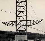
- The postcard says "Suspension Bridge. Jefferson, S.D." The bridge pictured here may be a predecessor to the current pipeline suspension bridge at Ponca, Nebraska, eight miles west of Jefferson. Patrick S. O'Donnell visited this area in 2006 to photograph the Ponca bridge, but could not locate a pipeline bridge matching the postcard.
- In late 2006, Pete Rissell writes that one of the piers from this pipeline bridge is still visible in the middle of the Missouri River: "In the early 1970s I visited the Ponca State Park and noticed a single concrete bridge support in the middle of the Missouri River. I always thought it was strange because there were no abandoned road or rail right-of-ways in that location... I'm sure that this concrete support matches the one in the foreground shown on your website's postcard labeled "Suspension Bridge, Jefferson SD". My guess is that the current Ponca Pipeline bridge (photographed in 2006) is the replacement because the former suspension bridge had to be relocated due to river flooding. The old concrete support is located approximately 1 mile up-river (to the northwest) from the current pipeline bridge." This pier is visible in satellite imagery at the location provided with this inventory entry.
- In 2009, Dale Harkness writes: "I grew up on a farm only a few miles from the existing pipeline. I believe you are correct that the cement pier does belong to the original gas pipeline. My aunt told me that my grandfather was present while the bridge was being constructed. From my understanding, my grandfather had been filming the construction and almost photographed an unusual event where one of the piers crashed down to the ground after a failed attempt to raise it using a pivot." Dale also provided photos of the construction of the newer bridge in 1961.
- The replacement span appears to have been demolished in late 2006 or 2007.
- Replaced by 1961 (pipeline bridge) - Jefferson vicinity, South Dakota and Ponca State Park, Nebraska, USA.
- All past and present bridges at this location.
Image Sets:
(pipeline bridge)
Jenesano, Boyaca, Colombia - Rio Jenesano
| Bridgemeister ID: | 6887 (added 2022-01-15) |
| Name: | (pipeline bridge) |
| Location: | Jenesano, Boyaca, Colombia |
| Crossing: | Rio Jenesano |
| Coordinates: | 5.384360 N 73.361741 W |
| Maps: | Acme, GeoHack, Google, OpenStreetMap |
| Use: | Pipeline |
| Status: | Extant (last checked: 2021) |
| Main Cables: | Wire |
| Suspended Spans: | 1 |
Notes:
(pipeline bridge)
Junction City, California, USA - Trinity River
| Bridgemeister ID: | 6708 (added 2021-10-05) |
| Name: | (pipeline bridge) |
| Location: | Junction City, California, USA |
| Crossing: | Trinity River |
| Use: | Pipeline |
| Status: | Removed |
| Main Cables: | Wire |
| Main Span: | 1 |
Notes:
- Likely built in late 1800s, maybe early 1900s.
External Links:
(pipeline bridge)
Karolin, Poznań, Poland - Warta River
| Bridgemeister ID: | 7303 (added 2022-08-07) |
| Name: | (pipeline bridge) |
| Location: | Karolin, Poznań, Poland |
| Crossing: | Warta River |
| Coordinates: | 52.440219 N 16.975219 E |
| Maps: | Acme, GeoHack, Google, OpenStreetMap |
| Use: | Pipeline |
| Status: | Extant (last checked: 2022) |
| Main Cables: | Wire (steel) |
External Links:
(pipeline bridge)
Keener Township, Indiana, USA - Brent Ditch
| Bridgemeister ID: | 8413 (added 2024-03-03) |
| Name: | (pipeline bridge) |
| Location: | Keener Township, Indiana, USA |
| Crossing: | Brent Ditch |
| Coordinates: | 41.206889 N 87.261222 W |
| Maps: | Acme, GeoHack, Google, OpenStreetMap |
| Use: | Pipeline |
| Status: | Extant (last checked: 2023) |
| Suspended Spans: | 1 |
| Main Span: | 1 x 14 meters (45.9 feet) estimated |
Notes:
- One of six short suspended pipelines along a five mile stretch of, what appears to be, the same pipeline.
- Connects to (pipeline bridge) - Eagle Creek Township and Keener Township, Indiana, USA.
- Connects to (pipeline bridge) - Eagle Creek Township, Indiana, USA.
- Connects to (pipeline bridge) - Eagle Creek Township, Indiana, USA.
- Connects to (pipeline bridge) - Eagle Creek Township, Indiana, USA.
- Connects to (pipeline bridge) - Keener Township, Indiana, USA.
- All past and present bridges at this location.
(pipeline bridge)
Keener Township, Indiana, USA - Dehaan Ditch
| Bridgemeister ID: | 8414 (added 2024-03-03) |
| Name: | (pipeline bridge) |
| Location: | Keener Township, Indiana, USA |
| Crossing: | Dehaan Ditch |
| Coordinates: | 41.202500 N 87.258056 W |
| Maps: | Acme, GeoHack, Google, OpenStreetMap |
| Use: | Pipeline |
| Status: | Extant (last checked: 2023) |
| Suspended Spans: | 1 |
| Main Span: | 1 x 14.5 meters (47.6 feet) estimated |
Notes:
- One of six short suspended pipelines along a five mile stretch of, what appears to be, the same pipeline.
- Connects to (pipeline bridge) - Eagle Creek Township and Keener Township, Indiana, USA.
- Connects to (pipeline bridge) - Eagle Creek Township, Indiana, USA.
- Connects to (pipeline bridge) - Eagle Creek Township, Indiana, USA.
- Connects to (pipeline bridge) - Eagle Creek Township, Indiana, USA.
- Connects to (pipeline bridge) - Keener Township, Indiana, USA.
- All past and present bridges at this location.
(pipeline bridge)
Khairabad, Pakistan - Indus River
| Bridgemeister ID: | 5328 (added 2020-11-11) |
| Name: | (pipeline bridge) |
| Location: | Khairabad, Pakistan |
| Crossing: | Indus River |
| Coordinates: | 33.896931 N 72.235425 E |
| Maps: | Acme, GeoHack, Google, OpenStreetMap |
| Use: | Pipeline |
| Status: | Extant (last checked: 2020) |
Do you have any information or photos for these bridges that you would like to share? Please email david.denenberg@bridgemeister.com.
Mail | Facebook | X (Twitter) | Bluesky