Suspension Bridges of Switzerland
This is a list of all 54 bridges from the suspension bridge inventory for the country Switzerland. Wherever you see a Bridgemeister ID number click it to isolate the bridge on its own page.
Related Lists:
1823: Saint Antoine
Geneva, Switzerland
| Bridgemeister ID: | 377 (added before 2003) |
| Year Completed: | 1823 |
| Name: | Saint Antoine |
| Location: | Geneva, Switzerland |
| Principals: | Guillame Henri Dufour, Marc Seguin, Marc-Auguste Pictet |
| References: | AAJ, GHD, HBE, LAB, MOS, PTS2 |
| Status: | Removed, c.1864 |
| Main Cables: | Wire (iron) |
| Suspended Spans: | 2 |
| Main Spans: | 2 x 40 meters (131.2 feet) |
| Deck width: | 7.5 feet |
External Links:
1825: Pâquis
Geneva, Switzerland
| Bridgemeister ID: | 1825 (added 2005-05-30) |
| Year Completed: | 1825 |
| Name: | Pâquis |
| Location: | Geneva, Switzerland |
| Principals: | Guillame Henri Dufour |
| References: | AAJ, GHD |
| Status: | Demolished, early 1850's |
| Main Cables: | Wire (iron) |
| Suspended Spans: | 2 |
| Main Spans: | 2 x 41 meters (134.5 feet) |
1834: Ile aux Barques
Ile aux Barques, Geneva, Switzerland
| Bridgemeister ID: | 1826 (added 2005-05-30) |
| Year Completed: | 1834 |
| Name: | Ile aux Barques |
| Also Known As: | Bergues |
| Location: | Ile aux Barques, Geneva, Switzerland |
| Coordinates: | 46.205917 N 6.147361 E |
| Maps: | Acme, GeoHack, Google, OpenStreetMap |
| Principals: | Guillame Henri Dufour |
| References: | AAJ, GHD |
| Use: | Footbridge |
| Status: | Removed, 1881 |
| Main Cables: | Wire (iron) |
| Suspended Spans: | 1 |
| Main Span: | 1 x 33.5 meters (109.9 feet) |
| Characteristics: | Partially underspanned |
Notes:
- GHD: "...asymmetrical bridge supported by a single pier."
- Ile aux Barques is now known as Ile Jean-Jacques Rousseau.
- This location is better known for the large underspanned suspension bridge completed in 1834 by Dufour (documented in great detail in reference GHD). The underspanned bridge is omitted from the Bridgemeister inventory. This entry is for the small footbridge that connected to the larger underspanned bridge. Follow the image link for more information.
External Links:
Image Sets:
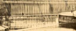
1834: Zaehringen
Fribourg, Switzerland - Sarine River
| Bridgemeister ID: | 395 (added before 2003) |
| Year Completed: | 1834 |
| Name: | Zaehringen |
| Also Known As: | Grand Pont Suspendu |
| Location: | Fribourg, Switzerland |
| Crossing: | Sarine River |
| Principals: | Joseph Chaley |
| References: | AAJ, BBR, BFL, HBE, LAB |
| Use: | Vehicular |
| Status: | Removed, 1920's |
| Main Cables: | Wire (iron) |
| Suspended Spans: | 1 |
| Main Span: | 1 x 273.1 meters (896 feet) |
Notes:
- Became longest suspension bridge by eclipsing 1826 Menai Strait - Menai Bridge and Bangor vicinity, Wales, United Kingdom.
- Eclipsed by new longest suspension bridge 1849 Wheeling (Wheeling and Belmont) - Wheeling, West Virginia, USA.
- Near 1840 Gotteron - Fribourg, Switzerland.
External Links:
Image Sets:
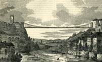
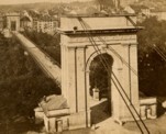
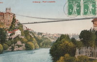
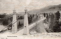
1838: Corbières
Corbières, Switzerland - Sarine River
| Bridgemeister ID: | 1778 (added 2005-04-22) |
| Year Completed: | 1838 |
| Name: | Corbières |
| Location: | Corbières, Switzerland |
| Crossing: | Sarine River |
| References: | AAJ |
| Use: | Vehicular (one-lane) |
| Status: | Replaced, 1931 |
| Main Cables: | Wire (iron) |
| Suspended Spans: | 1 |
Image Sets:
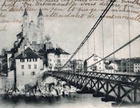
1839: Kettenbrücke
Aarburg, Switzerland - Aare River
| Bridgemeister ID: | 7844 (added 2023-09-04) |
| Year Completed: | 1839 |
| Name: | Kettenbrücke |
| Location: | Aarburg, Switzerland |
| Crossing: | Aare River |
| Coordinates: | 47.320377 N 7.898142 E |
| Maps: | Acme, GeoHack, Google, OpenStreetMap |
| Use: | Vehicular |
| Status: | Replaced, c. 1911 |
| Suspended Spans: | 1 |
Image Sets:
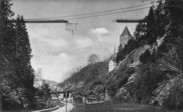
1840: Gotteron
Fribourg, Switzerland - Sarine River
| Bridgemeister ID: | 398 (added before 2003) |
| Year Completed: | 1840 |
| Name: | Gotteron |
| Location: | Fribourg, Switzerland |
| Crossing: | Sarine River |
| Principals: | Joseph Chaley |
| References: | AAJ, GHD, PTS2 |
| Use: | Vehicular |
| Status: | Removed |
| Main Cables: | Wire (iron) |
| Suspended Spans: | 1 |
| Main Span: | 1 x 220 meters (721.8 feet) |
Notes:
- 1919, May 9: An overloaded truck carrying logs causes the failure of several suspenders and collapse of a large section of the deck.
- Near 1834 Zaehringen (Grand Pont Suspendu) - Fribourg, Switzerland.
External Links:
Image Sets:
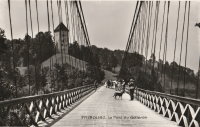
1850: Chain
Aarau, Switzerland - Aare River
| Bridgemeister ID: | 4761 (added 2020-06-28) |
| Year Completed: | 1850 |
| Name: | Chain |
| Also Known As: | Aarau Kettenbrücke |
| Location: | Aarau, Switzerland |
| Crossing: | Aare River |
| Coordinates: | 47.395431 N 8.042028 E |
| Maps: | Acme, GeoHack, Google, OpenStreetMap |
| Principals: | Jean Gaspard Dollfuss |
| References: | AAJ, PTS2 |
| Use: | Vehicular (one-lane) |
| Status: | Replaced, 1949 |
| Main Cables: | Eyebar (iron) |
| Suspended Spans: | 1 |
External Links:
- Kettenbrücke (Aarau) - Wikipedia. Notes bridge was opened for traffic December 28, 1850 and officially inaugurated January 6, 1851.
- Structurae - Structure ID 20043577
Image Sets:
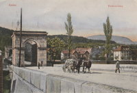
1853: Peney
Peney, Satigny vicinity, Geneva, Switzerland - Rhône River
| Bridgemeister ID: | 1827 (added 2005-05-30) |
| Year Completed: | 1853 |
| Name: | Peney |
| Location: | Peney, Satigny vicinity, Geneva, Switzerland |
| Crossing: | Rhône River |
| Principals: | Hug |
| References: | AAJ, GHD |
| Use: | Vehicular |
| Status: | Collapsed, May 24, 1853 |
| Main Cables: | Wire (iron) |
| Suspended Spans: | 1 |
| Main Span: | 1 x 100 meters (328.1 feet) |
Notes:
- GHD describes how Dufour designed the bridge but was replaced (for political reasons) by a novice engineer, Mr. Hug who produced his own design. The bridge collapsed under test loading.
Image Sets:
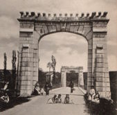
1857: Altenbergsteg
Berne, Switzerland - Aare River
| Bridgemeister ID: | 1475 (added 2004-09-02) |
| Year Completed: | 1857 |
| Name: | Altenbergsteg |
| Location: | Berne, Switzerland |
| Crossing: | Aare River |
| Coordinates: | 46.9503 N 7.4489 E |
| Maps: | Acme, GeoHack, Google, OpenStreetMap |
| References: | PTS2 |
| Use: | Footbridge |
| Status: | In use (last checked: 2019) |
| Main Cables: | Eyebar |
| Suspended Spans: | 1 |
| Main Span: | 1 x 57 meters (187 feet) |
External Links:
Image Sets:
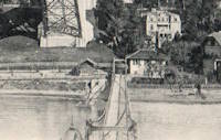
1863: Paul-Fischer
Wettingen and Neuenhof, Aargau, Switzerland - Limmat River
| Bridgemeister ID: | 8883 (added 2024-10-27) |
| Year Completed: | 1863 |
| Name: | Paul-Fischer |
| Also Known As: | Gwaggelibrugg, Wobbly |
| Location: | Wettingen and Neuenhof, Aargau, Switzerland |
| Crossing: | Limmat River |
| Coordinates: | 47.454944 N 8.311917 E |
| Maps: | Acme, GeoHack, Google, OpenStreetMap |
| Use: | Footbridge |
| Status: | In use (last checked: 2022) |
| Main Cables: | Wire |
| Main Span: | 1 |
Notes:
- 1982: The bridge is strengthened with additional towers and cables.
External Links:
1883: Turrian
Château-d'Oex, Switzerland - Sarine River
| Bridgemeister ID: | 2878 (added 2019-09-13) |
| Year Completed: | 1883 |
| Name: | Turrian |
| Location: | Château-d'Oex, Switzerland |
| Crossing: | Sarine River |
| Coordinates: | 46.468703 N 7.135172 E |
| Maps: | Acme, GeoHack, Google, OpenStreetMap |
| Use: | Footbridge |
| Status: | In use (last checked: 2019) |
| Main Cables: | Wire (steel) |
| Suspended Spans: | 1 |
External Links:
Image Sets:
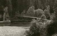
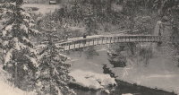
1906: Schönausteg
Berne, Switzerland - Aare River
| Bridgemeister ID: | 1396 (added 2004-07-04) |
| Year Completed: | 1906 |
| Name: | Schönausteg |
| Location: | Berne, Switzerland |
| Crossing: | Aare River |
| Coordinates: | 46.934417 N 7.445883 E |
| Maps: | Acme, GeoHack, Google, OpenStreetMap |
| References: | AAJ |
| Use: | Footbridge |
| Status: | In use (last checked: 2017) |
| Main Cables: | Eyebar (steel) |
| Suspended Spans: | 1 |
| Main Span: | 1 x 53.3 meters (174.88 feet) |
| Deck width: | 8.2 feet |
External Links:
Image Sets:
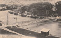
1915: (suspension bridge)
Landquart vicinity, Switzerland
| Bridgemeister ID: | 5675 (added 2021-02-27) |
| Year Completed: | 1915 |
| Name: | (suspension bridge) |
| Location: | Landquart vicinity, Switzerland |
| Main Cables: | Wire |
| Suspended Spans: | 1 |
External Links:
1917: Thusis
Thusis, Switzerland - Hinterrhein River
| Bridgemeister ID: | 3634 (added 2020-01-01) |
| Year Completed: | 1917 |
| Name: | Thusis |
| Location: | Thusis, Switzerland |
| Crossing: | Hinterrhein River |
| Coordinates: | 46.701886 N 9.446884 E |
| Maps: | Acme, GeoHack, Google, OpenStreetMap |
| Use: | Footbridge |
| Status: | In use (last checked: 2022) |
| Main Cables: | Wire |
| Suspended Spans: | 1 |
| Main Span: | 1 |
External Links:
1978: (footbridge)
Avegno vicinity, Ticino, Switzerland - Maggia River
| Bridgemeister ID: | 1796 (added 2005-05-17) |
| Year Completed: | 1978 |
| Name: | (footbridge) |
| Location: | Avegno vicinity, Ticino, Switzerland |
| Crossing: | Maggia River |
| At or Near Feature: | Valle Maggia |
| Coordinates: | 46.215524 N 8.744706 E |
| Maps: | Acme, GeoHack, Google, OpenStreetMap |
| Use: | Footbridge |
| Status: | In use (last checked: 2014) |
| Main Cables: | Wire (steel) |
| Suspended Spans: | 2 |
| Main Span: | 1 x 100 meters (328.1 feet) |
| Side Span: | 1 x 24 meters (78.7 feet) |
| Deck width: | 1.3 meters |
Notes:
- The side without a side span is anchored directly into rock.
External Links:
Image Sets:
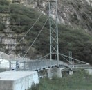
1987: Grabensaal
Fribourg, Switzerland - Sarine River
| Bridgemeister ID: | 4548 (added 2020-05-30) |
| Year Completed: | 1987 |
| Name: | Grabensaal |
| Location: | Fribourg, Switzerland |
| Crossing: | Sarine River |
| Coordinates: | 46.807646 N 7.164400 E |
| Maps: | Acme, GeoHack, Google, OpenStreetMap |
| Use: | Footbridge |
| Status: | In use |
| Main Cables: | Wire (steel) |
| Suspended Spans: | 1 |
External Links:
1996: (footbridge)
Tegna and Losone, Ticino, Switzerland - Melezza River
| Bridgemeister ID: | 1798 (added 2005-05-17) |
| Year Completed: | 1996 |
| Name: | (footbridge) |
| Location: | Tegna and Losone, Ticino, Switzerland |
| Crossing: | Melezza River |
| Coordinates: | 46.180795 N 8.748574 E |
| Maps: | Acme, GeoHack, Google, OpenStreetMap |
| Use: | Footbridge |
| Status: | In use (last checked: 2023) |
| Main Cables: | Wire (steel) |
| Suspended Spans: | 1 |
| Main Span: | 1 x 120 meters (393.7 feet) |
| Deck width: | 2.7 meters |
External Links:
Image Sets:
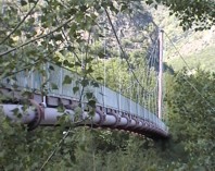
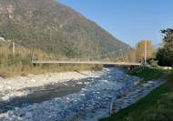
1997: (footbridge)
Giumaglio vicinity, Ticino, Switzerland - Maggia River
| Bridgemeister ID: | 1794 (added 2005-05-17) |
| Year Completed: | 1997 |
| Name: | (footbridge) |
| Location: | Giumaglio vicinity, Ticino, Switzerland |
| Crossing: | Maggia River |
| At or Near Feature: | Valle Maggia |
| Coordinates: | 46.271237 N 8.676774 E |
| Maps: | Acme, GeoHack, Google, OpenStreetMap |
| Use: | Footbridge |
| Status: | In use (last checked: 2018) |
| Main Cables: | Wire (steel) |
| Suspended Spans: | 3 |
| Main Spans: | 3 x 83 meters (272.3 feet) |
| Deck width: | 0.6 meters (path), 0.9 meters (between side rails) |
Notes:
- Deck rests on secondary cables instead of deck stringers.
External Links:
Image Sets:
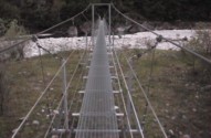
1997: (footbridge)
Motta vicinity, Brione and Lavertezzo vicinity, Ticino, Switzerland - Verzasca River
| Bridgemeister ID: | 1109 (added 2004-01-03) |
| Year Completed: | 1997 |
| Name: | (footbridge) |
| Location: | Motta vicinity, Brione and Lavertezzo vicinity, Ticino, Switzerland |
| Crossing: | Verzasca River |
| At or Near Feature: | Val Verzasca |
| Coordinates: | 46.271641 N 8.812424 E |
| Maps: | Acme, GeoHack, Google, OpenStreetMap |
| Principals: | Passera and Pedretti |
| Use: | Footbridge |
| Status: | In use (last checked: 2014) |
| Main Cables: | Wire (steel) |
| Suspended Spans: | 1 |
| Main Span: | 1 x 60 meters (196.9 feet) |
| Deck width: | 1 meter |
Notes:
- Narrow modern footbridge with unconventional H-shaped towers.
External Links:
Image Sets:
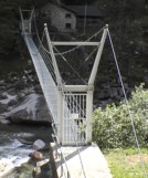
1998: Ile Falcon
Sierre, Switzerland - Rhône River
| Bridgemeister ID: | 2047 (added 2006-05-10) |
| Year Completed: | 1998 |
| Name: | Ile Falcon |
| Location: | Sierre, Switzerland |
| Crossing: | Rhône River |
| Coordinates: | 46.284582 N 7.550457 E |
| Maps: | Acme, GeoHack, Google, OpenStreetMap |
| Use: | Footbridge |
| Status: | In use (last checked: 2013) |
| Main Cables: | Wire (steel) |
| Suspended Spans: | 1 |
| Main Span: | 1 x 68 meters (223.1 feet) |
External Links:
1998: Neigles
Fribourg, Switzerland - Sarine River
| Bridgemeister ID: | 4549 (added 2020-05-30) |
| Year Completed: | 1998 |
| Name: | Neigles |
| Location: | Fribourg, Switzerland |
| Crossing: | Sarine River |
| Coordinates: | 46.811816 N 7.160525 E |
| Maps: | Acme, GeoHack, Google, OpenStreetMap |
| Use: | Footbridge |
| Status: | In use (last checked: 2018) |
| Main Cables: | Wire (steel) |
| Suspended Spans: | 1 |
External Links:
2001: Farinet
Saillon and Leytron, Switzerland - Salentze Gorge
| Bridgemeister ID: | 1871 (added 2005-08-06) |
| Year Completed: | 2001 |
| Name: | Farinet |
| Location: | Saillon and Leytron, Switzerland |
| Crossing: | Salentze Gorge |
| Coordinates: | 46.183344 N 7.182941 E |
| Maps: | Acme, GeoHack, Google, OpenStreetMap |
| Use: | Footbridge |
| Status: | In use (last checked: 2021) |
| Main Cables: | Wire (steel) |
| Main Span: | 1 x 95 meters (311.7 feet) estimated |
| Deck width: | 1.2 meters |
Notes:
- This bridge is 136 meters high.
External Links:
2007: (footbridge)
Solothurn, Switzerland - Aare River
| Bridgemeister ID: | 4760 (added 2020-06-28) |
| Year Completed: | 2007 |
| Name: | (footbridge) |
| Location: | Solothurn, Switzerland |
| Crossing: | Aare River |
| Coordinates: | 47.200455 N 7.530966 E |
| Maps: | Acme, GeoHack, Google, OpenStreetMap |
| Use: | Footbridge |
| Status: | In use (last checked: 2019) |
| Main Cables: | Wire (steel) |
| Suspended Spans: | 1 |
| Main Span: | 1 x 72 meters (236.2 feet) |
External Links:
2008: VfA-Energiebrücke
Buchs, Switzerland and Schaan, Liechtenstein - Rhine River
| Bridgemeister ID: | 8830 (added 2024-09-28) |
| Year Completed: | 2008 |
| Name: | VfA-Energiebrücke |
| Location: | Buchs, Switzerland and Schaan, Liechtenstein |
| Crossing: | Rhine River |
| Coordinates: | 47.175167 N 9.487750 E |
| Maps: | Acme, GeoHack, Google, OpenStreetMap |
| Use: | Footbridge and Pipeline |
| Status: | In use (last checked: 2024) |
| Main Cables: | Wire (steel) |
| Suspended Spans: | 3 |
| Main Span: | 1 x 10² meters (334.6 feet) estimated |
| Side Spans: | 2 |
External Links:
2010: Ruinaulta
Trin vicinity, Switzerland - Vorderrhein
| Bridgemeister ID: | 2840 (added 2019-07-06) |
| Year Completed: | 2010 |
| Name: | Ruinaulta |
| Location: | Trin vicinity, Switzerland |
| Crossing: | Vorderrhein |
| At or Near Feature: | Ruinaulta Gorge |
| Coordinates: | 46.816374 N 9.357050 E |
| Maps: | Acme, GeoHack, Google, OpenStreetMap |
| Use: | Footbridge |
| Status: | In use (last checked: 2019) |
| Main Cables: | Wire (steel) |
| Suspended Spans: | 1 |
External Links:
2012: Sigriswil
Sigriswil, Switzerland
| Bridgemeister ID: | 3052 (added 2019-10-20) |
| Year Completed: | 2012 |
| Name: | Sigriswil |
| Location: | Sigriswil, Switzerland |
| Coordinates: | 46.718247 N 7.707540 E |
| Maps: | Acme, GeoHack, Google, OpenStreetMap |
| Use: | Footbridge |
| Status: | In use (last checked: 2019) |
| Main Cables: | Wire (steel) |
External Links:
2017: Pardisla
Chur and Haldenstein, Switzerland - Rhine River
| Bridgemeister ID: | 6775 (added 2021-10-27) |
| Year Completed: | 2017 |
| Name: | Pardisla |
| Also Known As: | Pardislabrücke |
| Location: | Chur and Haldenstein, Switzerland |
| Crossing: | Rhine River |
| Coordinates: | 46.866695 N 9.515785 E |
| Maps: | Acme, GeoHack, Google, OpenStreetMap |
| Use: | Footbridge |
| Status: | In use (last checked: 2021) |
| Main Cables: | Wire (steel) |
| Suspended Spans: | 1 |
| Main Span: | 1 x 89 meters (292 feet) |
External Links:
2019: Val digl Guert
Alvaneu, Switzerland - Val digl Guert
| Bridgemeister ID: | 3632 (added 2020-01-01) |
| Year Completed: | 2019 |
| Name: | Val digl Guert |
| Location: | Alvaneu, Switzerland |
| Crossing: | Val digl Guert |
| Coordinates: | 46.695354 N 9.635260 E |
| Maps: | Acme, GeoHack, Google, OpenStreetMap |
| Use: | Footbridge |
| Status: | In use (last checked: 2019) |
| Main Cables: | Wire (steel) |
| Suspended Spans: | 1 |
| Main Span: | 1 x 52 meters (170.6 feet) |
2020: Bisse du Rô
Crans-Montana, Switzerland
| Bridgemeister ID: | 7770 (added 2023-08-17) |
| Year Completed: | 2020 |
| Name: | Bisse du Rô |
| Also Known As: | Noir, Bisse du Rho |
| Location: | Crans-Montana, Switzerland |
| Coordinates: | 46.326750 N 7.456052 E |
| Maps: | Acme, GeoHack, Google, OpenStreetMap |
| Use: | Footbridge |
| Status: | In use (last checked: 2023) |
| Main Cables: | Wire (steel) |
2020: Himmelhausmattesteg
Trubschachen, Switzerland - River Trub
| Bridgemeister ID: | 6141 (added 2021-07-06) |
| Year Completed: | 2020 |
| Name: | Himmelhausmattesteg |
| Location: | Trubschachen, Switzerland |
| Crossing: | River Trub |
| Coordinates: | 46.921708 N 7.843647 E |
| Maps: | Acme, GeoHack, Google, OpenStreetMap |
| Principals: | Jakob AG, Thuner Bau AG, Kambly SA |
| Use: | Footbridge and Bicycle |
| Status: | In use (last checked: 2021) |
| Main Cables: | Wire (steel) |
| Suspended Spans: | 1 |
| Main Span: | 1 x 21.5 meters (70.5 feet) |
Notes:
- This bridge employs a mesh system, "Webnet," instead of traditional deck suspenders. From Jakob Rope Systems-Jakob AG literature about the project: "The wire mesh Webnet consists of 3 mm stainless steel ropes, with a construction of 6 × 19 + WC, which with sleeves, forms a mesh width of 80 mm. The Webnet is connected to 26 mm diameter suspension cables, which are 1 x 37 open spiral strand stainless cables, with Jakob Forte turnbuckles fitted at both ends."
External Links:
(footbridge)
Alnasca, Brione, Ticino, Switzerland - Verzasca River
| Bridgemeister ID: | 1792 (added 2005-05-17) |
| Name: | (footbridge) |
| Location: | Alnasca, Brione, Ticino, Switzerland |
| Crossing: | Verzasca River |
| At or Near Feature: | Val Verzasca |
| Coordinates: | 46.304296 N 8.795310 E |
| Maps: | Acme, GeoHack, Google, OpenStreetMap |
| Use: | Footbridge |
| Status: | In use (last checked: 2014) |
| Main Cables: | Wire (steel) |
| Suspended Spans: | 1 |
| Main Span: | 1 x 79 meters (259.2 feet) |
| Deck width: | 1.1 meters |
Notes:
- Only one tower. On one side the cables are anchored directly into rock.
Image Sets:
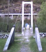
(footbridge)
Amden vicinity, Switzerland
| Bridgemeister ID: | 1926 (added 2005-10-23) |
| Name: | (footbridge) |
| Location: | Amden vicinity, Switzerland |
| Coordinates: | 47.141933 N 9.14025 E |
| Maps: | Acme, GeoHack, Google, OpenStreetMap |
| Use: | Footbridge |
| Status: | In use (last checked: 2005) |
| Main Cables: | Wire |
| Suspended Spans: | 1 |
Notes:
- Narrow footbridge with A-shaped towers.
(footbridge)
Brugg, Switzerland - Aare River
| Bridgemeister ID: | 999 (added 2003-11-16) |
| Name: | (footbridge) |
| Location: | Brugg, Switzerland |
| Crossing: | Aare River |
| Coordinates: | 47.483249 N 8.196140 E |
| Maps: | Acme, GeoHack, Google, OpenStreetMap |
| Use: | Footbridge |
| Status: | In use (last checked: 2019) |
| Main Cables: | Wire |
Notes:
- This interesting bridge is suspended from the four towers of a larger highway viaduct. The footpath passes through the viaduct towers.
External Links:
(footbridge)
Chamoson, Valais, Switzerland - Losentse River
| Bridgemeister ID: | 8881 (added 2024-10-27) |
| Name: | (footbridge) |
| Location: | Chamoson, Valais, Switzerland |
| Crossing: | Losentse River |
| Coordinates: | 46.202917 N 7.219111 E |
| Maps: | Acme, GeoHack, Google, OpenStreetMap |
| Use: | Footbridge |
| Status: | In use (last checked: 2024) |
| Main Cables: | Wire (iron) |
| Suspended Spans: | 1 |
Notes:
(footbridge)
Chamoson, Valais, Switzerland - Losentse River
| Bridgemeister ID: | 8882 (added 2024-10-27) |
| Name: | (footbridge) |
| Location: | Chamoson, Valais, Switzerland |
| Crossing: | Losentse River |
| Coordinates: | 46.200583 N 7.219361 E |
| Maps: | Acme, GeoHack, Google, OpenStreetMap |
| Use: | Footbridge |
| Status: | In use (last checked: 2021) |
| Main Cables: | Wire (steel) |
| Suspended Spans: | 1 |
| Main Span: | 1 x 36 meters (118.1 feet) estimated |
Notes:
(footbridge)
Châtel-sur-Montsalvens vicinity and Gruyère vicinity, Switzerland - Lac de Montsalvens
| Bridgemeister ID: | 3053 (added 2019-10-20) |
| Name: | (footbridge) |
| Location: | Châtel-sur-Montsalvens vicinity and Gruyère vicinity, Switzerland |
| Crossing: | Lac de Montsalvens |
| Coordinates: | 46.619407 N 7.148535 E |
| Maps: | Acme, GeoHack, Google, OpenStreetMap |
| Use: | Footbridge |
| Status: | In use (last checked: 2017) |
| Main Cables: | Wire (steel) |
(footbridge)
Corcapolo vicinity, Intragna, Ticino, Switzerland - Melezza River
| Bridgemeister ID: | 1797 (added 2005-05-17) |
| Name: | (footbridge) |
| Location: | Corcapolo vicinity, Intragna, Ticino, Switzerland |
| Crossing: | Melezza River |
| Coordinates: | 46.166807 N 8.676307 E |
| Maps: | Acme, GeoHack, Google, OpenStreetMap |
| Use: | Footbridge |
| Status: | In use (last checked: 2005) |
| Main Cables: | Wire (steel) |
| Suspended Spans: | 1 |
| Main Span: | 1 x 48 meters (157.5 feet) |
| Deck width: | 1.2 meters |
Image Sets:
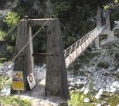
(footbridge)
Frasco, Ticino, Switzerland - Verzasca River
| Bridgemeister ID: | 1790 (added 2005-05-17) |
| Name: | (footbridge) |
| Location: | Frasco, Ticino, Switzerland |
| Crossing: | Verzasca River |
| At or Near Feature: | Val Verzasca |
| Coordinates: | 46.339056 N 8.801326 E |
| Maps: | Acme, GeoHack, Google, OpenStreetMap |
| Use: | Footbridge |
| Status: | In use (last checked: 2014) |
| Main Cables: | Wire (steel) |
| Suspended Spans: | 1 |
| Main Span: | 1 x 90 meters (295.3 feet) |
| Deck width: | 1.1 meters |
Image Sets:
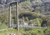
(footbridge)
Fribourg vicinity, Switzerland - Sarine River
| Bridgemeister ID: | 2615 (added 2014-04-16) |
| Name: | (footbridge) |
| Location: | Fribourg vicinity, Switzerland |
| Crossing: | Sarine River |
| Coordinates: | 46.81183 N 7.16050 E |
| Maps: | Acme, GeoHack, Google, OpenStreetMap |
| Use: | Footbridge |
| Status: | In use (last checked: 2014) |
| Main Cables: | Wire |
(footbridge)
Gerra, Ticino, Switzerland - Verzasca River
| Bridgemeister ID: | 1791 (added 2005-05-17) |
| Name: | (footbridge) |
| Location: | Gerra, Ticino, Switzerland |
| Crossing: | Verzasca River |
| At or Near Feature: | Val Verzasca |
| Coordinates: | 46.318696 N 8.804561 E |
| Maps: | Acme, GeoHack, Google, OpenStreetMap |
| Use: | Footbridge |
| Status: | In use (last checked: 2005) |
| Main Cables: | Wire (steel) |
| Suspended Spans: | 1 |
| Main Span: | 1 x 45 meters (147.6 feet) |
| Deck width: | 1.2 meters |
Image Sets:
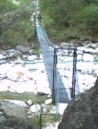
(footbridge)
Kandersteg, Gasterntal, Switzerland - Kander
| Bridgemeister ID: | 6736 (added 2021-10-17) |
| Name: | (footbridge) |
| Location: | Kandersteg, Gasterntal, Switzerland |
| Crossing: | Kander |
| Coordinates: | 46.444604 N 7.724130 E |
| Maps: | Acme, GeoHack, Google, OpenStreetMap |
| Use: | Footbridge |
| Status: | In use (last checked: 2021) |
| Main Cables: | Wire (steel) |
| Suspended Spans: | 1 |
| Main Span: | 1 |
(footbridge)
Someo vicinity, Ticino, Switzerland - Maggia River
| Bridgemeister ID: | 1793 (added 2005-05-17) |
| Name: | (footbridge) |
| Location: | Someo vicinity, Ticino, Switzerland |
| Crossing: | Maggia River |
| At or Near Feature: | Valle Maggia |
| Coordinates: | 46.285998 N 8.656939 E |
| Maps: | Acme, GeoHack, Google, OpenStreetMap |
| Use: | Footbridge |
| Status: | In use (last checked: 2019) |
| Main Cables: | Wire (steel) |
| Suspended Spans: | 3 |
| Main Spans: | 2 x 10⁶ meters (347.8 feet), 1 x 10⁷ meters (351 feet) |
| Deck width: | 0.4 meters (path), 1.0 meters (between side rails) |
Notes:
- Deck rests on secondary cables instead of deck stringers.
Image Sets:
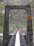
(footbridge)
Sonogno, Ticino, Switzerland - Verzasca River
| Bridgemeister ID: | 1799 (added 2005-05-17) |
| Name: | (footbridge) |
| Location: | Sonogno, Ticino, Switzerland |
| Crossing: | Verzasca River |
| At or Near Feature: | Val Verzasca |
| Use: | Footbridge |
| Status: | Removed, circa 2003-2005 |
| Suspended Spans: | 1 |
| Main Span: | 1 x 26 meters (85.3 feet) |
(footbridge)
St. Gallen, Switzerland - Sitter River
| Bridgemeister ID: | 5836 (added 2021-05-02) |
| Name: | (footbridge) |
| Location: | St. Gallen, Switzerland |
| Crossing: | Sitter River |
| Coordinates: | 47.418310 N 9.338512 E |
| Maps: | Acme, GeoHack, Google, OpenStreetMap |
| Use: | Footbridge |
| Status: | In use (last checked: 2021) |
| Main Span: | 1 |
(footbridge)
Tersnaus and Uors, Switzerland - Tersnausbach
| Bridgemeister ID: | 3635 (added 2020-01-01) |
| Name: | (footbridge) |
| Location: | Tersnaus and Uors, Switzerland |
| Crossing: | Tersnausbach |
| Coordinates: | 46.697771 N 9.186299 E |
| Maps: | Acme, GeoHack, Google, OpenStreetMap |
| Use: | Footbridge |
| Status: | In use (last checked: 2019) |
| Main Cables: | Wire (steel) |
(pipeline bridge)
Maggia, Ticino, Switzerland - Maggia River
| Bridgemeister ID: | 3631 (added 2020-01-01) |
| Name: | (pipeline bridge) |
| Location: | Maggia, Ticino, Switzerland |
| Crossing: | Maggia River |
| Coordinates: | 46.243668 N 8.704117 E |
| Maps: | Acme, GeoHack, Google, OpenStreetMap |
| Use: | Pipeline |
| Status: | Extant (last checked: 2014) |
| Main Cables: | Wire (steel) |
Notes:
Fellital
Gurtnellen, Switzerland - Fellibach
| Bridgemeister ID: | 7106 (added 2022-06-04) |
| Name: | Fellital |
| Location: | Gurtnellen, Switzerland |
| Crossing: | Fellibach |
| Coordinates: | 46.740381 N 8.639588 E |
| Maps: | Acme, GeoHack, Google, OpenStreetMap |
| Use: | Footbridge |
| Status: | In use (last checked: 2022) |
| Main Cables: | Wire (steel) |
| Suspended Spans: | 1 |
| Main Span: | 1 |
Frutigen
Frutigen, Switzerland
| Bridgemeister ID: | 2851 (added 2019-09-08) |
| Name: | Frutigen |
| Location: | Frutigen, Switzerland |
| Coordinates: | 46.560196 N 7.617164 E |
| Maps: | Acme, GeoHack, Google, OpenStreetMap |
| Use: | Footbridge |
| Status: | In use (last checked: 2019) |
| Main Cables: | Wire (steel) |
Granite Plant
Andeer, Switzerland - Hinterrhein River
| Bridgemeister ID: | 2678 (added 2019-03-30) |
| Name: | Granite Plant |
| Location: | Andeer, Switzerland |
| Crossing: | Hinterrhein River |
| Coordinates: | 46.596664 N 9.426572 E |
| Maps: | Acme, GeoHack, Google, OpenStreetMap |
| Use: | Vehicular (one-lane) |
| Status: | In use (last checked: 2019) |
| Main Cables: | Wire (steel) |
| Suspended Spans: | 1 |
Maggia
Maggia, Ticino, Switzerland - Maggia River
| Bridgemeister ID: | 3629 (added 2020-01-01) |
| Name: | Maggia |
| Location: | Maggia, Ticino, Switzerland |
| Crossing: | Maggia River |
| Coordinates: | 46.243473 N 8.705708 E |
| Maps: | Acme, GeoHack, Google, OpenStreetMap |
| Use: | Footbridge |
| Status: | Replaced |
| Main Cables: | Wire (steel) |
| Suspended Spans: | 1 |
Notes:
- Replaced at some point between 2014 and 2019.
- Replaced by Maggia - Maggia, Ticino, Switzerland.
- All past and present bridges at this location.
Maggia
Maggia, Ticino, Switzerland - Maggia River
| Bridgemeister ID: | 3630 (added 2020-01-01) |
| Name: | Maggia |
| Location: | Maggia, Ticino, Switzerland |
| Crossing: | Maggia River |
| Coordinates: | 46.243019 N 8.705354 E |
| Maps: | Acme, GeoHack, Google, OpenStreetMap |
| Use: | Footbridge |
| Status: | In use (last checked: 2019) |
| Main Cables: | Wire (steel) |
Notes:
Ronchini
Aurigeno and Maggia, Ticino, Switzerland - Maggia River
| Bridgemeister ID: | 1795 (added 2005-05-17) |
| Name: | Ronchini |
| Location: | Aurigeno and Maggia, Ticino, Switzerland |
| Crossing: | Maggia River |
| At or Near Feature: | Valle Maggia |
| Coordinates: | 46.231664 N 8.721555 E |
| Maps: | Acme, GeoHack, Google, OpenStreetMap |
| Use: | Footbridge |
| Status: | In use (last checked: 2022) |
| Main Cables: | Wire (steel) |
| Suspended Spans: | 3 |
| Main Span: | 1 x 96 meters (315 feet) |
| Side Spans: | 2 x 12 meters (39.4 feet) |
| Deck width: | 1.2 meters (path), 1.6 meters (between side rails) |
Notes:
- Side rails are secondary main cables.
External Links:
Image Sets:
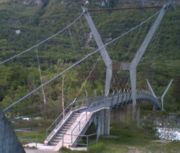
Val Meltger
Lantsch/Lenz, Switzerland
| Bridgemeister ID: | 3633 (added 2020-01-01) |
| Name: | Val Meltger |
| Location: | Lantsch/Lenz, Switzerland |
| Coordinates: | 46.685902 N 9.580230 E |
| Maps: | Acme, GeoHack, Google, OpenStreetMap |
| Use: | Footbridge |
| Status: | In use (last checked: 2015) |
| Main Cables: | Wire (steel) |
Do you have any information or photos for these bridges that you would like to share? Please email david.denenberg@bridgemeister.com.
Mail | Facebook | X (Twitter) | Bluesky