Suspension Bridges of Mexico
This is a list of all 38 bridges from the suspension bridge inventory for the country Mexico. Wherever you see a Bridgemeister ID number click it to isolate the bridge on its own page.
Related Lists:
1894: Arcediano
Guadalajara vicinity, Mexico - Grande de Santiago River
| Bridgemeister ID: | 2492 (added 2008-12-23) |
| Year Completed: | 1894 |
| Name: | Arcediano |
| Location: | Guadalajara vicinity, Mexico |
| Crossing: | Grande de Santiago River |
| At or Near Feature: | Barranca de Portillo |
| Coordinates: | 20.741396 N 103.294783 W |
| Maps: | Acme, GeoHack, Google, OpenStreetMap |
| Use: | Vehicular (one-lane) |
| Status: | Restricted to foot traffic (last checked: 2022) |
| Main Cables: | Wire |
| Suspended Spans: | 1 |
| Main Span: | 1 x 71 meters (232.9 feet) estimated |
Notes:
- 2005: Dismantled and reassembled 700 meters downstream from original location to make way for construction of the Arcediano dam. Coordinates provided here are for the newer location.
Image Sets:
1900: Ojuela
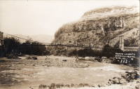
Mapimí, Torreon vicinity, Durango, Mexico
| Bridgemeister ID: | 1043 (added 2003-12-06) |
| Year Completed: | 1900 |
| Name: | Ojuela |
| Also Known As: | Mapimi, Mampimi, Miampimi |
| Location: | Mapimí, Torreon vicinity, Durango, Mexico |
| Coordinates: | 25.791768 N 103.790706 W |
| Maps: | Acme, GeoHack, Google, OpenStreetMap |
| Principals: | Santiago Minguín, William Hildenbrand?, Henry G. Tyrell |
| References: | AAJ, HBE, PTS2 |
| Use: | Vehicular |
| Status: | Restricted to foot traffic (last checked: 2019) |
| Main Cables: | Wire (steel) |
| Suspended Spans: | 1 |
| Main Span: | 1 x 271.5 meters (890.7 feet) estimated |
Notes:
- Misspelled on every long span bridge list I've ever seen, this long narrow footbridge is located at Mapimí, Mexico.
- AAJ notes this bridge as having a 10-foot wide roadway and having been built by William Hildenbrand. The present-day bridge's deck measures only 1.8 meters and is restricted to foot traffic. In HBE, Tyrell takes credit for the design of the bridge and also notes the 10-foot roadway (though, HBE was probably a source for AAJ).
External Links:
Image Sets:
1908: Belisario Domínguez
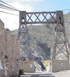
Tuxtla Gutiérrez, Chiapas, Mexico - Rio Grijalva
| Bridgemeister ID: | 3219 (added 2019-11-11) |
| Year Completed: | 1908 |
| Name: | Belisario Domínguez |
| Also Known As: | Porfirio Díaz |
| Location: | Tuxtla Gutiérrez, Chiapas, Mexico |
| Crossing: | Rio Grijalva |
| Coordinates: | 16.742344 N 93.034593 W |
| Maps: | Acme, GeoHack, Google, OpenStreetMap |
| Use: | Vehicular (two-lane) |
| Status: | Only towers remain (last checked: 2021) |
| Main Cables: | Wire (steel) |
| Suspended Spans: | 1 |
Notes:
- 1955: Failed due to a truck colliding with part of the bridge. Adjacent replacement was already under construction.
- 2021: Towers are still present and one set of suspension cables is carrying a small pipeline. Unclear how long the bridge has been in this state.
External Links:
- Puente Belisario Domínguez en Chiapa de Corzo, que atravesaba el Río Grijalva alrededor de 1955. - Facebook
- Puente Belisario Domínguez, Chiapas, México - YouTube
Image Sets:
1922: Cortazar
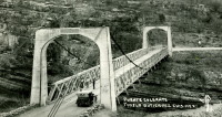
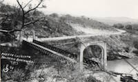
Cortazar, Guanajuato, Mexico - Laja River
| Bridgemeister ID: | 6930 (added 2022-01-22) |
| Year Completed: | 1922 |
| Name: | Cortazar |
| Also Known As: | Arquitecto Ernesto Brunel |
| Location: | Cortazar, Guanajuato, Mexico |
| Crossing: | Laja River |
| Coordinates: | 20.491846 N 100.962915 W |
| Maps: | Acme, GeoHack, Google, OpenStreetMap |
| Use: | Vehicular (one-lane) |
| Status: | Restricted to foot traffic (last checked: 2021) |
| Main Cables: | Wire (steel) |
| Suspended Spans: | 1 |
Notes:
- 1922: During inauguration event, one end of the bridge dipped 1-2 feet, possibly due to the weight of the crowd. The bridge was repaired and entered into service.
- 2020-2021: Disassembled, rehabilitated, reassembled and reopened
1926: Hidalgo-Reynosa International
Hidalgo, Texas, USA and Reynosa, Tamaulipas, Mexico - Rio Grande
| Bridgemeister ID: | 146 (added before 2003) |
| Year Completed: | 1926 |
| Name: | Hidalgo-Reynosa International |
| Location: | Hidalgo, Texas, USA and Reynosa, Tamaulipas, Mexico |
| Crossing: | Rio Grande |
| Coordinates: | 26.095389 N 98.272000 W |
| Maps: | Acme, GeoHack, Google, OpenStreetMap |
| Principals: | Austin Bridge Co. |
| References: | AAJ, AUB, HAERTX98, PTS2 |
| Use: | Vehicular |
| Status: | Demolished, 1960's |
| Main Cables: | Wire (steel) |
| Suspended Spans: | 1 |
| Main Span: | 1 x 137.2 meters (450 feet) |
Notes:
- Damaged by flood, 1933. Rebuilt, 1934. Cables failed, 1939. Rebuilt.
Image Sets:
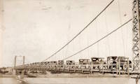
1928: (suspension bridge)
Rio Rico, Mexico and Mercedes, Texas, USA - Rio Grande
1928: Roma-Miguel Alemán International
Roma, Texas, USA and Ciudad Miguel Alemán, Mexico - Rio Grande
| Bridgemeister ID: | 157 (added before 2003) |
| Year Completed: | 1928 |
| Name: | Roma-Miguel Alemán International |
| Also Known As: | Roma-San Pedro International |
| Location: | Roma, Texas, USA and Ciudad Miguel Alemán, Mexico |
| Crossing: | Rio Grande |
| Coordinates: | 26.403821 N 99.018856 W |
| Maps: | Acme, GeoHack, Google, OpenStreetMap |
| Principals: | George Cole, Starr County Bridge Co., Compañía del Puente de San Pedro de Roma |
| References: | HAERTX98, PTS2 |
| Use: | Vehicular |
| Status: | Closed, 1979 (last checked: 2024) |
| Main Cables: | Wire (steel) |
| Suspended Spans: | 1 |
| Main Span: | 1 x 192 meters (629.9 feet) |
| Deck width: | 6.9 meters |
Notes:
- 2024, April: Funds secured to restore the bridge.
External Links:
- Funds secured to restore historic international suspension bridge in South Texas | WGNO.com. Article dated April 24, 2024 regarding funds secured for the bridge's restoration: "Final plans for the bridge’s renovation aren’t clear, but there is talk that the old suspension bridge could become a pedestrian bridge, since it is located next to the current vehicular international bridge"
- Structurae - Structure ID 20005556
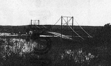
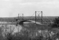
1928: Zapata
Zapata, Texas, USA and Ciudad Guerrero, Mexico - Rio Grande
| Bridgemeister ID: | 1445 (added 2004-07-31) |
| Year Completed: | 1928 |
| Name: | Zapata |
| Location: | Zapata, Texas, USA and Ciudad Guerrero, Mexico |
| Crossing: | Rio Grande |
| Coordinates: | 26.878472 N 99.326563 W |
| Maps: | Acme, GeoHack, Google, OpenStreetMap |
| References: | HAERTX98, PTS2 |
| Use: | Vehicular |
| Status: | Inundated, 1953 |
| Main Cables: | Wire (steel) |
| Suspended Spans: | 3 |
| Main Span: | 1 x 165 meters (541.3 feet) |
| Side Spans: | 2 |
Notes:
- Inundated during creation of Falcon Reservoir.
Image Sets:
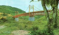
1962: El Remolino
El Remolino, Veracruz, Mexico - Rio Tecolutla
| Bridgemeister ID: | 7504 (added 2023-01-02) |
| Year Completed: | 1962 |
| Name: | El Remolino |
| Location: | El Remolino, Veracruz, Mexico |
| Crossing: | Rio Tecolutla |
| Coordinates: | 20.397481 N 97.239187 W |
| Maps: | Acme, GeoHack, Google, OpenStreetMap |
| Use: | Vehicular and Pipeline |
| Status: | Extant (last checked: 2022) |
| Main Cables: | Wire (steel) |
| Suspended Spans: | 3 |
| Main Span: | 1 x 172 meters (564.3 feet) estimated |
| Side Spans: | 2 |
Image Sets:
1980: Cadereyta
Cadereyta Jiménez, Nuevo Leon, Mexico - Rio Santa Catarina
| Bridgemeister ID: | 7085 (added 2022-05-29) |
| Year Completed: | 1980 |
| Name: | Cadereyta |
| Location: | Cadereyta Jiménez, Nuevo Leon, Mexico |
| Crossing: | Rio Santa Catarina |
| Coordinates: | 25.596181 N 99.992324 W |
| Maps: | Acme, GeoHack, Google, OpenStreetMap |
| Use: | Footbridge |
| Status: | Destroyed, September, 1988 |
| Main Cables: | Wire (steel) |
| Suspended Spans: | 3 |
| Main Span: | 1 x 81.4 meters (267 feet) estimated |
| Side Spans: | 2 |
Notes:
- Destroyed during Hurricane Gilbert, September 1988.
External Links:
- Facebook - PUENTE COLGANTE DE CADEREYTA. Image of the bridge, posted in 2012.
- Facebook - Puente Colgante en Cadereyta, Año de 1980. Image of the bridge, posted in 2012.
2022: (footbridge)
Emiliano Zapata, Tamaulipas, Mexico - Guayalejo River
| Bridgemeister ID: | 7366 (added 2022-11-04) |
| Year Completed: | 2022 |
| Name: | (footbridge) |
| Location: | Emiliano Zapata, Tamaulipas, Mexico |
| Crossing: | Guayalejo River |
| Coordinates: | 23.021991 N 98.888132 W |
| Maps: | Acme, GeoHack, Google, OpenStreetMap |
| Use: | Footbridge |
| Status: | In use (last checked: 2022) |
| Main Cables: | Wire (steel) |
| Suspended Spans: | 3 |
| Main Span: | 1 x 140 meters (459.3 feet) estimated |
| Side Spans: | 2 |
| Bridgemeister ID: | 7454 (added 2022-12-24) |
| Year Completed: | 2022 |
| Name: | (footbridge) |
| Location: | Puerto Vallarta, Jalisco, Mexico |
| Crossing: | Rio Cuale |
| Coordinates: | 20.605843 N 105.235450 W |
| Maps: | Acme, GeoHack, Google, OpenStreetMap |
| Use: | Footbridge |
| Status: | In use (last checked: 2022) |
| Main Cables: | Wire (steel) |
Notes:
- Replaced (footbridge) - Puerto Vallarta, Jalisco, Mexico.
- All past and present bridges at this location.
External Links:
(footbridge)
Batopilas, Chihuahua, Mexico
(footbridge)
Cazones de Herrera, Veracruz, Mexico - Cazones River
| Bridgemeister ID: | 7207 (added 2022-07-08) |
| Name: | (footbridge) |
| Location: | Cazones de Herrera, Veracruz, Mexico |
| Crossing: | Cazones River |
| Coordinates: | 20.706484 N 97.313810 W |
| Maps: | Acme, GeoHack, Google, OpenStreetMap |
| Use: | Footbridge |
| Status: | Closed, 2021 |
| Main Cables: | Wire (steel) |
| Main Spans: | 2 |
Notes:
- 2021: Damaged by Hurricane Grace. Closed awaiting repairs or replacement.
(footbridge)
Chacaltianguis, Veracruz, Mexico - Rio Papaloapan
| Bridgemeister ID: | 8844 (added 2024-09-29) |
| Name: | (footbridge) |
| Location: | Chacaltianguis, Veracruz, Mexico |
| Crossing: | Rio Papaloapan |
| Coordinates: | 18.310917 N 95.844194 W |
| Maps: | Acme, GeoHack, Google, OpenStreetMap |
| Use: | Footbridge |
| Status: | In use (last checked: 2024) |
| Main Cables: | Wire (steel) |
| Main Span: | 1 x 149 meters (488.8 feet) estimated |
(footbridge)
Jalcomulco, Veracruz, Mexico - Rio La Antiqua
| Bridgemeister ID: | 8856 (added 2024-09-30) |
| Name: | (footbridge) |
| Location: | Jalcomulco, Veracruz, Mexico |
| Crossing: | Rio La Antiqua |
| Coordinates: | 19.330658 N 96.763536 W |
| Maps: | Acme, GeoHack, Google, OpenStreetMap |
| Use: | Footbridge |
| Status: | In use (last checked: 2024) |
| Main Cables: | Wire (steel) |
| Suspended Spans: | 1 |
| Main Span: | 1 x 71 meters (232.9 feet) estimated |
Notes:
- 2023: Deck and cables replaced in extensive renovation project.
(footbridge)
La Antigua, Veracruz, Mexico - Rio La Antigua
| Bridgemeister ID: | 2438 (added 2008-04-22) |
| Name: | (footbridge) |
| Location: | La Antigua, Veracruz, Mexico |
| Crossing: | Rio La Antigua |
| Coordinates: | 19.319318 N 96.323015 W |
| Maps: | Acme, GeoHack, Google, OpenStreetMap |
| Use: | Footbridge |
| Status: | In use (last checked: 2018) |
| Main Cables: | Wire (steel) |
Notes:
- Large, long footbridge.
| Bridgemeister ID: | 6953 (added 2022-02-13) |
| Name: | (footbridge) |
| Location: | Puerto Vallarta, Jalisco, Mexico |
| Crossing: | Rio Cuale |
| Coordinates: | 20.605882 N 105.235449 W |
| Maps: | Acme, GeoHack, Google, OpenStreetMap |
| Use: | Footbridge |
| Status: | Destroyed, 2021 |
| Suspended Spans: | 1 |
Notes:
- 2021, August: Destroyed by flood during Hurricane Nora.
- Replaced by 2022 (footbridge) - Puerto Vallarta, Jalisco, Mexico.
- All past and present bridges at this location.
(footbridge)
San Felipe Tejalapam, Oaxaca, Mexico
(footbridge)
Teteloloya, Puebla, Mexico - Rio San Marcos
| Bridgemeister ID: | 7245 (added 2022-07-16) |
| Name: | (footbridge) |
| Location: | Teteloloya, Puebla, Mexico |
| Crossing: | Rio San Marcos |
| Coordinates: | 20.361334 N 97.950981 W |
| Maps: | Acme, GeoHack, Google, OpenStreetMap |
| Use: | Footbridge |
| Status: | Extant (last checked: 2020) |
| Main Span: | 1 |
External Links:
- Wikimedia Commons - Puente colgante peatonal en Teteloloya, Puebla. Image of the bridge.
(footbridge)
Tolantongo, Hidalgo, Mexico
| Bridgemeister ID: | 7686 (added 2023-07-04) |
| Name: | (footbridge) |
| Location: | Tula de Allende, Hidalgo, Mexico |
| Crossing: | Rio Tula |
| Coordinates: | 20.060476 N 99.341784 W |
| Maps: | Acme, GeoHack, Google, OpenStreetMap |
| Use: | Footbridge |
| Status: | Derelict, since September 2021 (last checked: 2023) |
| Main Cables: | Wire |
| Suspended Spans: | 1 |
Notes:
- 2021, September: Deck wrecked by flood.
External Links:
- Tula rehabilitará puente por incumplimiento de Conagua - Grupo Milenio. June 2023 article regarding the local community potentially funding the repair work needed for the bridge.
(footbridge)
Xicoténcatl, Tamaulipas, Mexico - Guayalejo River
| Bridgemeister ID: | 7572 (added 2023-04-16) |
| Name: | (footbridge) |
| Location: | Xicoténcatl, Tamaulipas, Mexico |
| Crossing: | Guayalejo River |
| Coordinates: | 23.037937 N 98.846354 W |
| Maps: | Acme, GeoHack, Google, OpenStreetMap |
| Status: | Extant (last checked: 2021) |
| Main Cables: | Wire (steel) |
| Main Span: | 1 x 10⁷ meters (351 feet) estimated |
| Side Spans: | 2 |
Notes:
- Completed at some point in late 2020 or 2021. May be some kind of industrial bridge.
(suspension bridge)
Chiapa de Corzo vicinity, Chiapas, Mexico - Sumidero Canyon
| Bridgemeister ID: | 1443 (added 2004-07-31) |
| Name: | (suspension bridge) |
| Location: | Chiapa de Corzo vicinity, Chiapas, Mexico |
| Crossing: | Sumidero Canyon |
| Coordinates: | 16.742310 N 93.034537 W |
| Maps: | Acme, GeoHack, Google, OpenStreetMap |
| Use: | Vehicular |
| Status: | Extant (last checked: 2019, as pipeline bridge only) |
| Main Cables: | Wire |
| Suspended Spans: | 1 |
Notes:
- This bridge is adjacent to the large deck arch bridge that carries the Pan-American Highway across Sumidero Canyon. It appears to have originally been a vehicular suspension bridge, but now only has one cable carrying a small pipeline. No road or pedestrian deck remains.
(suspension bridge)
Puerto Vallarta, Jalisco, Mexico - Ameca River
| Bridgemeister ID: | 2742 (added 2019-06-23) |
| Name: | (suspension bridge) |
| Location: | Puerto Vallarta, Jalisco, Mexico |
| Crossing: | Ameca River |
| At or Near Feature: | Vidanta Nuevo Vallarta Golf Course |
| Coordinates: | 20.682861 N 105.276049 W |
| Maps: | Acme, GeoHack, Google, OpenStreetMap |
| Use: | Golf cart |
| Status: | In use (last checked: 2019) |
| Main Cables: | Wire (steel) |
| Suspended Spans: | 1 |
Notes:
- Constructed mid-2010s. Heralded as "longest golf cart suspension bridge in the world."
(suspension bridge)
Santa Rosa Solís and Santa Rosa Solís, Mexico - River Lerma
| Bridgemeister ID: | 8971 (added 2024-12-20) |
| Name: | (suspension bridge) |
| Location: | Santa Rosa Solís and Santa Rosa Solís, Mexico |
| Crossing: | River Lerma |
| Coordinates: | 20.011056 N 100.085000 W |
| Maps: | Acme, GeoHack, Google, OpenStreetMap |
| Status: | In use (last checked: 2020) |
| Main Cables: | Wire (steel) |
| Suspended Spans: | 1 |
(suspension bridge)
Zoquiapan, Puebla, Mexico - San Marcos River
| Bridgemeister ID: | 7208 (added 2022-07-08) |
| Name: | (suspension bridge) |
| Location: | Zoquiapan, Puebla, Mexico |
| Crossing: | San Marcos River |
| Coordinates: | 20.420250 N 97.822199 W |
| Maps: | Acme, GeoHack, Google, OpenStreetMap |
| Status: | Extant (last checked: 2022) |
| Main Cables: | Wire |
| Main Span: | 1 |
Carlos Castillo Peraza
Playa Vicente, Veracruz, Mexico - Rio Tesechoacan
| Bridgemeister ID: | 7733 (added 2023-07-07) |
| Name: | Carlos Castillo Peraza |
| Location: | Playa Vicente, Veracruz, Mexico |
| Crossing: | Rio Tesechoacan |
| Coordinates: | 17.833802 N 95.812130 W |
| Maps: | Acme, GeoHack, Google, OpenStreetMap |
| Use: | Footbridge |
| Status: | In use (last checked: 2022) |
| Main Cables: | Wire (steel) |
| Main Spans: | 3 |
External Links:
- Wikipedia. Image of the bridge.
Cuajimoloyas
Cuajimoloyas, Oaxaca, Mexico
| Bridgemeister ID: | 8791 (added 2024-09-02) |
| Name: | Cuajimoloyas |
| Location: | Cuajimoloyas, Oaxaca, Mexico |
| Coordinates: | 17.114417 N 96.459056 W |
| Maps: | Acme, GeoHack, Google, OpenStreetMap |
| Use: | Footbridge |
| Status: | In use (last checked: 2024) |
| Main Cables: | Wire (steel) |
| Suspended Spans: | 1 |
| Main Span: | 1 x 135 meters (442.9 feet) estimated |
Notes:
- Completed at some point in the 2016-2021 time frame.
Huapoca
Madera vicinity, Chihuahua, Mexico - Sirupa River
| Bridgemeister ID: | 291 (added before 2003) |
| Name: | Huapoca |
| Location: | Madera vicinity, Chihuahua, Mexico |
| Crossing: | Sirupa River |
| At or Near Feature: | Huapoca Canyon |
| Coordinates: | 29.184149 N 108.326139 W |
| Maps: | Acme, GeoHack, Google, OpenStreetMap |
| Use: | Vehicular (one-lane) |
| Status: | Extant (last checked: 2017) |
| Main Cables: | Wire |
| Suspended Spans: | 1 |
Image Sets:
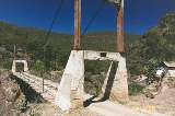
Jicaltepec
Jicaltepec, Veracruz, Mexico - Rio Filobobos
| Bridgemeister ID: | 7610 (added 2023-05-19) |
| Name: | Jicaltepec |
| Location: | Jicaltepec, Veracruz, Mexico |
| Crossing: | Rio Filobobos |
| Coordinates: | 20.169449 N 96.850697 W |
| Maps: | Acme, GeoHack, Google, OpenStreetMap |
| Use: | Footbridge |
| Status: | In use (last checked: 2023) |
| Main Cables: | Wire (steel) |
| Main Span: | 1 x 128 meters (419.9 feet) estimated |
Notes:
- Built at some point in the 2010s.
Plan Martín Chino
Plan Martín Chino and San José Mano Marqués, Oaxaca, Mexico - Rio Tesechoacan
| Bridgemeister ID: | 8788 (added 2024-09-02) |
| Name: | Plan Martín Chino |
| Location: | Plan Martín Chino and San José Mano Marqués, Oaxaca, Mexico |
| Crossing: | Rio Tesechoacan |
| Coordinates: | 17.789167 N 96.009528 W |
| Maps: | Acme, GeoHack, Google, OpenStreetMap |
| Use: | Footbridge |
| Status: | In use (last checked: 2021) |
| Main Cables: | Wire (steel) |
| Main Span: | 1 x 125 meters (410.1 feet) estimated |
Playa Limón
Playa Limón and San Agustín, Oaxaca, Mexico - Rio Tesechoacan
| Bridgemeister ID: | 8789 (added 2024-09-02) |
| Name: | Playa Limón |
| Location: | Playa Limón and San Agustín, Oaxaca, Mexico |
| Crossing: | Rio Tesechoacan |
| Coordinates: | 17.779306 N 96.038194 W |
| Maps: | Acme, GeoHack, Google, OpenStreetMap |
| Use: | Footbridge |
| Status: | In use (last checked: 2023) |
| Main Cables: | Wire (steel) |
| Main Span: | 1 |
Rancho Palmar
Rancho Palmar, Oaxaca, Mexico - Rio Tesechoacan
| Bridgemeister ID: | 8787 (added 2024-09-02) |
| Name: | Rancho Palmar |
| Location: | Rancho Palmar, Oaxaca, Mexico |
| Crossing: | Rio Tesechoacan |
| Coordinates: | 17.730861 N 96.107333 W |
| Maps: | Acme, GeoHack, Google, OpenStreetMap |
| Use: | Footbridge |
| Status: | In use (last checked: 2023) |
| Main Cables: | Wire (steel) |
| Main Span: | 1 x 112 meters (367.5 feet) estimated |
| Side Span: | 1 |
San Jacinto Amilpas
San Jacinto Amilpas, Oaxaca, Mexico - Rio Atoyac
| Bridgemeister ID: | 8792 (added 2024-09-02) |
| Name: | San Jacinto Amilpas |
| Location: | San Jacinto Amilpas, Oaxaca, Mexico |
| Crossing: | Rio Atoyac |
| Coordinates: | 17.101972 N 96.760806 W |
| Maps: | Acme, GeoHack, Google, OpenStreetMap |
| Use: | Footbridge |
| Status: | In use (last checked: 2024) |
| Main Cables: | Wire (steel) |
| Main Span: | 1 x 120 meters (393.7 feet) estimated |
Tolantongo
Tolantongo, Hidalgo, Mexico
Tuxtepec-San Bartolo
San Juan Bautista Tuxtepec and San Bartolo, Oaxaca, Mexico - Rio Papaloapan
| Bridgemeister ID: | 8821 (added 2024-09-28) |
| Name: | Tuxtepec-San Bartolo |
| Location: | San Juan Bautista Tuxtepec and San Bartolo, Oaxaca, Mexico |
| Crossing: | Rio Papaloapan |
| Coordinates: | 18.0922748 N 96.1109586 W |
| Maps: | Acme, GeoHack, Google, OpenStreetMap |
| Use: | Footbridge |
| Status: | In use (last checked: 2022) |
| Main Cables: | Wire (steel) |
| Main Span: | 1 x 172 meters (564.3 feet) estimated |
Do you have any information or photos for these bridges that you would like to share? Please email david.denenberg@bridgemeister.com.
Mail | Facebook | X (Twitter) | Bluesky