Suspension Bridges of Belgium
This is a list of all 23 bridges from the suspension bridge inventory for the country Belgium. Wherever you see a Bridgemeister ID number click it to isolate the bridge on its own page.
Related Lists:
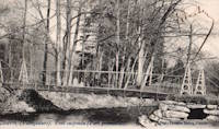
1824: Wissekerke
Bazel, Belgium
| Bridgemeister ID: | 1681 (added 2005-03-26) |
| Year Completed: | 1824 |
| Name: | Wissekerke |
| Location: | Bazel, Belgium |
| At or Near Feature: | Wissekerke Castle |
| Coordinates: | 51.145383 N 4.302667 E |
| Maps: | Acme, GeoHack, Google, OpenStreetMap |
| Principals: | Jean-Baptiste Vifquain |
| References: | IBB, ISFF |
| Status: | Closed, 1990 |
| Main Cables: | Eyebar (iron) |
| Suspended Spans: | 1 |
| Main Span: | 1 x 23.11 meters (75.8 feet) |
| Deck width: | 1.9 |
External Links:
Image Sets:
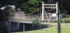
1826: Vermontois
Péruwelz, Belgium - Pommerœul-Antoing Canal
| Bridgemeister ID: | 6629 (added 2021-09-07) |
| Year Completed: | 1826 |
| Name: | Vermontois |
| Location: | Péruwelz, Belgium |
| Crossing: | Pommerœul-Antoing Canal |
| Principals: | Pierre Simons |
| References: | IBB |
| Status: | Replaced, 1866 |
| Suspended Spans: | 1 |
| Main Span: | 1 x 36.7 meters (120.4 feet) estimated |
Notes:
- IBB: Replaced in 1866. Multiple figures exist for main span length: 36.4, 36.7, and 40 meters.
Image Sets:
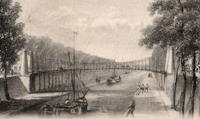
1841: Oban
Lavacherie, Sainte-Ode, Belgium - Ourthe River
| Bridgemeister ID: | 5577 (added 2020-12-20) |
| Year Completed: | 1841 |
| Name: | Oban |
| Location: | Lavacherie, Sainte-Ode, Belgium |
| Crossing: | Ourthe River |
| Coordinates: | 50.062789 N 5.507661 E |
| Maps: | Acme, GeoHack, Google, OpenStreetMap |
| Status: | Destroyed, December, 1944 |
| Suspended Spans: | 1 |
| Main Span: | 1 x 14 meters (45.9 feet) |
External Links:
- PONTS SUSPENDUS - Les ponts metalliques historiques belges. Details about this bridge and several other Belgium suspension bridges.
Image Sets:

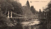
1842: Aywaille
Aywaille, Wallonia, Belgium - Amblève River
| Bridgemeister ID: | 6630 (added 2021-09-07) |
| Year Completed: | 1842 |
| Name: | Aywaille |
| Location: | Aywaille, Wallonia, Belgium |
| Crossing: | Amblève River |
| Coordinates: | 50.475583 N 5.675444 E |
| Maps: | Acme, GeoHack, Google, OpenStreetMap |
| References: | IBB |
| Use: | Vehicular |
| Status: | Replaced, 1934 |
| Main Cables: | Eyebar (iron) |
| Suspended Spans: | 1 |
| Main Span: | 1 x 50 meters (164 feet) estimated |
Notes:
- Two of the bridge's pylons and some of its eyebar chains are still standing (as of the 2020s) as part of a park area immediately north of the current bridge.
External Links:
- PONTS SUSPENDUS - Les ponts métalliques historiques belges. Details about this bridge and several other Belgium suspension bridges.
Image Sets:
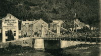
1843: Seraing
Seraing, Liège vicinity, Belgium - Meuse River
| Bridgemeister ID: | 6550 (added 2021-08-29) |
| Year Completed: | 1843 |
| Name: | Seraing |
| Location: | Seraing, Liège vicinity, Belgium |
| Crossing: | Meuse River |
| Coordinates: | 50.616960 N 5.509567 E |
| Maps: | Acme, GeoHack, Google, OpenStreetMap |
| Principals: | Hubert Brialmont, John Cockerill & Cie |
| References: | AAJ, IBB, PTS2 |
| Use: | Vehicular |
| Status: | Removed, 1905 |
| Main Cables: | Chain (iron) |
| Suspended Spans: | 1 |
| Main Span: | 1 x 10⁵ meters (344.5 feet) |
External Links:
- PONTS SUSPENDUS - Les ponts métalliques historiques belges. Details about this bridge and several other Belgium suspension bridges.
Image Sets:
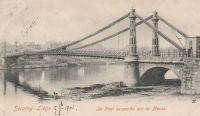
| Bridgemeister ID: | 6631 (added 2021-09-07) |
| Year Completed: | 1844 |
| Name: | Faubourg |
| Location: | La Roche-en-Ardenne, Wallonia, Belgium |
| Crossing: | Ourthe |
| Coordinates: | 50.180861 N 5.575861 E |
| Maps: | Acme, GeoHack, Google, OpenStreetMap |
| References: | IBB |
| Use: | Vehicular |
| Status: | Replaced, 1901 |
| Main Cables: | Eyebar (iron) |
| Suspended Spans: | 1 |
| Main Span: | 1 x 35 meters (114.8 feet) estimated |
External Links:
- PONTS SUSPENDUS - Les ponts métalliques historiques belges. Details about this bridge and several other Belgium suspension bridges.
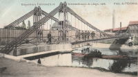
1852: Vennes
Liège, Belgium - Meuse Dérivation
| Bridgemeister ID: | 2319 (added 2007-05-05) |
| Year Completed: | 1852 |
| Name: | Vennes |
| Also Known As: | Boverie, Englebert |
| Location: | Liège, Belgium |
| Crossing: | Meuse Dérivation |
| Coordinates: | 50.62959 N 5.57801 E |
| Maps: | Acme, GeoHack, Google, OpenStreetMap |
| References: | IBB |
| Use: | Vehicular |
| Status: | Removed, 1905 or 1906 |
| Main Cables: | Chain (iron) |
| Suspended Spans: | 1 |
Notes:
- Adjacent replacement completed in 1903. The suspension bridge was still standing at the time of the world's fair (Exposition Universelle et Internationale de Liège) held in Liège in 1905.
- IBB: Precise construction date unknown, but was in time frame 1852-1864. Other sources cite 1852.
- Coordinates refer to the current Vennes Bridge. This is the approximate location of the removed suspension bridge.
External Links:
- Pont des Vennes — Wikipédia
- PONTS SUSPENDUS - Les ponts métalliques historiques belges. Details about this bridge and several other Belgium suspension bridges.
Image Sets:
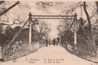
1869: Stadspark
Antwerp, Belgium
| Bridgemeister ID: | 2078 (added 2006-06-10) |
| Year Completed: | 1869 |
| Name: | Stadspark |
| Also Known As: | City Park |
| Location: | Antwerp, Belgium |
| Coordinates: | 51.211054 N 4.414975 E |
| Maps: | Acme, GeoHack, Google, OpenStreetMap |
| Principals: | Cail et Halot |
| References: | ISFF |
| Use: | Footbridge |
| Status: | In use (last checked: 2019) |
| Main Cables: | Chain (iron) |
| Main Span: | 1 x 27.5 meters (90.2 feet) |
| Deck width: | 3.5 |
Notes:
- Cables and deck replaced, 1976.
External Links:
Image Sets:
1899: Hanssenspark
Vilvoorde, Belgium
| Bridgemeister ID: | 2079 (added 2006-06-10) |
| Year Completed: | 1899 |
| Name: | Hanssenspark |
| Location: | Vilvoorde, Belgium |
| Coordinates: | 50.924332 N 4.428762 E |
| Maps: | Acme, GeoHack, Google, OpenStreetMap |
| References: | ISFF |
| Use: | Footbridge |
| Status: | In use (last checked: 2019) |
| Main Cables: | Wire |
| Main Span: | 1 x 17.55 meters (57.6 feet) |
| Deck width: | 3.08 meters |
Notes:
- ISFF: Renovated in 1970s and again in 2000.
External Links:
- PONTS SUSPENDUS - Les ponts métalliques historiques belges. Details about this bridge and several other Belgium suspension bridges.
- Structurae - Structure ID 20020527
Image Sets:
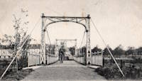
1932: Salzinnes
Namur, Belgium - Sambre River
| Bridgemeister ID: | 8961 (added 2024-11-30) |
| Year Completed: | 1932 |
| Name: | Salzinnes |
| Location: | Namur, Belgium |
| Crossing: | Sambre River |
| Coordinates: | 50.464278 N 4.855861 E |
| Maps: | Acme, GeoHack, Google, OpenStreetMap |
| Use: | Footbridge |
| Status: | Removed, 1940 |
| Main Cables: | Eyebar |
| Suspended Spans: | 1 |
External Links:
- PONTS SUSPENDUS - Les ponts métalliques historiques belges. Details about this bridge and several other Belgium suspension bridges.
| Bridgemeister ID: | 4571 (added 2020-06-02) |
| Year Completed: | 1965 |
| Name: | Fraterstraat |
| Location: | Merelbeke, East Flanders, Belgium |
| Crossing: | Ringvaart |
| Coordinates: | 51.005227 N 3.760873 E |
| Maps: | Acme, GeoHack, Google, OpenStreetMap |
| Use: | Vehicular (two-lane), with walkway |
| Status: | Removed, c. 2021 |
| Main Cables: | Wire (steel) |
| Suspended Spans: | 1 |
| Main Span: | 1 x 56 meters (183.7 feet) estimated |
Notes:
- Replaced by a stayed or extradosed bridge at some point in the 2021-2022 time frame.
- Near (suspension bridge) - Merelbeke, East Flanders, Belgium.
External Links:
Image Sets:
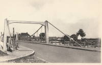
2005: Kanne
Kanne, Belgium - Albert Canal
| Bridgemeister ID: | 2136 (added 2006-10-28) |
| Year Completed: | 2005 |
| Name: | Kanne |
| Location: | Kanne, Belgium |
| Crossing: | Albert Canal |
| Coordinates: | 50.810612 N 5.671073 E |
| Maps: | Acme, GeoHack, Google, OpenStreetMap |
| Use: | Vehicular (two-lane) |
| Status: | In use (last checked: 2019) |
| Suspended Spans: | 1 |
External Links:
2007: College
Kortrijk, Flanders, Belgium - Leie River
| Bridgemeister ID: | 3333 (added 2019-12-07) |
| Year Completed: | 2007 |
| Name: | College |
| Location: | Kortrijk, Flanders, Belgium |
| Crossing: | Leie River |
| Coordinates: | 50.833342 N 3.267162 E |
| Maps: | Acme, GeoHack, Google, OpenStreetMap |
| Use: | Footbridge |
| Status: | In use (last checked: 2019) |
| Main Cables: | Wire (steel) |
| Suspended Spans: | 3 |
| Main Span: | 1 |
| Side Spans: | 2 |
External Links:
2016: La Belle Liégeoise
Liége, Belgium - Meuse River
| Bridgemeister ID: | 6551 (added 2021-08-29) |
| Year Completed: | 2016 |
| Name: | La Belle Liégeoise |
| Location: | Liége, Belgium |
| Crossing: | Meuse River |
| At or Near Feature: | Parc de la Boverie |
| Coordinates: | 50.627863 N 5.573774 E |
| Maps: | Acme, GeoHack, Google, OpenStreetMap |
| Use: | Footbridge |
| Status: | In use (last checked: 2021) |
| Suspended Spans: | 1 |
| Main Span: | 1 |
External Links:
| Bridgemeister ID: | 7900 (added 2023-10-15) |
| Name: | (footbridge) |
| Location: | Zeebrugge, Belgium |
| Crossing: | North Sea |
| Coordinates: | 51.342407 N 3.173718 E |
| Maps: | Acme, GeoHack, Google, OpenStreetMap |
| Use: | Footbridge |
| Status: | Removed |
| Main Cables: | Wire |
| Suspended Spans: | 1 |
Notes:
- Temporary bridge built across the gap in the Zeebrugge Mole created during the Zeebrugge Raid (April 23, 1918). Presumably erected in 1918. Coordinates provided here are approximate.
Image Sets:
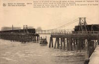
(footbridge)
Zelzate, East Flanders, Belgium
| Bridgemeister ID: | 4584 (added 2020-06-05) |
| Name: | (footbridge) |
| Location: | Zelzate, East Flanders, Belgium |
| Coordinates: | 51.198797 N 3.814564 E |
| Maps: | Acme, GeoHack, Google, OpenStreetMap |
| References: | ISFF |
| Use: | Footbridge |
| Status: | Derelict (last checked: 2006) |
| Main Cables: | Wire |
| Suspended Spans: | 1 |
| Main Span: | 1 x 8.25 meters (27.1 feet) |
| Deck width: | 1.5 meters |
Notes:
- ISFF: Built 1880-1885 in a private garden and noted (in 2006) the bridge was in poor condition.
External Links:
(suspension bridge)
Couvin, Belgium
(suspension bridge)
Evergem, Gent vicinity, East Flanders, Belgium - Westbekesluis
| Bridgemeister ID: | 4570 (added 2020-06-02) |
| Name: | (suspension bridge) |
| Location: | Evergem, Gent vicinity, East Flanders, Belgium |
| Crossing: | Westbekesluis |
| Coordinates: | 51.087382 N 3.659881 E |
| Maps: | Acme, GeoHack, Google, OpenStreetMap |
| Use: | Vehicular (three-lane), with walkway |
| Status: | In use (last checked: 2019) |
| Main Cables: | Wire (steel) |
| Suspended Spans: | 3 |
| Main Span: | 1 x 99.7 meters (327.1 feet) estimated |
| Side Spans: | 2 |
Notes:
External Links:
| Bridgemeister ID: | 4572 (added 2020-06-02) |
| Name: | (suspension bridge) |
| Location: | Merelbeke, East Flanders, Belgium |
| Crossing: | Ringvaart |
| Coordinates: | 51.007842 N 3.751466 E |
| Maps: | Acme, GeoHack, Google, OpenStreetMap |
| Use: | Vehicular (three or more lanes), with walkway |
| Status: | In use (last checked: 2022) |
| Main Cables: | Wire (steel) |
| Suspended Spans: | 3 |
| Main Span: | 1 x 99 meters (324.8 feet) estimated |
| Side Spans: | 2 |
Notes:
External Links:
Grimohaye
Limal, Wavre vicinity, Belgium
| Bridgemeister ID: | 6628 (added 2021-09-07) |
| Name: | Grimohaye |
| Also Known As: | Limal, Limale |
| Location: | Limal, Wavre vicinity, Belgium |
| At or Near Feature: | Limal Castle |
| References: | IBB |
| Use: | Footbridge |
| Main Cables: | Wire (iron) |
Notes:
- IBB: One of earliest known wire suspension bridges in Belgium. Bridge was in existence in 1830, presumably built in mid-to-late 1820s.
Kasteel Cortewalle
Cortewalle Castle, Beveren, Belgium
| Bridgemeister ID: | 1819 (added 2005-05-21) |
| Name: | Kasteel Cortewalle |
| Location: | Cortewalle Castle, Beveren, Belgium |
| Coordinates: | 51.21435 N 4.2651 E |
| Maps: | Acme, GeoHack, Google, OpenStreetMap |
| References: | ISFF |
| Use: | Footbridge |
| Status: | In use (last checked: 2019) |
| Main Cables: | Wire |
| Suspended Spans: | 1 |
| Main Span: | 1 x 26.37 meters (86.5 feet) |
| Deck width: | 2.4 meters |
Notes:
- ISFF: Completed in time frame 1900-1905. Renovated, 1970, and again in 1991.
External Links:
Image Sets:
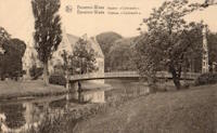
| Bridgemeister ID: | 4569 (added 2020-06-02) |
| Name: | Speybrug |
| Location: | Lievegem, Gent vicinity, East Flanders, Belgium |
| Crossing: | Ringvaart |
| Coordinates: | 51.085412 N 3.658703 E |
| Maps: | Acme, GeoHack, Google, OpenStreetMap |
| Use: | Vehicular (two-lane) |
| Status: | In use (last checked: 2019) |
| Main Cables: | Wire (steel) |
| Suspended Spans: | 1 |
| Main Span: | 1 x 54.5 meters (178.8 feet) estimated |
Notes:
External Links:
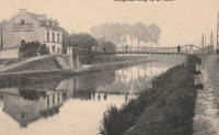
Waggelbrug
Halle, Belgium - Canal Bruxelles Charleroi
| Bridgemeister ID: | 7484 (added 2022-12-28) |
| Name: | Waggelbrug |
| Also Known As: | Branlant |
| Location: | Halle, Belgium |
| Crossing: | Canal Bruxelles Charleroi |
| Coordinates: | 50.735462 N 4.241489 E |
| Maps: | Acme, GeoHack, Google, OpenStreetMap |
| Status: | Removed, 1930s |
| Suspended Spans: | 1 |
External Links:
- Klarabrug | Waterwegen en Zeekanaal. History of the canal bridges at this location.
Image Sets:
Do you have any information or photos for these bridges that you would like to share? Please email david.denenberg@bridgemeister.com.
Mail | Facebook | X (Twitter) | Bluesky
